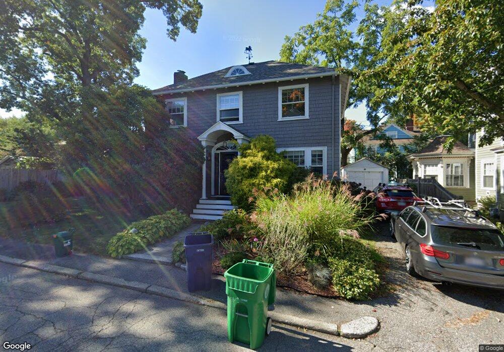
19 Barnes Rd Newton, MA 02458
Newton Corner NeighborhoodEstimated Value: $1,060,000 - $1,403,000
About This Home
This home is located at 19 Barnes Rd, Newton, MA 02458 and is currently estimated at $1,290,028, approximately $775 per square foot. 19 Barnes Rd is a home located in Middlesex County with nearby schools including Underwood Elementary School, Bigelow Middle School, and Newton North High School.
Ownership History
We collect this data history from publicly available records. To have your information removed, we recommend requesting removal directly through your county’s website.
Purchase Details
Purchase Details
Home Financials for this Owner
Home Financials are based on the most recent Mortgage that was taken out on this home.Purchase Details
Home Values in the Area
Average Home Value in this Area
Purchase History
We collect this data history from publicly available records. To have your information removed, we recommend requesting removal directly through your county’s website.
| Date | Buyer | Sale Price | Title Company |
|---|---|---|---|
| -- | -- | ||
| -- | -- | ||
| -- | -- | ||
| $208,500 | -- |
Mortgage History
We collect this data history from publicly available records. To have your information removed, we recommend requesting removal directly through your county’s website.
| Date | Status | Borrower | Loan Amount |
|---|---|---|---|
| Previous Owner | $345,000 | ||
| Previous Owner | $25,000 | ||
| Previous Owner | $204,000 |
Tax History
We collect this data history from publicly available records. To have your information removed, we recommend requesting removal directly through your county’s website.
| Year | Tax Paid | Tax Assessment Tax Assessment Total Assessment is a certain percentage of the fair market value that is determined by local assessors to be the total taxable value of land and additions on the property. | Land | Improvement |
|---|---|---|---|---|
| 2025 | $9,338 | $952,900 | $943,900 | $9,000 |
| 2024 | $9,029 | $925,100 | $916,400 | $8,700 |
| 2023 | $8,587 | $843,500 | $692,400 | $151,100 |
| 2022 | $8,216 | $781,000 | $641,100 | $139,900 |
| 2021 | $3,670 | $736,800 | $604,800 | $132,000 |
| 2020 | $7,692 | $736,800 | $604,800 | $132,000 |
| 2019 | $7,475 | $715,300 | $587,200 | $128,100 |
| 2018 | $7,097 | $655,900 | $531,100 | $124,800 |
| 2017 | $3,154 | $618,800 | $501,000 | $117,800 |
| 2016 | $6,581 | $578,300 | $468,200 | $110,100 |
| 2015 | $5,927 | $510,500 | $437,600 | $72,900 |
Map
- 12 Barnes Rd Unit 2
- 17 Copley St
- 159 Washington St Unit 4
- 17 Vernon St
- 35-37 Presentation Rd
- 9 Mina Way
- 123 Charlesbank Rd
- 143 Tremont St Unit 143-2
- 143 Tremont St Unit 143-5
- 143 Tremont St Unit 3
- 156 Newton St Unit 4
- 38-40 Pequossette St
- 121 Tremont St Unit A6
- 121 Tremont St Unit B4
- 121 Tremont St Unit 316
- 14 Atkins St
- 50 Beechwood Ave Unit 2
- 99 Tremont St Unit 513
- 99 Tremont St Unit 416
- 99 Tremont St Unit 301
- 12 Willard St
- 18 Willard St
- 6 Willard St
- 6 Willard St Unit 2
- 6 Willard St Unit 1
- 11 Barnes Rd
- 21 Willard St
- 11 Willard St
- 5 Willard St
- 17 Willard St
- 12 Barnes Rd Unit 1
- 18 Barnes Rd
- 91 Hunnewell Ave
- 89 Hunnewell Ave
- 8 Barnes Rd
- 1 Barnes Rd
- 26 Barnes Rd
- 10 Fairview St
- 16 Fairview St
- 103 Hunnewell Ave
Ask me questions while you tour the home.