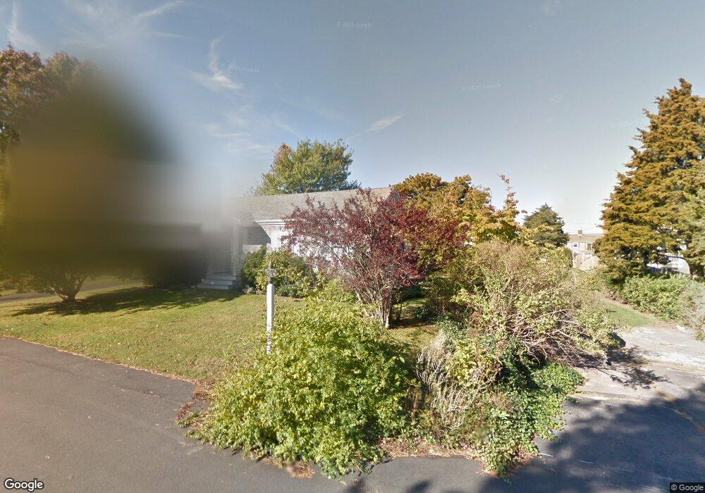
19 Benedict Rd Bourne, MA 2532
Estimated Value: $542,000 - $755,000
3
Beds
1
Bath
948
Sq Ft
$669/Sq Ft
Est. Value
About This Home
This home is located at 19 Benedict Rd, Bourne, MA 2532 and is currently estimated at $634,513, approximately $669 per square foot. 19 Benedict Rd is a home located in Barnstable County with nearby schools including Bourne High School, St Margaret Regional School, and Cadence Academy Preschool - Bourne.
Ownership History
Date
Name
Owned For
Owner Type
Purchase Details
Closed on
Apr 20, 2001
Sold by
Burchill William F and Burchill Anne K
Bought by
Coen Donald M and Marvel Deborah J
Current Estimated Value
Purchase Details
Closed on
Apr 24, 2000
Sold by
Farnum Peter M and Farnum Catherine R
Bought by
Burchill William F and Burchill Anne K
Home Financials for this Owner
Home Financials are based on the most recent Mortgage that was taken out on this home.
Original Mortgage
$150,000
Interest Rate
8.21%
Mortgage Type
Purchase Money Mortgage
Purchase Details
Closed on
Oct 12, 1990
Sold by
Carvelli Joseph A
Bought by
Farnam Peter M
Home Financials for this Owner
Home Financials are based on the most recent Mortgage that was taken out on this home.
Original Mortgage
$115,000
Interest Rate
10.18%
Mortgage Type
Purchase Money Mortgage
Create a Home Valuation Report for This Property
The Home Valuation Report is an in-depth analysis detailing your home's value as well as a comparison with similar homes in the area
Purchase History
| Date | Buyer | Sale Price | Title Company |
|---|---|---|---|
| Coen Donald M | $240,000 | -- | |
| Coen Donald M | $240,000 | -- | |
| Burchill William F | $195,000 | -- | |
| Burchill William F | $195,000 | -- | |
| Farnam Peter M | $145,000 | -- | |
| Farnam Peter M | $145,000 | -- |
Source: Public Records
Mortgage History
| Date | Status | Borrower | Loan Amount |
|---|---|---|---|
| Previous Owner | Farnam Peter M | $150,000 | |
| Previous Owner | Farnam Peter M | $115,000 |
Source: Public Records
Tax History
| Year | Tax Paid | Tax Assessment Tax Assessment Total Assessment is a certain percentage of the fair market value that is determined by local assessors to be the total taxable value of land and additions on the property. | Land | Improvement |
|---|---|---|---|---|
| 2025 | $3,989 | $510,700 | $322,100 | $188,600 |
| 2024 | $3,900 | $486,300 | $306,700 | $179,600 |
| 2023 | $3,792 | $430,400 | $271,500 | $158,900 |
| 2022 | $3,696 | $366,300 | $240,200 | $126,100 |
| 2021 | $3,591 | $333,400 | $218,600 | $114,800 |
| 2020 | $3,495 | $325,400 | $216,600 | $108,800 |
| 2019 | $3,545 | $337,300 | $234,600 | $102,700 |
| 2018 | $2,970 | $281,800 | $189,100 | $92,700 |
| 2017 | $2,816 | $273,400 | $181,600 | $91,800 |
| 2016 | $2,617 | $257,600 | $181,600 | $76,000 |
| 2015 | $2,594 | $257,600 | $181,600 | $76,000 |
Source: Public Records
Map
Nearby Homes
- 35 Benedict Rd
- 5 Zoli Ln
- 203 County Rd
- 40-A Lafayette Ave
- 46 Holt Rd Unit A
- 46 Holt Rd
- 4 Van Bummel Rd
- 13 Laurel Hill Ct
- 3 Fairway Dr Unit F
- 36B Starboard Dr Unit 36E
- 36B Starboard Dr Unit 36G
- 36B Starboard Dr Unit 36C
- 36B Starboard Dr Unit 36A
- 36B Starboard Dr Unit 36D
- 36B Starboard Dr Unit 36B
- 36B Starboard Dr Unit 36F
- 36B Starboard Dr Unit 36H
- 23 Starboard Dr Unit Lot 50
- 5 Sea Knoll Ct
- 44 Cotuit Rd
Your Personal Tour Guide
Ask me questions while you tour the home.