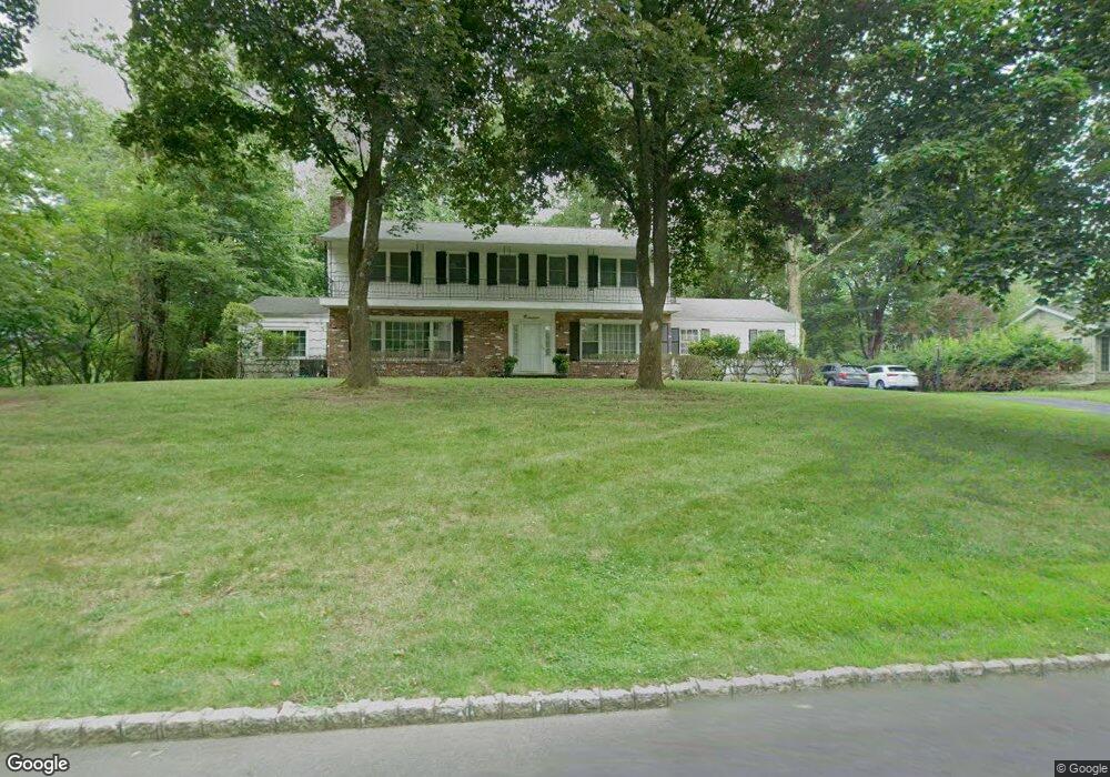
19 Beresford Rd Allendale, NJ 07401
Estimated Value: $1,080,647 - $1,299,000
Studio
--
Bath
2,520
Sq Ft
$480/Sq Ft
Est. Value
About This Home
This home is located at 19 Beresford Rd, Allendale, NJ 07401 and is currently estimated at $1,210,162, approximately $480 per square foot. 19 Beresford Rd is a home located in Bergen County with nearby schools including Hillside Elementary School, Brookside Elementary School, and Northern Highlands Reg High School.
Ownership History
Date
Name
Owned For
Owner Type
Purchase Details
Closed on
Nov 21, 2000
Sold by
Estate Of Walter F Rant
Bought by
Bond Joseph F and Bond Elizabeth
Current Estimated Value
Home Financials for this Owner
Home Financials are based on the most recent Mortgage that was taken out on this home.
Original Mortgage
$349,000
Outstanding Balance
$126,947
Interest Rate
7.7%
Estimated Equity
$1,083,215
Purchase Details
Closed on
Apr 25, 2000
Sold by
Walter F Rant Qualified Per Re
Bought by
Rant Walter F
Home Financials for this Owner
Home Financials are based on the most recent Mortgage that was taken out on this home.
Original Mortgage
$4,292
Interest Rate
8.23%
Create a Home Valuation Report for This Property
The Home Valuation Report is an in-depth analysis detailing your home's value as well as a comparison with similar homes in the area
Home Values in the Area
Average Home Value in this Area
Purchase History
| Date | Buyer | Sale Price | Title Company |
|---|---|---|---|
| Bond Joseph F | $549,000 | -- | |
| Rant Walter F | $585,000 | -- |
Source: Public Records
Mortgage History
| Date | Status | Borrower | Loan Amount |
|---|---|---|---|
| Open | Bond Joseph F | $349,000 | |
| Previous Owner | Rant Walter F | $4,292 |
Source: Public Records
Tax History
| Year | Tax Paid | Tax Assessment Tax Assessment Total Assessment is a certain percentage of the fair market value that is determined by local assessors to be the total taxable value of land and additions on the property. | Land | Improvement |
|---|---|---|---|---|
| 2025 | $18,264 | $926,900 | $505,400 | $421,500 |
| 2024 | $18,408 | $866,000 | $467,900 | $398,100 |
| 2023 | $17,931 | $837,100 | $448,400 | $388,700 |
| 2022 | $17,931 | $787,500 | $417,500 | $370,000 |
| 2021 | $17,650 | $751,400 | $379,600 | $371,800 |
| 2020 | $18,498 | $766,600 | $384,300 | $382,300 |
| 2019 | $18,007 | $766,600 | $384,300 | $382,300 |
| 2018 | $17,609 | $766,600 | $384,300 | $382,300 |
| 2017 | $17,540 | $766,600 | $384,300 | $382,300 |
| 2016 | $17,563 | $766,600 | $384,300 | $382,300 |
| 2015 | $17,210 | $757,200 | $384,300 | $372,900 |
| 2014 | $16,924 | $710,200 | $370,100 | $340,100 |
Source: Public Records
Map
Nearby Homes
- 53 Lockwood Dr
- 8 Masterson Ct
- 37-1 Tamaron Dr
- 1002 Whitney Ln
- 103 Crescent Ave
- 260 W Allendale Ave
- 314 Meadowbrook Rd
- 16-3 Tamaron Dr
- 77 Myrtle Ave
- 8 Crestwood Mews
- 290 Wyckoff Ave
- 4 Lee Ct
- 89 Barrett Ln
- 33 Homewood Ave
- 31 Smith St
- 44 Leonard Dr
- 6 Cottage Place
- 28 Zazzetti St
- 24 Summit Ave
- 39 1 & 2 Smith
- 23 Beresford Rd
- 15 Beresford Rd
- 20 Beresford Rd
- 27 Beresford Rd
- 11 Beresford Rd
- 24 Beresford Rd
- 19 Scott Ct
- 1 Schuyler Rd
- 792 W Crescent Ave
- 7 Schuyler Rd
- 7 Beresford Rd
- 27 Scott Ct
- 8 Beresford Rd
- 4 Schuyler Rd
- 19 Stone Fence Rd
- 756 W Crescent Ave
- 4 Newton Place
- 794 W Crescent Ave
- 8 Schuyler Rd
- 15 Stone Fence Rd
Your Personal Tour Guide
Ask me questions while you tour the home.