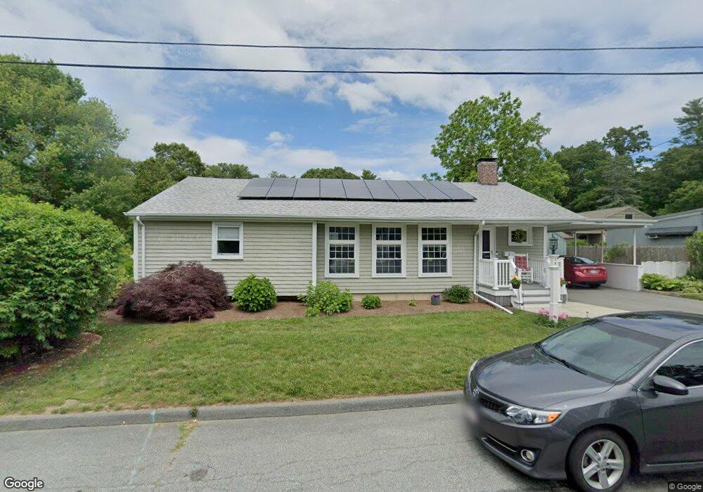
19 Beverly St North Dartmouth, MA 02747
Idlewood NeighborhoodEstimated Value: $501,000 - $575,000
2
Beds
2
Baths
1,586
Sq Ft
$333/Sq Ft
Est. Value
About This Home
This home is located at 19 Beverly St, North Dartmouth, MA 02747 and is currently estimated at $528,596, approximately $333 per square foot. 19 Beverly St is a home located in Bristol County with nearby schools including Dartmouth High School, Friends Academy, and Nazarene Christian Academy.
Ownership History
Date
Name
Owned For
Owner Type
Purchase Details
Closed on
Feb 2, 2018
Sold by
Raczka Nancy J
Bought by
Raczka Nancy J and Raczka Gary Ingrid
Current Estimated Value
Purchase Details
Closed on
Dec 28, 1976
Bought by
Raczka Nancy J
Create a Home Valuation Report for This Property
The Home Valuation Report is an in-depth analysis detailing your home's value as well as a comparison with similar homes in the area
Home Values in the Area
Average Home Value in this Area
Purchase History
| Date | Buyer | Sale Price | Title Company |
|---|---|---|---|
| Raczka Nancy J | -- | -- | |
| Raczka Nancy J | -- | -- |
Source: Public Records
Mortgage History
| Date | Status | Borrower | Loan Amount |
|---|---|---|---|
| Previous Owner | Raczka Nancy J | $24,361 | |
| Previous Owner | Raczka Nancy J | $50,000 | |
| Previous Owner | Raczka Nancy J | $45,000 |
Source: Public Records
Tax History Compared to Growth
Tax History
| Year | Tax Paid | Tax Assessment Tax Assessment Total Assessment is a certain percentage of the fair market value that is determined by local assessors to be the total taxable value of land and additions on the property. | Land | Improvement |
|---|---|---|---|---|
| 2025 | $3,568 | $394,200 | $162,000 | $232,200 |
| 2024 | $3,320 | $363,200 | $149,900 | $213,300 |
| 2023 | $3,277 | $338,200 | $145,100 | $193,100 |
| 2022 | $3,176 | $306,600 | $145,100 | $161,500 |
| 2021 | $3,059 | $282,500 | $135,000 | $147,500 |
| 2020 | $2,928 | $269,100 | $127,900 | $141,200 |
| 2019 | $2,841 | $261,800 | $122,100 | $139,700 |
| 2018 | $2,725 | $258,000 | $133,800 | $124,200 |
| 2017 | $2,643 | $248,400 | $126,200 | $122,200 |
| 2016 | $2,493 | $235,600 | $120,700 | $114,900 |
| 2015 | $2,410 | $229,300 | $112,800 | $116,500 |
| 2014 | $2,319 | $222,100 | $107,900 | $114,200 |
Source: Public Records
Map
Nearby Homes
- 1406 Tucker Rd
- 46 Old Westport Rd
- 40 Golf St
- 6 Strathmore Rd
- 135 Old Westport Rd
- 73 Gifford Ave
- 35 Suffolk Ave
- 0 Norfolk Ave Unit 73403282
- 0 Undisclosed Unit 73376281
- 24 Wayne Memorial Dr
- 0 Middlesex St
- 28 Greystone Ave
- 968 Geraldine St Unit 1A
- 1 Spring Hill Rd
- 59 Longwood Ave
- 317 Commonwealth Ave
- 295 Commonwealth Ave
- 48 Valley View Dr
- 0 Mosher Ln Unit 73370974
- 50 Gaywood St
- 26 Ricketson St
- 15 Beverly St
- 39 Rockhill Dr
- 20 Beverly St
- 43 Rockhill Dr
- 16 Beverly St
- 31 Rockhill Dr
- 11 Beverly St
- 11 Idlewood Ave
- 15 Idlewood Ave
- 15 Idlewood Ave
- 12 Beverly St
- LOT 1 Morton Ave
- 40 Rockhill Dr
- 29 Ricketson St
- 27 Ricketson St
- 47 Rockhill Dr
- 5 Idlewood Ave
- 25 Ricketson St
- 34 Rock Hill Dr