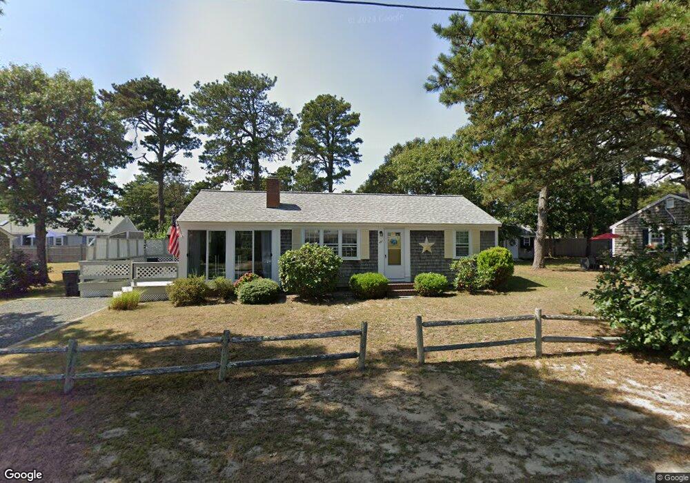
19 Blueberry Ln Dennis Port, MA 02639
Dennis Port NeighborhoodEstimated Value: $588,000 - $731,000
4
Beds
2
Baths
1,509
Sq Ft
$436/Sq Ft
Est. Value
About This Home
This home is located at 19 Blueberry Ln, Dennis Port, MA 02639 and is currently estimated at $658,396, approximately $436 per square foot. 19 Blueberry Ln is a home located in Barnstable County with nearby schools including Dennis-Yarmouth Regional High School and St. Pius X. School.
Ownership History
Date
Name
Owned For
Owner Type
Purchase Details
Closed on
Nov 16, 2007
Sold by
Dawes Carol L
Bought by
Francescon Gary and Boyden Patricia M
Current Estimated Value
Home Financials for this Owner
Home Financials are based on the most recent Mortgage that was taken out on this home.
Original Mortgage
$227,000
Interest Rate
6.41%
Mortgage Type
Purchase Money Mortgage
Purchase Details
Closed on
Mar 31, 1999
Sold by
Marchese John J and Marchese Mary E
Bought by
Dawes Carol L
Create a Home Valuation Report for This Property
The Home Valuation Report is an in-depth analysis detailing your home's value as well as a comparison with similar homes in the area
Home Values in the Area
Average Home Value in this Area
Purchase History
| Date | Buyer | Sale Price | Title Company |
|---|---|---|---|
| Francescon Gary | $287,000 | -- | |
| Dawes Carol L | $120,000 | -- |
Source: Public Records
Mortgage History
| Date | Status | Borrower | Loan Amount |
|---|---|---|---|
| Open | Dawes Carol L | $221,000 | |
| Closed | Dawes Carol L | $226,000 | |
| Closed | Francescon Gary | $227,000 | |
| Previous Owner | Dawes Carol L | $86,000 |
Source: Public Records
Tax History Compared to Growth
Tax History
| Year | Tax Paid | Tax Assessment Tax Assessment Total Assessment is a certain percentage of the fair market value that is determined by local assessors to be the total taxable value of land and additions on the property. | Land | Improvement |
|---|---|---|---|---|
| 2025 | $2,671 | $616,900 | $184,500 | $432,400 |
| 2024 | $2,598 | $591,800 | $177,500 | $414,300 |
| 2023 | $2,502 | $535,800 | $161,300 | $374,500 |
| 2022 | $2,356 | $420,800 | $145,300 | $275,500 |
| 2021 | $2,253 | $373,600 | $142,500 | $231,100 |
| 2020 | $2,082 | $341,300 | $131,500 | $209,800 |
| 2019 | $1,946 | $315,400 | $129,000 | $186,400 |
| 2018 | $1,903 | $300,200 | $133,000 | $167,200 |
| 2017 | $1,751 | $284,700 | $122,800 | $161,900 |
| 2016 | $1,728 | $264,600 | $127,900 | $136,700 |
| 2015 | $1,693 | $264,600 | $127,900 | $136,700 |
| 2014 | $1,582 | $249,200 | $112,500 | $136,700 |
Source: Public Records
Map
Nearby Homes
- 22 Wixon Rd
- 31 Easy St
- 72 Bassett Ln
- 22 Ferncliff Rd
- 19 Standish Way
- 268 Main St
- 102 Sea St
- 37-A Beach Hills Rd
- 37 Beach Hills Rd
- 4 Coffey Ln
- 125 Main St Unit 3
- 12 Cross St
- 262 Old Wharf Rd Unit 67
- 262 Old Wharf Rd Unit 5
- 262 Old Wharf Rd Unit 5
- 262 Old Wharf Rd Unit 20
- 262 Old Wharf Rd Unit 87
- 80 Michaels Ave
- 71 Main St
- 3 Blueberry Ln
- 15 Blueberry Ln
- 25 Blueberry Ln
- 18 Huckleberry Ln
- 14 Huckleberry Ln
- 24 Blueberry Ln
- 28 Blueberry Ln
- 10 Huckleberry Ln
- 32 Blueberry Ln
- 22 Huckleberry Ln
- 11 Blueberry Ln
- 29 Blueberry Ln
- 27 Beach Plum Ln
- 27 Beachplum Ln
- 20 Blueberry Ln
- 31 Beach Plum Ln
- 6 Huckleberry Ln
- 25 Beach Plum Ln
- 25 Beachplum Ln
- 33 Beach Plum Ln