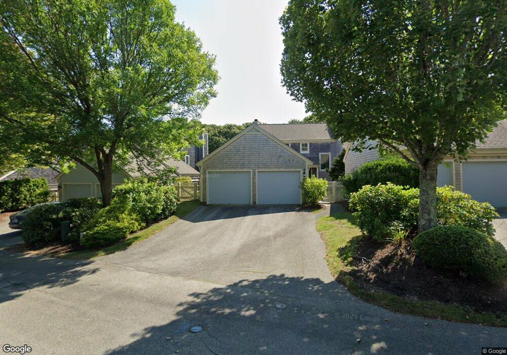
19 Blueberry Path Yarmouth Port, MA 02675
Yarmouth Port NeighborhoodEstimated Value: $778,246 - $867,000
2
Beds
4
Baths
1,826
Sq Ft
$439/Sq Ft
Est. Value
About This Home
This home is located at 19 Blueberry Path, Yarmouth Port, MA 02675 and is currently estimated at $802,312, approximately $439 per square foot. 19 Blueberry Path is a home located in Barnstable County with nearby schools including Dennis-Yarmouth Regional High School.
Ownership History
Date
Name
Owned For
Owner Type
Purchase Details
Closed on
Jan 25, 2019
Sold by
Eugene C Smit T
Bought by
Barbara G Smith Lt
Current Estimated Value
Purchase Details
Closed on
Apr 23, 2007
Sold by
Smith Barbara G and Smith Eugene C
Bought by
Barbara G Smith Lt
Purchase Details
Closed on
Aug 3, 2000
Sold by
Kings Way Prop Rt
Bought by
Neubert Joy H
Home Financials for this Owner
Home Financials are based on the most recent Mortgage that was taken out on this home.
Original Mortgage
$252,000
Interest Rate
8.1%
Mortgage Type
Purchase Money Mortgage
Create a Home Valuation Report for This Property
The Home Valuation Report is an in-depth analysis detailing your home's value as well as a comparison with similar homes in the area
Home Values in the Area
Average Home Value in this Area
Purchase History
| Date | Buyer | Sale Price | Title Company |
|---|---|---|---|
| Barbara G Smith Lt | -- | -- | |
| Barbara G Smith Lt | -- | -- | |
| Barbara G Smith Lt | -- | -- | |
| Neubert Joy H | $386,684 | -- |
Source: Public Records
Mortgage History
| Date | Status | Borrower | Loan Amount |
|---|---|---|---|
| Previous Owner | Neubert Joy H | $252,000 |
Source: Public Records
Tax History Compared to Growth
Tax History
| Year | Tax Paid | Tax Assessment Tax Assessment Total Assessment is a certain percentage of the fair market value that is determined by local assessors to be the total taxable value of land and additions on the property. | Land | Improvement |
|---|---|---|---|---|
| 2025 | $5,449 | $769,600 | $0 | $769,600 |
| 2024 | $5,472 | $741,500 | $0 | $741,500 |
| 2023 | $5,030 | $620,200 | $0 | $620,200 |
| 2022 | $4,915 | $535,400 | $0 | $535,400 |
| 2021 | $4,782 | $500,200 | $0 | $500,200 |
| 2020 | $4,826 | $482,600 | $0 | $482,600 |
| 2019 | $4,526 | $448,100 | $0 | $448,100 |
| 2018 | $4,256 | $413,600 | $0 | $413,600 |
| 2017 | $3,971 | $396,300 | $0 | $396,300 |
| 2016 | $3,782 | $379,000 | $0 | $379,000 |
| 2015 | $3,833 | $381,800 | $0 | $381,800 |
Source: Public Records
Map
Nearby Homes
- 2 Pine Grove
- 25 Oak Glen
- 25 Oak Glen Village Unit 25
- 7 Forest Gate Unit 7
- 30 W Woods Cir Unit 30
- 30 W Woods
- 43 Canterbury Rd
- 17 Kates Path Unit A
- 1 Barnacle Rd
- 228 Kates Path
- 34 Kates Path
- 34 Kates Path Unit 34
- 86 Pompano Rd
- 64 Kates Path
- 23 Dauphine Dr
- 24 Minnetuxet Way
- 44 Stratford Ln
- 50 John Hall Cartway
- 50 John Hall Cartway Unit 50
- 42 John Hall Cartway Unit 42
- 48 Blueberry Path
- 44 Blueberry Path
- 34 Blueberry Path
- 33 Blueberry Path
- 31 Blueberry Path
- 29 Blueberry Path
- 27 Blueberry Path
- 24 Blueberry Path
- 21 Blueberry Path
- 15 Blueberry Path
- 13 Blueberry Path
- 9 Blueberry Path
- 1 Blueberry Path
- 1 Blueberry Path Unit H
- 48 Blueberry Path Unit P
- 48 Blueberry Path Unit 48-P
- 34 Blueberry Path Unit 34
- 27 Blueberry Path Unit K*
- 34 Blueberry Path Unit O
- 15 Blueberry Path Unit G