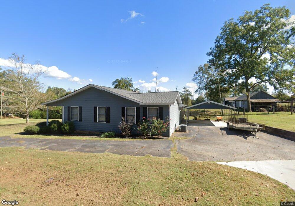
19 Bradfield Dr Lagrange, GA 30240
Estimated Value: $186,000 - $222,000
3
Beds
2
Baths
1,880
Sq Ft
$111/Sq Ft
Est. Value
About This Home
This home is located at 19 Bradfield Dr, Lagrange, GA 30240 and is currently estimated at $207,985, approximately $110 per square foot. 19 Bradfield Dr is a home located in Troup County with nearby schools including Berta Weathersbee Elementary School, Long Cane Elementary School, and Whitesville Road Elementary School.
Ownership History
Date
Name
Owned For
Owner Type
Purchase Details
Closed on
Nov 18, 2019
Sold by
Hale Donald R
Bought by
Hale Nancy D and Rudbeck Anissa Sky
Current Estimated Value
Purchase Details
Closed on
Feb 1, 1986
Bought by
Hale Donald R
Purchase Details
Closed on
Jan 1, 1972
Create a Home Valuation Report for This Property
The Home Valuation Report is an in-depth analysis detailing your home's value as well as a comparison with similar homes in the area
Home Values in the Area
Average Home Value in this Area
Purchase History
| Date | Buyer | Sale Price | Title Company |
|---|---|---|---|
| Hale Nancy D | -- | -- | |
| Hale Donald R | -- | -- | |
| -- | -- | -- |
Source: Public Records
Tax History Compared to Growth
Tax History
| Year | Tax Paid | Tax Assessment Tax Assessment Total Assessment is a certain percentage of the fair market value that is determined by local assessors to be the total taxable value of land and additions on the property. | Land | Improvement |
|---|---|---|---|---|
| 2024 | $1,407 | $59,400 | $7,560 | $51,840 |
| 2023 | $1,298 | $55,400 | $7,560 | $47,840 |
| 2022 | $1,466 | $52,520 | $7,560 | $44,960 |
| 2021 | $1,075 | $35,640 | $9,160 | $26,480 |
| 2020 | $1,075 | $35,640 | $9,160 | $26,480 |
| 2019 | $963 | $31,920 | $7,200 | $24,720 |
| 2018 | $963 | $31,920 | $7,200 | $24,720 |
| 2017 | $963 | $31,920 | $7,200 | $24,720 |
| 2016 | $954 | $31,624 | $7,200 | $24,424 |
| 2015 | $1,000 | $33,099 | $9,199 | $23,900 |
| 2014 | $964 | $31,841 | $9,199 | $22,642 |
| 2013 | -- | $33,227 | $9,004 | $24,223 |
Source: Public Records
Map
Nearby Homes
- 0 Bradfield Dr Unit 10568803
- 808 S Fling Rd
- 288 Bradfield Dr
- 114 Westgate Dr
- 610 Ginger Cir
- 509 Connie Dr
- 141 Avery Dr
- 22 Freeman Rd
- 275 Hanson Dr
- 0 Hanson Dr Unit 10641272
- 243 Oak Dr
- 3 Reed Dr
- 190 Hill Rd
- 0 Unit 10514554
- 110 Hawthorne Cir
- 103 Hawthorne Cir
- 146 Whitaker Rd
- 124 Foxdale Dr
- 102 Foxdale Dr
- 167 S Kight Dr
- 2639 West Point Rd
- 20 Bradfield Dr
- 2663 W Point Rd
- 2663 West Point Rd
- 47 Bradfield Dr
- 46 Bradfield Dr
- 0 Bradfield Dr Unit 8348693
- 0 Bradfield Dr Unit 8931502
- 0 Bradfield Dr Unit 7.52 Ac 8506083
- 2654 West Point Rd
- 55 Bradfield Dr
- 54 Bradfield Dr
- 2636 West Point Rd
- 65 Bradfield Dr
- 2688 W Point Rd
- 73 Bradfield Dr
- 76 Bradfield Dr
- 2700 West Point Rd
- 2610 West Point Rd
- 85 Bradfield Dr