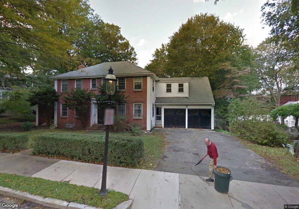
19 Brae Burn Rd Auburndale, MA 02466
Auburndale NeighborhoodEstimated Value: $2,035,000 - $2,764,000
4
Beds
3
Baths
1,857
Sq Ft
$1,380/Sq Ft
Est. Value
About This Home
This home is located at 19 Brae Burn Rd, Auburndale, MA 02466 and is currently estimated at $2,563,518, approximately $1,380 per square foot. 19 Brae Burn Rd is a home located in Middlesex County with nearby schools including Peirce Elementary School, Williams Elementary School, and F.A. Day Middle School.
Ownership History
Date
Name
Owned For
Owner Type
Purchase Details
Closed on
Apr 1, 2013
Sold by
Powdetmaker Carla C
Bought by
Goldberg Jordan and Goldbed Jennifer
Current Estimated Value
Home Financials for this Owner
Home Financials are based on the most recent Mortgage that was taken out on this home.
Original Mortgage
$1,162,500
Outstanding Balance
$823,903
Interest Rate
3.56%
Mortgage Type
Purchase Money Mortgage
Estimated Equity
$1,739,615
Purchase Details
Closed on
Mar 21, 2012
Sold by
Moore Celia L
Bought by
Powdermaker Carla C
Create a Home Valuation Report for This Property
The Home Valuation Report is an in-depth analysis detailing your home's value as well as a comparison with similar homes in the area
Home Values in the Area
Average Home Value in this Area
Purchase History
| Date | Buyer | Sale Price | Title Company |
|---|---|---|---|
| Goldberg Jordan | $1,550,000 | -- | |
| Goldberg Jordan | $1,550,000 | -- | |
| Powdermaker Carla C | $675,000 | -- |
Source: Public Records
Mortgage History
| Date | Status | Borrower | Loan Amount |
|---|---|---|---|
| Open | Goldberg Jordan | $1,162,500 | |
| Closed | Goldberg Jordan | $1,162,500 |
Source: Public Records
Tax History Compared to Growth
Tax History
| Year | Tax Paid | Tax Assessment Tax Assessment Total Assessment is a certain percentage of the fair market value that is determined by local assessors to be the total taxable value of land and additions on the property. | Land | Improvement |
|---|---|---|---|---|
| 2025 | $25,133 | $2,564,600 | $983,900 | $1,580,700 |
| 2024 | $24,301 | $2,489,900 | $955,200 | $1,534,700 |
| 2023 | $23,365 | $2,295,200 | $735,400 | $1,559,800 |
| 2022 | $22,357 | $2,125,200 | $680,900 | $1,444,300 |
| 2021 | $21,573 | $2,004,900 | $642,400 | $1,362,500 |
| 2020 | $3,508 | $2,004,900 | $642,400 | $1,362,500 |
| 2019 | $20,341 | $1,946,500 | $623,700 | $1,322,800 |
| 2018 | $3,238 | $1,820,900 | $565,700 | $1,255,200 |
| 2017 | $19,102 | $1,717,800 | $533,700 | $1,184,100 |
| 2016 | $18,269 | $1,605,400 | $498,800 | $1,106,600 |
| 2015 | $17,420 | $1,500,400 | $466,200 | $1,034,200 |
Source: Public Records
Map
Nearby Homes
- 13 Weir St
- 1639 Washington St
- 51 Bourne St
- 17 Gilbert St
- 224 Auburn St Unit 224
- 224 Auburn St Unit A
- 226 Auburn St Unit 226
- 283 Woodland Rd
- 0 Duncan Rd Unit 72925240
- 62-64 Rowe St Unit B
- 17 Crescent St
- 1754 Washington St
- 10 Crescent St Unit 1
- 10 Crescent St Unit 2
- 1640 Commonwealth Ave
- 17 Lasell St
- 283 Melrose St
- 160 Pine St Unit 12
- 40 Sewall St
- 90 Auburndale Ave
- 11 Brae Burn Rd
- 29 Brae Burn Rd
- 116 Auburn St
- 16 Brae Burn Rd
- 22 Brae Burn Rd
- 5 Brae Burn Rd
- 122 Auburn St
- 35 Brae Burn Rd
- 32 Brae Burn Rd
- 7 Windermere Rd
- 4 Windermere Rd
- 1863 Commonwealth Ave
- 1875 Commonwealth Ave
- 1855 Commonwealth Ave
- 38 Brae Burn Rd
- 1881 Commonwealth Ave
- 1841 Commonwealth Ave
- 1845 Commonwealth Ave
- 12 Windermere Rd
- 41 Windermere Rd