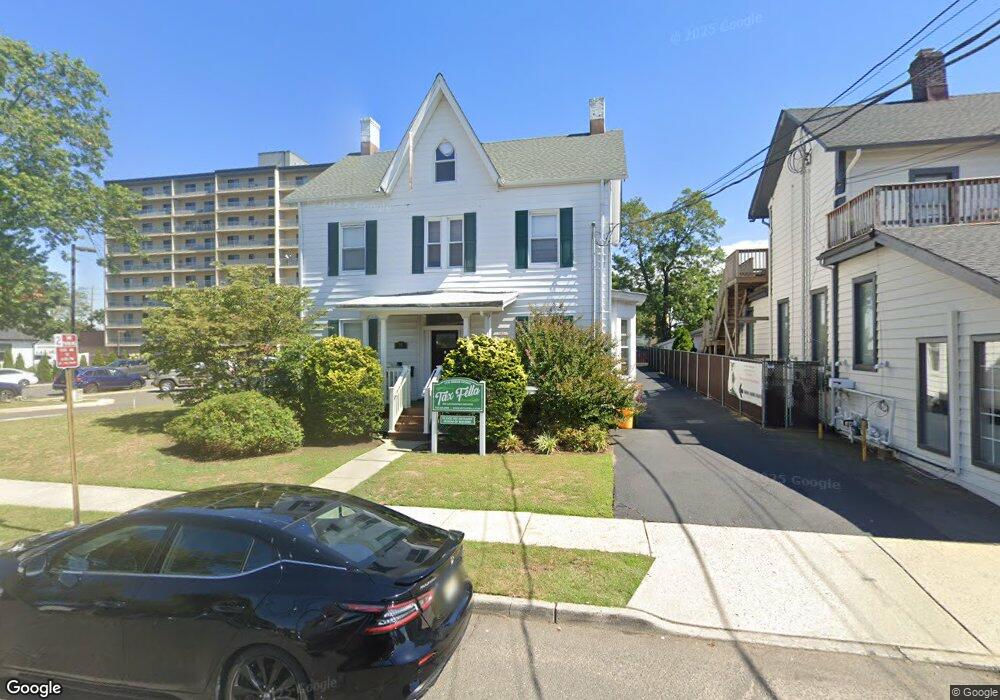
19 Bridge Ave Red Bank, NJ 07701
Estimated Value: $809,638 - $815,000
--
Bed
--
Bath
1,910
Sq Ft
$425/Sq Ft
Est. Value
About This Home
This home is located at 19 Bridge Ave, Red Bank, NJ 07701 and is currently estimated at $812,319, approximately $425 per square foot. 19 Bridge Ave is a home located in Monmouth County with nearby schools including Red Bank Primary School, Red Bank Middle School, and Red Bank Reg High School.
Ownership History
Date
Name
Owned For
Owner Type
Purchase Details
Closed on
Jun 23, 2021
Sold by
19 Bridge Avenue Llc
Bought by
Roarin Twenties Realty Llc
Current Estimated Value
Home Financials for this Owner
Home Financials are based on the most recent Mortgage that was taken out on this home.
Original Mortgage
$428,415
Interest Rate
2.8%
Mortgage Type
Purchase Money Mortgage
Purchase Details
Closed on
Jan 14, 2009
Sold by
Propert Stephen and Propert Diane
Bought by
19 Bridge Avenue Llc
Purchase Details
Closed on
Mar 22, 2000
Sold by
Geraghty Kenneth
Bought by
Propert Stephen
Purchase Details
Closed on
Dec 18, 1996
Sold by
Pear Edwars
Bought by
Geraghty Kenneth
Home Financials for this Owner
Home Financials are based on the most recent Mortgage that was taken out on this home.
Original Mortgage
$116,000
Interest Rate
7.46%
Mortgage Type
FHA
Create a Home Valuation Report for This Property
The Home Valuation Report is an in-depth analysis detailing your home's value as well as a comparison with similar homes in the area
Home Values in the Area
Average Home Value in this Area
Purchase History
| Date | Buyer | Sale Price | Title Company |
|---|---|---|---|
| Roarin Twenties Realty Llc | $585,000 | Green Label Title | |
| 19 Bridge Avenue Llc | $430,000 | Multiple | |
| Propert Stephen | $189,000 | -- | |
| Geraghty Kenneth | $110,000 | -- |
Source: Public Records
Mortgage History
| Date | Status | Borrower | Loan Amount |
|---|---|---|---|
| Previous Owner | Roarin Twenties Realty Llc | $428,415 | |
| Previous Owner | Geraghty Kenneth | $116,000 |
Source: Public Records
Tax History Compared to Growth
Tax History
| Year | Tax Paid | Tax Assessment Tax Assessment Total Assessment is a certain percentage of the fair market value that is determined by local assessors to be the total taxable value of land and additions on the property. | Land | Improvement |
|---|---|---|---|---|
| 2025 | $14,688 | $877,700 | $419,000 | $458,700 |
| 2024 | $14,637 | $743,300 | $303,000 | $440,300 |
| 2023 | $14,637 | $731,100 | $303,000 | $428,100 |
| 2022 | $14,737 | $691,300 | $281,600 | $409,700 |
| 2021 | $14,737 | $629,000 | $256,000 | $373,000 |
| 2020 | $10,617 | $446,100 | $256,000 | $190,100 |
| 2019 | $10,198 | $440,500 | $256,000 | $184,500 |
| 2018 | $9,968 | $433,600 | $256,000 | $177,600 |
| 2017 | $9,554 | $432,500 | $256,000 | $176,500 |
| 2016 | $9,444 | $427,900 | $256,000 | $171,900 |
| 2015 | $10,406 | $486,700 | $331,000 | $155,700 |
| 2014 | $9,788 | $486,700 | $331,000 | $155,700 |
Source: Public Records
Map
Nearby Homes
- 130 Bodman Place Unit 15
- 28 Riverside Ave Unit 2G
- 28 Riverside Ave Unit 2F
- 28 Riverside Ave Unit 1H
- 28 Riverside Ave Unit 9 G
- 42 Chestnut St
- 4 Boat Club Ct Unit 3E
- 32 Earl St
- 11 Wharf Ave Unit 3
- 79 Lake Shore Dr
- 195 Bridge Ave
- 24 River St
- 23 Wallace St Unit 207
- 24 Cedar Crossing
- 44 Waverly Place
- 8 Cherry St
- 17 Leroy Place Unit 3B
- 17 Leroy Place Unit 1C
- 23 Cedar Crossing
- 244 S Bridge Ave
- 31 N Bridge Ave
- 22 Bridge Ave
- 35 N Bridge Ave
- 35 N Bridge Ave Unit B
- 212 W Front St
- 32 N Bridge Ave
- 41 N Bridge Ave Unit 43
- 34 N Bridge Ave
- 34 N Bridge Ave Unit A
- 34 N Bridge Ave Unit 1
- 34 N Bridge Ave Unit 2
- 3 Bridge Ave
- 38 N Bridge Ave
- 210 W Front St Unit 103
- 210 W Front St Unit 102
- 210 W Front St Unit 101
- 240 W Front St
- 240 W Front St
- 16 Rector Place
- 20 Rector Place