Estimated Value: $810,000 - $969,000
3
Beds
2
Baths
2,486
Sq Ft
$365/Sq Ft
Est. Value
About This Home
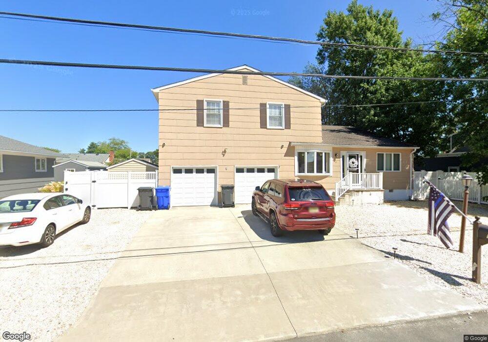
This home is located at 19 Brower Dr, Brick, NJ 08723 and is currently estimated at $908,112, approximately $365 per square foot. 19 Brower Dr is a home located in Ocean County with nearby schools including Emma Havens Young Elementary School, Lake Riviera Middle School, and Brick Township High School.
Ownership History
Date
Name
Owned For
Owner Type
Purchase Details
Closed on
Jul 30, 1999
Sold by
Oshea James J and Oshea Lynne D
Bought by
Stevens William A and Stevens Noreen M
Current Estimated Value
Home Financials for this Owner
Home Financials are based on the most recent Mortgage that was taken out on this home.
Original Mortgage
$207,200
Outstanding Balance
$59,310
Interest Rate
7.6%
Mortgage Type
Stand Alone First
Estimated Equity
$848,802
Create a Home Valuation Report for This Property
The Home Valuation Report is an in-depth analysis detailing your home's value as well as a comparison with similar homes in the area
Home Values in the Area
Average Home Value in this Area
Purchase History
| Date | Buyer | Sale Price | Title Company |
|---|---|---|---|
| Stevens William A | $259,000 | Chicago Title Insurance Co |
Source: Public Records
Mortgage History
| Date | Status | Borrower | Loan Amount |
|---|---|---|---|
| Open | Stevens William A | $207,200 |
Source: Public Records
Tax History Compared to Growth
Tax History
| Year | Tax Paid | Tax Assessment Tax Assessment Total Assessment is a certain percentage of the fair market value that is determined by local assessors to be the total taxable value of land and additions on the property. | Land | Improvement |
|---|---|---|---|---|
| 2025 | $12,739 | $493,200 | $331,900 | $161,300 |
| 2024 | $12,108 | $493,200 | $331,900 | $161,300 |
| 2023 | $11,950 | $493,200 | $331,900 | $161,300 |
| 2022 | $11,950 | $493,200 | $331,900 | $161,300 |
| 2021 | $11,699 | $493,200 | $331,900 | $161,300 |
| 2020 | $11,551 | $493,200 | $331,900 | $161,300 |
| 2019 | $11,358 | $493,200 | $331,900 | $161,300 |
| 2018 | $11,097 | $493,200 | $331,900 | $161,300 |
| 2017 | $10,796 | $493,200 | $331,900 | $161,300 |
| 2016 | $10,742 | $493,200 | $331,900 | $161,300 |
| 2015 | $10,461 | $493,200 | $331,900 | $161,300 |
| 2014 | $10,377 | $493,200 | $331,900 | $161,300 |
Source: Public Records
Map
Nearby Homes
- 21 Mary Ann Dr
- 66 Nina Ct
- 269 Mantoloking Rd
- 21 Scoop Rd
- 25 Scoop Rd
- 47 Nina Ct
- 308 Mantoloking Rd
- 53 Driftwood Dr
- 94 Sandy Point Dr
- 18 Quail Run
- 101 Sandy Point Dr
- 00 Adamston Dr
- 13 Riverview Dr
- 00 Mantoloking Rd
- VZ0 Mantoloking Rd
- 599 Point Ave
- 15 Hulse Landing Rd
- 45 Hulse Landing Rd
- 648 Point Ave
- 53 Country Club Ct