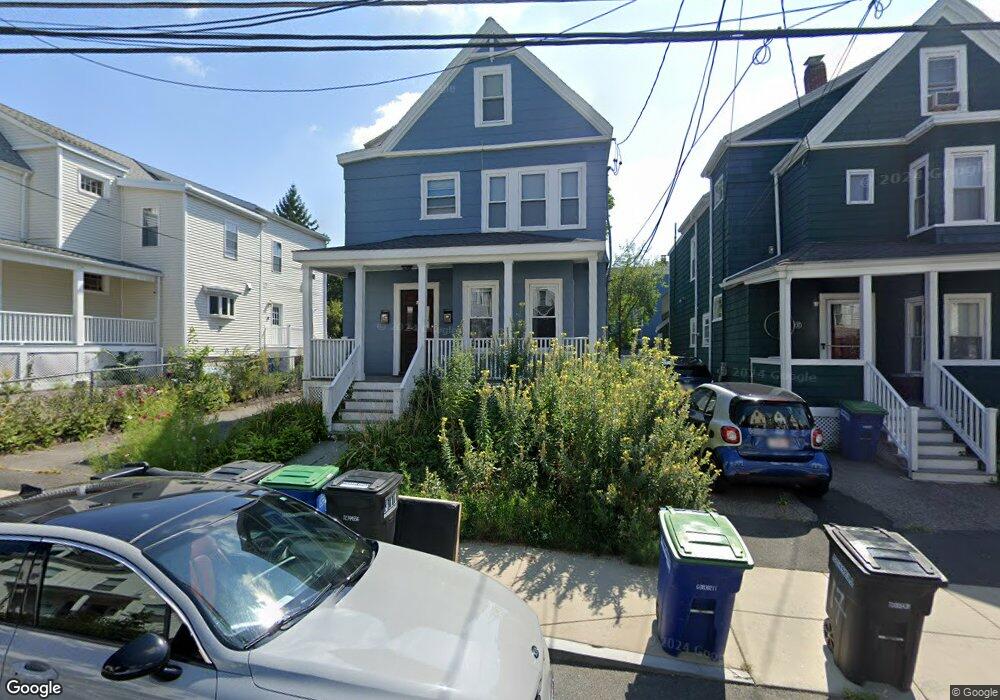
19 Cedar St Somerville, MA 02143
Porter Square NeighborhoodEstimated Value: $1,250,000 - $1,316,000
4
Beds
2
Baths
1,979
Sq Ft
$651/Sq Ft
Est. Value
About This Home
This home is located at 19 Cedar St, Somerville, MA 02143 and is currently estimated at $1,287,949, approximately $650 per square foot. 19 Cedar St is a home located in Middlesex County with nearby schools including Somerville High School, Saint Theresa School, and Wild Rose Montessori School.
Ownership History
Date
Name
Owned For
Owner Type
Purchase Details
Closed on
Jun 10, 2025
Sold by
Diamond Jacob
Bought by
Jacob P Diamond Ret and Diamond
Current Estimated Value
Purchase Details
Closed on
Jul 18, 2007
Sold by
Pullman Jacky and Diamond Jacob
Bought by
Diamond Jacob
Create a Home Valuation Report for This Property
The Home Valuation Report is an in-depth analysis detailing your home's value as well as a comparison with similar homes in the area
Home Values in the Area
Average Home Value in this Area
Purchase History
| Date | Buyer | Sale Price | Title Company |
|---|---|---|---|
| Jacob P Diamond Ret | -- | -- | |
| Jacob P Diamond Ret | -- | -- | |
| Diamond Jacob | -- | -- | |
| Diamond Jacob | -- | -- |
Source: Public Records
Mortgage History
| Date | Status | Borrower | Loan Amount |
|---|---|---|---|
| Previous Owner | Diamond Jacob | $118,000 | |
| Previous Owner | Diamond Jacob | $119,000 |
Source: Public Records
Tax History
| Year | Tax Paid | Tax Assessment Tax Assessment Total Assessment is a certain percentage of the fair market value that is determined by local assessors to be the total taxable value of land and additions on the property. | Land | Improvement |
|---|---|---|---|---|
| 2025 | $11,019 | $1,010,000 | $662,200 | $347,800 |
| 2024 | $10,415 | $990,000 | $662,200 | $327,800 |
| 2023 | $10,178 | $984,300 | $662,200 | $322,100 |
| 2022 | $9,524 | $935,600 | $630,600 | $305,000 |
| 2021 | $8,996 | $882,800 | $600,600 | $282,200 |
| 2020 | $8,516 | $844,000 | $577,500 | $266,500 |
| 2019 | $8,042 | $747,400 | $502,200 | $245,200 |
| 2018 | $7,621 | $673,800 | $456,600 | $217,200 |
| 2017 | $7,353 | $630,100 | $430,700 | $199,400 |
| 2016 | $7,339 | $585,700 | $393,800 | $191,900 |
Source: Public Records
Map
Nearby Homes
- 20 Mossland St
- 32-40 White St
- 49 Cherry St Unit 1
- 8 Craigie St
- 35 Ibbetson St
- 18 Upland Rd Unit 1
- 10 Beech St Unit 4
- 10 Beech St Unit 1
- 10 Beech St Unit 3
- 3 Arlington St Unit 44
- 42 Belmont St
- 148 Lowell St Unit 3
- 125 Lowell St Unit 3B
- 125 Lowell St Unit 5C
- 7 Beech St Unit 319
- 7 Beech St Unit 317
- 156 Albion St Unit 1
- 79 Willow Ave
- 161 Lowell St Unit 1
- 227 Highland Ave Unit 2
- 17 Cedar St
- 21 Cedar St
- 15 Cedar St
- 23 Cedar St
- 9 Gilson Terrace Unit 3
- 9 Gilson Terrace Unit 2
- 9 Gilson Terrace Unit 1
- 9 Gilson Terrace
- 11 Cedar St
- 11 Cedar St Unit 2
- 7 Carole Place
- 25 Cedar St
- 7 Gilson Terrace
- 28 Linden Ave
- 28 Linden Ave Unit R
- 28 Linden Ave Unit 1
- 28R Linden Ave
- 24 1/2 Linden Ave
- 8 Gilson Terrace Unit 3
- 8 Gilson Terrace
Your Personal Tour Guide
Ask me questions while you tour the home.