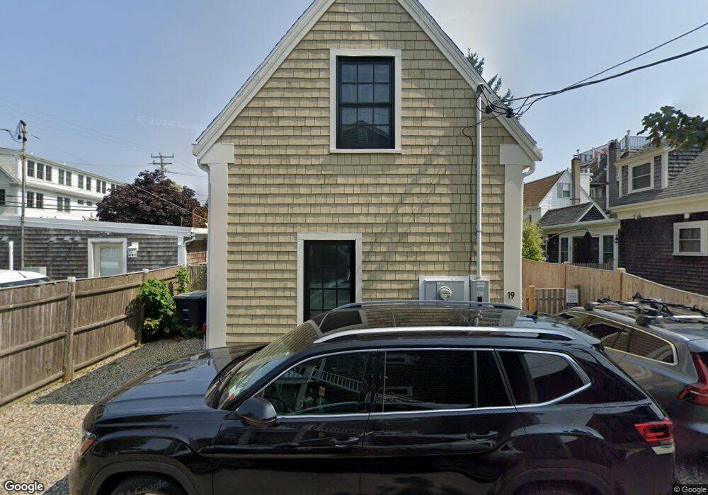
19 Central St Unit 2 Provincetown, MA 02657
Estimated Value: $744,000 - $877,000
1
Bed
1
Bath
606
Sq Ft
$1,374/Sq Ft
Est. Value
About This Home
This home is located at 19 Central St Unit 2, Provincetown, MA 02657 and is currently estimated at $832,461, approximately $1,373 per square foot. 19 Central St Unit 2 is a home located in Barnstable County with nearby schools including Provincetown Schools.
Ownership History
Date
Name
Owned For
Owner Type
Purchase Details
Closed on
Apr 21, 2021
Sold by
Douglass Mark A and Lin James C
Bought by
Yumi Douglin Rt and Douglass
Current Estimated Value
Purchase Details
Closed on
Sep 15, 2020
Sold by
19 Ctrl St Partners Llc
Bought by
Douglass Mark A and Lin James C
Home Financials for this Owner
Home Financials are based on the most recent Mortgage that was taken out on this home.
Original Mortgage
$470,000
Interest Rate
2.9%
Mortgage Type
New Conventional
Create a Home Valuation Report for This Property
The Home Valuation Report is an in-depth analysis detailing your home's value as well as a comparison with similar homes in the area
Home Values in the Area
Average Home Value in this Area
Purchase History
| Date | Buyer | Sale Price | Title Company |
|---|---|---|---|
| Yumi Douglin Rt | -- | None Available | |
| Yumi Douglin Rt | -- | None Available | |
| Douglass Mark A | $587,500 | None Available | |
| Douglass Mark A | $587,500 | None Available |
Source: Public Records
Mortgage History
| Date | Status | Borrower | Loan Amount |
|---|---|---|---|
| Previous Owner | Douglass Mark A | $470,000 |
Source: Public Records
Tax History Compared to Growth
Tax History
| Year | Tax Paid | Tax Assessment Tax Assessment Total Assessment is a certain percentage of the fair market value that is determined by local assessors to be the total taxable value of land and additions on the property. | Land | Improvement |
|---|---|---|---|---|
| 2025 | $3,506 | $626,100 | $0 | $626,100 |
| 2024 | $3,296 | $590,700 | $0 | $590,700 |
| 2023 | $3,474 | $580,900 | $0 | $580,900 |
| 2022 | $3,318 | $498,200 | $0 | $498,200 |
| 2021 | $1,999 | $282,300 | $0 | $282,300 |
| 2020 | $1,814 | $274,000 | $0 | $274,000 |
| 2019 | $1,825 | $258,500 | $0 | $258,500 |
| 2018 | $1,598 | $214,500 | $0 | $214,500 |
| 2017 | $1,590 | $206,200 | $0 | $206,200 |
| 2016 | $1,518 | $194,600 | $0 | $194,600 |
| 2015 | $1,368 | $185,300 | $0 | $185,300 |
Source: Public Records
Map
Nearby Homes
- 7 Central St
- 3 Atlantic Ave
- 162 Commercial St
- 165 Commercial St Unit 4
- 176 Commercial St Unit 2
- 3 Carver Ct
- 147 Commercial St Unit L7
- 147 Commercial St Unit UL7
- 134 Commercial St
- 26 Pleasant St Unit 5
- 27 Court St Pf
- 27 Court St Unit PF
- 7 Kings Way
- 36 Shank Painter Rd Unit 11
- 22 Brown St
- 234 Commercial St
- 10 Bradford St Unit 1
- 10A Bradford St Unit 1
- 10 Bradford St Unit 4
- 10 Bradford St Unit 2
- 19 Central St Unit 4
- 19 Central St Unit 3
- 19 Central St Unit 2-3
- 3 Central St
- 4 Central St
- 53 Bradford St Unit 1
- 53 Bradford St Unit U1
- 53 Bradford St
- 17 Central St
- 16 Winthrop St
- 15 Central St
- 12 Central St
- 56 Bradford St
- 12 Winthrop St
- 58 Bradford St Unit 4
- 58 Bradford St
- 58 Bradford St Unit 1
- 58 Bradford St Unit 2
- 58 Bradford St Unit 7
- 58 Bradford St Unit 6