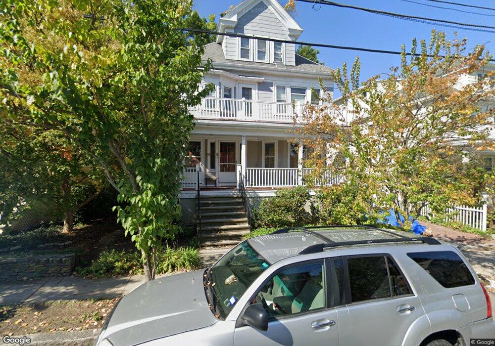
19 Commonwealth Rd Unit 21 Watertown, MA 02472
East Watertown NeighborhoodEstimated Value: $1,235,000 - $1,366,000
4
Beds
2
Baths
3,513
Sq Ft
$376/Sq Ft
Est. Value
About This Home
This home is located at 19 Commonwealth Rd Unit 21, Watertown, MA 02472 and is currently estimated at $1,319,556, approximately $375 per square foot. 19 Commonwealth Rd Unit 21 is a home located in Middlesex County with nearby schools including The Kendall School, Atrium School, and St Stephen's Armenian Elementary School.
Ownership History
Date
Name
Owned For
Owner Type
Purchase Details
Closed on
Jan 30, 1998
Sold by
Rothman Michael L and Rothman Karen
Bought by
Sasser Doris
Current Estimated Value
Home Financials for this Owner
Home Financials are based on the most recent Mortgage that was taken out on this home.
Original Mortgage
$224,000
Outstanding Balance
$39,725
Interest Rate
7.02%
Mortgage Type
Purchase Money Mortgage
Estimated Equity
$1,279,831
Create a Home Valuation Report for This Property
The Home Valuation Report is an in-depth analysis detailing your home's value as well as a comparison with similar homes in the area
Home Values in the Area
Average Home Value in this Area
Purchase History
| Date | Buyer | Sale Price | Title Company |
|---|---|---|---|
| Sasser Doris | $320,000 | -- |
Source: Public Records
Mortgage History
| Date | Status | Borrower | Loan Amount |
|---|---|---|---|
| Open | Sasser Doris | $224,000 |
Source: Public Records
Tax History
| Year | Tax Paid | Tax Assessment Tax Assessment Total Assessment is a certain percentage of the fair market value that is determined by local assessors to be the total taxable value of land and additions on the property. | Land | Improvement |
|---|---|---|---|---|
| 2025 | $13,323 | $1,140,700 | $589,100 | $551,600 |
| 2024 | $12,135 | $1,037,200 | $580,900 | $456,300 |
| 2023 | $13,410 | $987,500 | $544,600 | $442,900 |
| 2022 | $12,509 | $944,100 | $501,000 | $443,100 |
| 2021 | $10,928 | $892,100 | $464,700 | $427,400 |
| 2020 | $10,718 | $882,900 | $464,700 | $418,200 |
| 2019 | $10,465 | $812,500 | $464,700 | $347,800 |
| 2018 | $10,507 | $780,000 | $464,700 | $315,300 |
| 2017 | $10,633 | $765,500 | $450,200 | $315,300 |
| 2016 | $10,432 | $762,600 | $447,300 | $315,300 |
| 2015 | $9,583 | $637,600 | $403,400 | $234,200 |
| 2014 | $9,299 | $621,600 | $387,400 | $234,200 |
Source: Public Records
Map
Nearby Homes
- 29 Commonwealth Rd Unit 1
- 7-9 Clyde Rd
- 10-12 Clyde Rd Unit 1
- 354 School St Unit 354
- 182 Maplewood St Unit 2
- 147 Langdon Ave Unit 1
- 81 Winsor Ave
- 72 Fairview Ave Unit 72
- 210 Belmont St Unit 13
- 210 Belmont St Unit 2
- 198 Belmont St Unit 1
- 456 Belmont St Unit 10
- 6 Appleton St Unit 2
- 46 Maplewood St Unit 2
- 75 Foster Rd Unit 1
- 73 Foster Rd Unit 2
- 324 Mount Auburn St Unit 2
- 19 Keith St Unit 2
- 30 Unity Ave Unit 30
- 6 Irma Ave
- 17 Commonwealth Rd Unit 2
- 23 Commonwealth Rd
- 27 Commonwealth Rd
- 27 Commonwealth Rd Unit 1
- 11 Commonwealth Rd Unit 2
- 9 Commonwealth Rd Unit 1
- 9 Commonwealth Rd Unit 2
- 9 Commonwealth Rd Unit 1,9
- 9 Commonwealth Rd Unit 2,9
- 18 Commonwealth Rd Unit 20
- 24 Commonwealth Rd
- 14 Commonwealth Rd
- 14 Commonwealth Rd Unit 14
- 16 Commonwealth Rd Unit 16
- 29 Commonwealth Rd
- 29 Commonwealth Rd
- 29 Commonwealth Rd Unit 2
- 28 Commonwealth Rd
- 28 Commonwealth Rd
- 28 Commonwealth Rd Unit 3
Your Personal Tour Guide
Ask me questions while you tour the home.