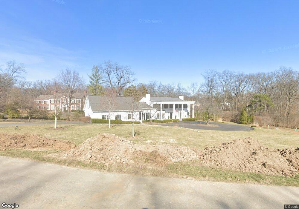
19 Countryside Ln Saint Louis, MO 63131
Estimated Value: $2,149,000 - $2,226,000
4
Beds
6
Baths
4,875
Sq Ft
$449/Sq Ft
Est. Value
About This Home
This home is located at 19 Countryside Ln, Saint Louis, MO 63131 and is currently estimated at $2,187,489, approximately $448 per square foot. 19 Countryside Ln is a home located in St. Louis County with nearby schools including Conway Elementary, Ladue 5th Grade Center, and Ladue Middle.
Ownership History
Date
Name
Owned For
Owner Type
Purchase Details
Closed on
Sep 30, 2022
Sold by
Trelstad Family Trust and Trelstad Paul T
Bought by
Paul J Trelstad Revocable Trust and Lynn Beall Trelstad Revocable Trust
Current Estimated Value
Purchase Details
Closed on
Jul 7, 2009
Sold by
Trelstad Paul and Trelstad Lynn Beall
Bought by
Trelstad Paul T and Trelstad Lynn Beall
Home Financials for this Owner
Home Financials are based on the most recent Mortgage that was taken out on this home.
Original Mortgage
$413,000
Interest Rate
5.39%
Mortgage Type
New Conventional
Purchase Details
Closed on
Jan 16, 1998
Sold by
Trelstad Paul T and Trelstad Lynn Beall
Bought by
Trelstad Paul T and Trelstad Lynn Beall
Purchase Details
Closed on
Nov 14, 1997
Sold by
Simpson Dennis L and Erickson Debra M
Bought by
Trelstad Paul J and Trelstad Lynn Beall
Home Financials for this Owner
Home Financials are based on the most recent Mortgage that was taken out on this home.
Original Mortgage
$470,000
Interest Rate
7.23%
Create a Home Valuation Report for This Property
The Home Valuation Report is an in-depth analysis detailing your home's value as well as a comparison with similar homes in the area
Home Values in the Area
Average Home Value in this Area
Purchase History
| Date | Buyer | Sale Price | Title Company |
|---|---|---|---|
| Paul J Trelstad Revocable Trust | -- | None Listed On Document | |
| Trelstad Paul T | -- | U S Title | |
| Trelstad Paul | -- | U S Title | |
| Trelstad Paul T | -- | -- | |
| Trelstad Paul J | -- | -- |
Source: Public Records
Mortgage History
| Date | Status | Borrower | Loan Amount |
|---|---|---|---|
| Previous Owner | Trelstad Paul | $413,000 | |
| Previous Owner | Trelstad Paul J | $470,000 |
Source: Public Records
Tax History Compared to Growth
Tax History
| Year | Tax Paid | Tax Assessment Tax Assessment Total Assessment is a certain percentage of the fair market value that is determined by local assessors to be the total taxable value of land and additions on the property. | Land | Improvement |
|---|---|---|---|---|
| 2025 | $15,619 | $270,090 | $134,790 | $135,300 |
| 2024 | $15,619 | $228,510 | $124,410 | $104,100 |
| 2023 | $15,601 | $228,510 | $124,410 | $104,100 |
| 2022 | $19,371 | $272,970 | $103,680 | $169,290 |
| 2021 | $19,259 | $272,970 | $103,680 | $169,290 |
| 2020 | $15,384 | $236,090 | $99,370 | $136,720 |
| 2019 | $15,153 | $236,090 | $99,370 | $136,720 |
| 2018 | $13,697 | $196,840 | $89,430 | $107,410 |
| 2017 | $13,642 | $196,840 | $89,430 | $107,410 |
| 2016 | $11,473 | $159,980 | $79,500 | $80,480 |
| 2015 | $10,927 | $159,980 | $79,500 | $80,480 |
| 2014 | $14,229 | $202,130 | $51,570 | $150,560 |
Source: Public Records
Map
Nearby Homes
- 22 Countryside Ln
- 108 Frontenac Forest
- 152 Frontenac Forest
- 1741 Pine Hill Dr
- 436 Tregaron Place
- 1728 Folkstone Dr
- 723 Oak Valley Dr
- 10444 Litzsinger Rd
- 8 Briarbrook Trail
- 11255 Talamore Cir Unit 13
- 11712 Westham Dr
- 5 W Point Ln
- 26 Huntleigh Woods
- TBB
- TBB Ballas Ridge Hawthorne II
- TBB Ballas Ridge Westchester IV
- TBB Ballas Ridge Roclare II
- TBB
- The Hawthorne Plan at Ballas Ridge
- The Roclare II Plan at Ballas Ridge
- 15 Countryside Ln
- 18 Countryside Ln
- 20 Countryside Ln
- 21 Countryside Ln
- 11266 Hermitage Hill Place
- 17 Countryside Ln
- 11278 Hermitage Hill Place
- 11254 Hermitage Hill Place
- 45 Countryside Ln
- 47 Countryside Ln
- 44 Countryside Ln
- 11 Countryside Ln
- 16 Countryside Ln
- 23 Countryside Ln
- 24 Countryside Ln
- 11271 Hermitage Hill Place
- 11242 Hermitage Hill Place
- 46 Countryside Ln
- 2403 Hermitage Hill Ln
- 26 Portland Dr