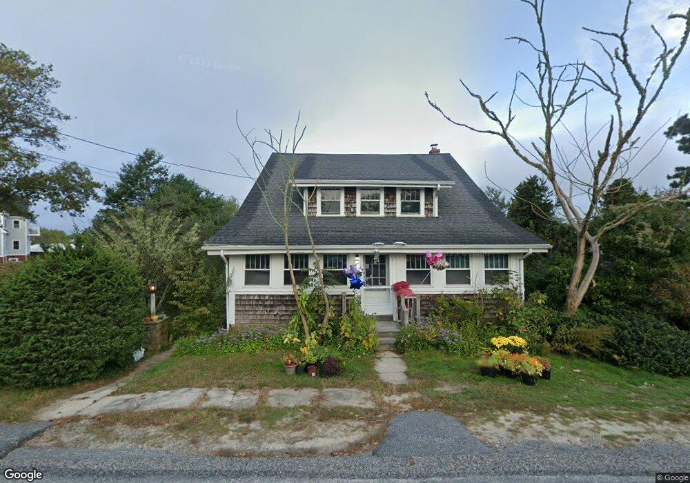
19 Cove Rd West Dennis, MA 2670
West Dennis NeighborhoodEstimated Value: $635,000 - $839,000
2
Beds
2
Baths
1,176
Sq Ft
$637/Sq Ft
Est. Value
About This Home
This home is located at 19 Cove Rd, West Dennis, MA 2670 and is currently estimated at $748,598, approximately $636 per square foot. 19 Cove Rd is a home located in Barnstable County with nearby schools including Dennis-Yarmouth Regional High School and St. Pius X. School.
Ownership History
Date
Name
Owned For
Owner Type
Purchase Details
Closed on
Nov 8, 2016
Sold by
Derosa Vera F
Bought by
Derosa Nicholas C
Current Estimated Value
Purchase Details
Closed on
Mar 13, 2015
Sold by
Derosa Rt
Bought by
Derosa Nicholas C and Derosa Vera F
Purchase Details
Closed on
Aug 21, 2007
Sold by
Derosa Vera
Bought by
Derosa Rt
Create a Home Valuation Report for This Property
The Home Valuation Report is an in-depth analysis detailing your home's value as well as a comparison with similar homes in the area
Home Values in the Area
Average Home Value in this Area
Purchase History
| Date | Buyer | Sale Price | Title Company |
|---|---|---|---|
| Derosa Nicholas C | -- | -- | |
| Derosa Nicholas C | -- | -- | |
| Derosa Rt | -- | -- |
Source: Public Records
Tax History Compared to Growth
Tax History
| Year | Tax Paid | Tax Assessment Tax Assessment Total Assessment is a certain percentage of the fair market value that is determined by local assessors to be the total taxable value of land and additions on the property. | Land | Improvement |
|---|---|---|---|---|
| 2025 | $3,366 | $777,300 | $302,400 | $474,900 |
| 2024 | $3,184 | $725,200 | $290,800 | $434,400 |
| 2023 | $3,045 | $652,100 | $257,000 | $395,100 |
| 2022 | $2,989 | $533,800 | $231,500 | $302,300 |
| 2021 | $2,609 | $432,600 | $194,500 | $238,100 |
| 2020 | $2,557 | $419,100 | $194,500 | $224,600 |
| 2019 | $2,179 | $353,200 | $152,600 | $200,600 |
| 2018 | $44,504 | $359,000 | $169,500 | $189,500 |
| 2017 | $2,208 | $359,000 | $169,500 | $189,500 |
| 2016 | $2,274 | $348,300 | $187,600 | $160,700 |
| 2015 | $2,144 | $335,000 | $174,300 | $160,700 |
| 2014 | $2,096 | $330,000 | $174,300 | $155,700 |
Source: Public Records
Map
Nearby Homes
- 209 Main St Unit 3
- 209 Main St Unit 6
- 209 Main St Unit 1
- 209 Main St Unit 2
- 209 Main St Unit 4
- 209 Main St Unit 5
- 14 Schoolhouse Ln
- 23 Doric Ave
- 401 Main St Unit 201
- 401 Main St Unit 101
- 45 Seth Ln
- 428 Main St Unit 1-11
- 467 Main St
- 178 School St
- 40 Kelley Rd
- 29 Bass River Rd
- 2 Rita Mary Way
- 308 Old Main St
- 18 Turner Ln
- 116 N Main St
- 164 Main St
- 164 Main St Unit 1-6
- 27 Cove Rd
- 22 Cove Rd
- 184 Main (Route 28) St
- 178 Main St
- 174 Main St
- 27 Cove Rd
- 184 Main Street (Route 28)
- 184 Main
- 202 Main St
- 154 Main St
- 196 Main St
- 202 Main St
- 160 Main St
- 196 Massachusetts 28 Unit A
- 193 Main St
- 161 Main St
- 191 Main Route 28 Hwy
- 111 Main St Confidential