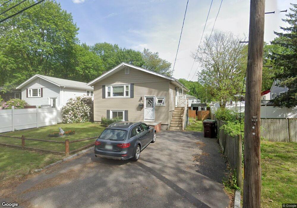
19 Cranston Ave Dedham, MA 02026
Greenlodge NeighborhoodEstimated Value: $570,000 - $664,000
2
Beds
2
Baths
936
Sq Ft
$660/Sq Ft
Est. Value
About This Home
This home is located at 19 Cranston Ave, Dedham, MA 02026 and is currently estimated at $617,476, approximately $659 per square foot. 19 Cranston Ave is a home located in Norfolk County with nearby schools including Greenlodge Elementary School, Dedham Middle School, and Dedham High School.
Ownership History
Date
Name
Owned For
Owner Type
Purchase Details
Closed on
Nov 26, 2003
Sold by
Corrado Steven A and Corrado Andrea
Bought by
Martinello Stephen E
Current Estimated Value
Home Financials for this Owner
Home Financials are based on the most recent Mortgage that was taken out on this home.
Original Mortgage
$274,000
Outstanding Balance
$128,826
Interest Rate
6.09%
Mortgage Type
Purchase Money Mortgage
Estimated Equity
$488,650
Purchase Details
Closed on
Jan 24, 2003
Sold by
Lynch Rita A and Zuliani Rita A
Bought by
Corrado Andrea and Corrado Steven A
Home Financials for this Owner
Home Financials are based on the most recent Mortgage that was taken out on this home.
Original Mortgage
$283,500
Interest Rate
6.11%
Mortgage Type
Purchase Money Mortgage
Create a Home Valuation Report for This Property
The Home Valuation Report is an in-depth analysis detailing your home's value as well as a comparison with similar homes in the area
Home Values in the Area
Average Home Value in this Area
Purchase History
| Date | Buyer | Sale Price | Title Company |
|---|---|---|---|
| Martinello Stephen E | $342,500 | -- | |
| Corrado Andrea | $315,000 | -- |
Source: Public Records
Mortgage History
| Date | Status | Borrower | Loan Amount |
|---|---|---|---|
| Open | Martinello Stephen E | $274,000 | |
| Previous Owner | Corrado Andrea | $283,500 |
Source: Public Records
Tax History
| Year | Tax Paid | Tax Assessment Tax Assessment Total Assessment is a certain percentage of the fair market value that is determined by local assessors to be the total taxable value of land and additions on the property. | Land | Improvement |
|---|---|---|---|---|
| 2025 | $7,331 | $580,900 | $315,600 | $265,300 |
| 2024 | $6,893 | $551,400 | $286,300 | $265,100 |
| 2023 | $6,839 | $532,600 | $259,200 | $273,400 |
| 2022 | $6,340 | $474,900 | $243,500 | $231,400 |
| 2021 | $5,890 | $430,900 | $225,400 | $205,500 |
| 2020 | $5,798 | $422,600 | $225,400 | $197,200 |
| 2019 | $5,452 | $385,300 | $196,000 | $189,300 |
| 2018 | $5,183 | $356,200 | $174,000 | $182,200 |
| 2017 | $4,930 | $334,000 | $163,100 | $170,900 |
| 2016 | $4,986 | $321,900 | $151,000 | $170,900 |
| 2015 | $4,525 | $285,100 | $143,000 | $142,100 |
| 2014 | $4,433 | $275,700 | $140,400 | $135,300 |
Source: Public Records
Map
Nearby Homes
- 53 Winfield St
- 193 Vincent Rd
- 215 Blue Hill Dr
- 989 East St Unit 402
- 22 Azalea Cir
- 355 Canton St
- 59 Hamilton Ave
- 50 Sprague St
- 21 Birch St
- 350 Blue Hill Dr
- 18 Greensboro Rd
- 93 Alden St
- 290 East St
- 158 Strasser Ave
- 360 Blue Hill Dr
- 59 Grafton Ave
- 72 Crane St
- 14 Eldridge Place
- 391 Sprague St
- 397 Sprague St
- 25 Cranston Ave
- 86 Vincent Rd
- 90 Vincent Rd
- 20 Overlook Ave
- 29 Cranston Ave
- 16 Overlook Ave
- 24 Overlook Ave Unit 1
- 60 Cranston St
- 60 Cranston St
- 94 Vincent Rd
- 38 Overlook Ave
- 22 Cranston Ave
- 74 Vincent Rd
- 42 Overlook Ave
- 30 Cranston Ave
- 19 Overlook Ave
- 70 Vincent Rd
- 87 Vincent Rd
- 95 Vincent Rd
- 73 Winfield St
Your Personal Tour Guide
Ask me questions while you tour the home.