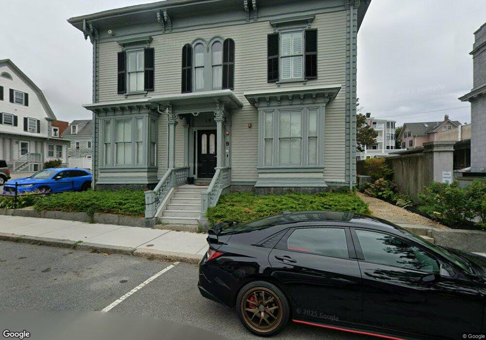
19 Dale Ave Unit 3 Gloucester, MA 01930
Central Gloucester NeighborhoodEstimated Value: $470,000 - $636,000
2
Beds
2
Baths
1,252
Sq Ft
$419/Sq Ft
Est. Value
About This Home
This home is located at 19 Dale Ave Unit 3, Gloucester, MA 01930 and is currently estimated at $524,790, approximately $419 per square foot. 19 Dale Ave Unit 3 is a home located in Essex County with nearby schools including East Gloucester Elementary School, Ralph B O'maley Middle School, and Gloucester High School.
Ownership History
Date
Name
Owned For
Owner Type
Purchase Details
Closed on
Sep 19, 2011
Sold by
Easterday Diane
Bought by
Young Joanne and Young Paul W
Current Estimated Value
Purchase Details
Closed on
Mar 31, 2011
Sold by
Easterday Diane
Bought by
Gloucester City Of
Purchase Details
Closed on
Oct 24, 2008
Sold by
Historic Seaport Home
Bought by
Easterday Diane
Create a Home Valuation Report for This Property
The Home Valuation Report is an in-depth analysis detailing your home's value as well as a comparison with similar homes in the area
Home Values in the Area
Average Home Value in this Area
Purchase History
| Date | Buyer | Sale Price | Title Company |
|---|---|---|---|
| Young Joanne | $240,000 | -- | |
| Gloucester City Of | $1,622 | -- | |
| Easterday Diane | $275,000 | -- |
Source: Public Records
Tax History Compared to Growth
Tax History
| Year | Tax Paid | Tax Assessment Tax Assessment Total Assessment is a certain percentage of the fair market value that is determined by local assessors to be the total taxable value of land and additions on the property. | Land | Improvement |
|---|---|---|---|---|
| 2025 | $4,194 | $431,500 | $0 | $431,500 |
| 2024 | $3,939 | $404,800 | $0 | $404,800 |
| 2023 | $4,132 | $390,200 | $0 | $390,200 |
| 2022 | $4,155 | $354,200 | $0 | $354,200 |
| 2021 | $4,150 | $333,600 | $0 | $333,600 |
| 2020 | $4,113 | $333,600 | $0 | $333,600 |
| 2019 | $3,929 | $309,600 | $0 | $309,600 |
| 2018 | $3,715 | $287,300 | $0 | $287,300 |
| 2017 | $3,518 | $266,700 | $0 | $266,700 |
| 2016 | $3,520 | $258,600 | $0 | $258,600 |
| 2015 | $3,456 | $253,200 | $0 | $253,200 |
Source: Public Records
Map
Nearby Homes
- 90 Middle St Unit L
- 191 Main St Unit 2B
- 191 Main St Unit 3
- 191 Main St Unit 2A
- 33 Maplewood Ave Unit 21
- 119 Pleasant St
- 35 Middle St Unit 4
- 4 Mount Vernon St
- 33 Middle St
- 5 Washington Square
- 160 Prospect St Unit 3
- 40 Sargent St
- 8 Summer St Unit 103
- 22 Taylor St Unit 1
- 16 Cleveland Place Unit 11
- 78 Grove St
- 15 Harvard St
- 60 Rocky Neck Ave Unit 202
- 196 Washington St
- 73 Rocky Neck Ave Unit 2
- 19 Dale Ave Unit 4
- 19 Dale Ave Unit 2
- 19 Dale Ave Unit 1
- 19 Dale Ave
- 7 Franklin Square
- 5 Franklin Square
- 5 Franklin Square Unit 5
- 23 Dale Ave
- 23 Dale Ave Unit 1
- 23 Dale Ave Unit 3
- 67 Prospect St
- 22 Dale Ave
- 18 Dale Ave Unit 2
- 18 Dale Ave
- 52 Pleasant St
- 28 Dale Ave
- 50 Pleasant St Unit 3
- 50 Pleasant St Unit 2
- 50 Pleasant St Unit 1
- 50 Pleasant St