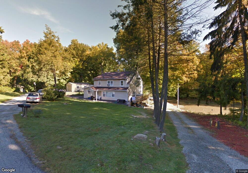
19 Deerhaunt Dr Croton On Hudson, NY 10520
Estimated Value: $519,982 - $874,000
--
Bed
--
Bath
--
Sq Ft
0.56
Acres
About This Home
This home is located at 19 Deerhaunt Dr, Croton On Hudson, NY 10520 and is currently estimated at $686,746. 19 Deerhaunt Dr is a home located in Westchester County with nearby schools including Frank G. Lindsey Elementary School, Blue Mountain Middle School, and Hendrick Hudson High School.
Ownership History
Date
Name
Owned For
Owner Type
Purchase Details
Closed on
Jun 17, 2004
Sold by
Yang Kyong Hui
Bought by
Chacha Jose Mario and Guzman Sandra F
Current Estimated Value
Home Financials for this Owner
Home Financials are based on the most recent Mortgage that was taken out on this home.
Original Mortgage
$404,165
Interest Rate
5.85%
Mortgage Type
Purchase Money Mortgage
Purchase Details
Closed on
Feb 14, 2003
Sold by
Diggin Michael and Yang Kyong Hui
Bought by
Yang Kyong Hui
Home Financials for this Owner
Home Financials are based on the most recent Mortgage that was taken out on this home.
Original Mortgage
$125,000
Interest Rate
5.86%
Mortgage Type
Purchase Money Mortgage
Purchase Details
Closed on
Oct 17, 2000
Sold by
Machan Jaromir and Machan Dagmar
Bought by
Diggin Michael and Yang Kyong Hui
Create a Home Valuation Report for This Property
The Home Valuation Report is an in-depth analysis detailing your home's value as well as a comparison with similar homes in the area
Home Values in the Area
Average Home Value in this Area
Purchase History
| Date | Buyer | Sale Price | Title Company |
|---|---|---|---|
| Chacha Jose Mario | $445,000 | -- | |
| Yang Kyong Hui | $50,000 | Commonwealth Land Title Ins | |
| Diggin Michael | $140,000 | Lawyers Title Insurance Corp |
Source: Public Records
Mortgage History
| Date | Status | Borrower | Loan Amount |
|---|---|---|---|
| Previous Owner | Chacha Jose Mario | $404,165 | |
| Previous Owner | Yang Kyong Hui | $125,000 |
Source: Public Records
Tax History Compared to Growth
Tax History
| Year | Tax Paid | Tax Assessment Tax Assessment Total Assessment is a certain percentage of the fair market value that is determined by local assessors to be the total taxable value of land and additions on the property. | Land | Improvement |
|---|---|---|---|---|
| 2024 | $8,858 | $5,025 | $350 | $4,675 |
| 2023 | $9,389 | $5,025 | $350 | $4,675 |
| 2022 | $8,529 | $5,025 | $350 | $4,675 |
| 2021 | $8,760 | $5,025 | $350 | $4,675 |
| 2020 | $9,252 | $5,025 | $350 | $4,675 |
| 2019 | $7,836 | $5,025 | $350 | $4,675 |
| 2018 | $7,901 | $5,025 | $350 | $4,675 |
| 2017 | $0 | $5,025 | $350 | $4,675 |
| 2016 | $7,642 | $5,025 | $350 | $4,675 |
| 2015 | -- | $5,025 | $350 | $4,675 |
| 2014 | -- | $5,025 | $350 | $4,675 |
| 2013 | -- | $5,025 | $350 | $4,675 |
Source: Public Records
Map
Nearby Homes
- 11 Deer Haunt Dr
- 110 Laurel Hill Rd
- 114 Laurel Hill Rd
- 0 Laurel Hill Rd Unit KEY925925
- 149 Cortlandt St
- 14 Amalfi Dr
- 49 Henning Dr
- 196 Furnace Dock Rd
- 13 Scenic Dr Unit M
- 13 Scenic Dr Unit D
- 12 Scenic Dr Unit K
- 14 Scenic Dr Unit 14T
- 23 Chester Ct
- 15 Scenic Dr Unit D
- 15 Scenic Dr Unit K
- 16 Scenic Dr Unit X
- 16 Scenic Dr Unit S
- 16 Scenic Dr Unit N
- 16 Scenic Dr Unit M
- 23 Meadow Rd
- 21 Deerhaunt Dr
- 17 Deerhaunt Dr
- 23 Deerhaunt Dr
- 18 Deerhaunt Dr
- 11 Deerhaunt Dr
- 16 Deerhaunt Dr
- 12 Deerhaunt Dr
- 2059 Albany Post Ferris Ln Rd
- 2059 Albany Post Rd
- 15 Birch Ln
- 8 Deerhaunt Dr
- 29 Westminster Dr
- 11 Birch Ln
- 31 Westminster Dr
- 25 Westminster Dr
- 6 Deerhaunt Dr Unit L
- 6 Deerhaunt Dr Unit U
- 6 Deerhaunt Dr
- 9 Birch Ln
- 33 Westminster Dr