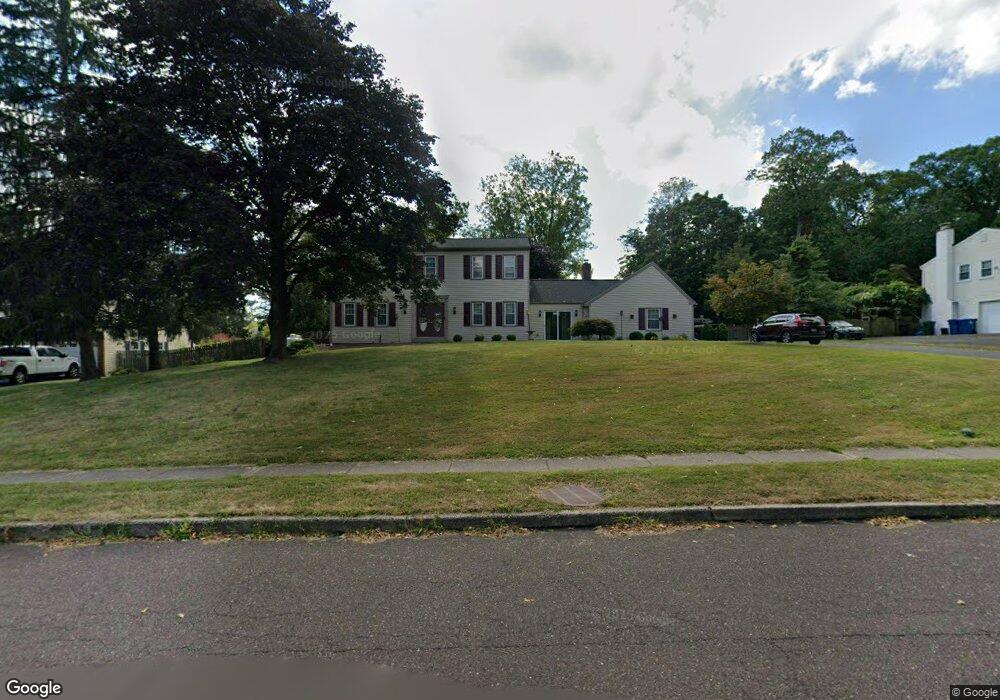
19 Deerpath Rd Chalfont, PA 18914
Estimated Value: $695,000 - $755,000
4
Beds
3
Baths
2,553
Sq Ft
$282/Sq Ft
Est. Value
About This Home
This home is located at 19 Deerpath Rd, Chalfont, PA 18914 and is currently estimated at $720,621, approximately $282 per square foot. 19 Deerpath Rd is a home located in Bucks County with nearby schools including Simon Butler Elementary, Unami Middle School, and Central Bucks High School - South.
Ownership History
Date
Name
Owned For
Owner Type
Purchase Details
Closed on
Sep 30, 2002
Sold by
Nolen John J and Nolen Carol F
Bought by
Ross Robert and Ross Suzanne M
Current Estimated Value
Home Financials for this Owner
Home Financials are based on the most recent Mortgage that was taken out on this home.
Original Mortgage
$288,000
Outstanding Balance
$121,447
Interest Rate
6.24%
Estimated Equity
$599,174
Purchase Details
Closed on
Jul 13, 1979
Bought by
Nolen John J and Nolen Carol F
Create a Home Valuation Report for This Property
The Home Valuation Report is an in-depth analysis detailing your home's value as well as a comparison with similar homes in the area
Home Values in the Area
Average Home Value in this Area
Purchase History
| Date | Buyer | Sale Price | Title Company |
|---|---|---|---|
| Ross Robert | $320,000 | First American Title Ins Co | |
| Nolen John J | $85,000 | -- |
Source: Public Records
Mortgage History
| Date | Status | Borrower | Loan Amount |
|---|---|---|---|
| Open | Ross Robert | $288,000 |
Source: Public Records
Tax History Compared to Growth
Tax History
| Year | Tax Paid | Tax Assessment Tax Assessment Total Assessment is a certain percentage of the fair market value that is determined by local assessors to be the total taxable value of land and additions on the property. | Land | Improvement |
|---|---|---|---|---|
| 2025 | $8,523 | $47,600 | $8,600 | $39,000 |
| 2024 | $8,523 | $47,600 | $8,600 | $39,000 |
| 2023 | $8,165 | $47,600 | $8,600 | $39,000 |
| 2022 | $8,076 | $47,600 | $8,600 | $39,000 |
| 2021 | $7,987 | $47,600 | $8,600 | $39,000 |
| 2020 | $7,987 | $47,600 | $8,600 | $39,000 |
| 2019 | $7,940 | $47,600 | $8,600 | $39,000 |
| 2018 | $7,940 | $47,600 | $8,600 | $39,000 |
| 2017 | $7,821 | $47,600 | $8,600 | $39,000 |
| 2016 | $7,821 | $47,600 | $8,600 | $39,000 |
| 2015 | -- | $47,600 | $8,600 | $39,000 |
| 2014 | -- | $47,600 | $8,600 | $39,000 |
Source: Public Records
Map
Nearby Homes
- 108 Devon Rd
- 245 Coventry Rd
- 172 Chestnut St
- 40 E Butler Ave
- 202 Cornwall Dr
- 217 Pebble Ct
- 110 Palace Ct
- 425 Elm Cir
- 210 Remington Ct Unit 210
- 117 S Limekiln Pike
- 10 Hellberg Ave
- 103 Bonnie Lark Ct
- 113 Krista Ct
- 0 S Limekiln Pike
- 1075 Patrick Place Unit 75
- 124 Brianna Ct Unit 35
- 154 Galway Cir
- 122 Brianna Ct Unit 36
- Simmons Plan at Birch Run at New Britain
- Simmons Elite Plan at Birch Run at New Britain
- 15 Deerpath Rd
- 23 Deerpath Rd
- 11 Deerpath Rd
- 21 Skyline Dr
- 27 Deerpath Rd
- 19 Skyline Dr
- 25 Skyline Dr
- 93 Meadowbrook Ln
- 22 Deerpath Rd
- 94 Meadowbrook Ln
- 17 Skyline Dr
- 26 Deerpath Rd
- 9 Deerpath Rd
- 27 Skyline Dr
- 31 Deerpath Rd
- 30 Deerpath Rd
- 3 Deerpath Rd
- 89 Meadowbrook Ln
- 92 Meadowbrook Ln
- 29 Skyline Dr