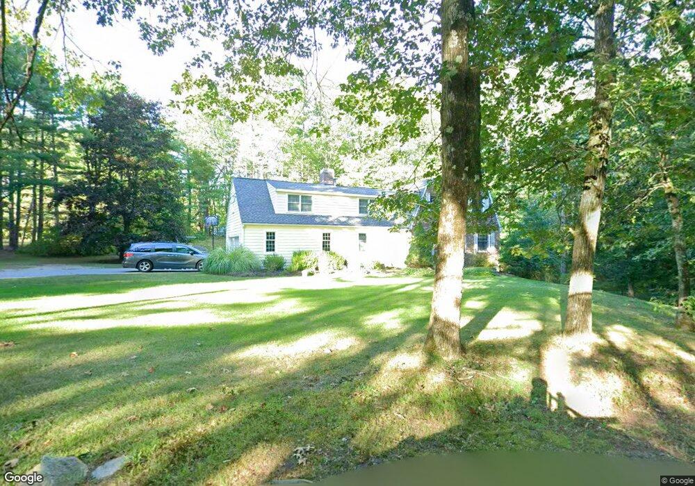
19 Dunstable Rd Westford, MA 01886
Estimated Value: $878,424 - $988,000
About This Home
This home is located at 19 Dunstable Rd, Westford, MA 01886 and is currently estimated at $914,106, approximately $359 per square foot. 19 Dunstable Rd is a home located in Middlesex County with nearby schools including Rita E. Miller Elementary School, Day Elementary School, and Stony Brook School.
Ownership History
We collect this data history from publicly available records. To have your information removed, we recommend requesting removal directly through your county’s website.
Purchase Details
Home Financials for this Owner
Home Financials are based on the most recent Mortgage that was taken out on this home.Purchase Details
Home Financials for this Owner
Home Financials are based on the most recent Mortgage that was taken out on this home.Purchase Details
Home Values in the Area
Average Home Value in this Area
Purchase History
We collect this data history from publicly available records. To have your information removed, we recommend requesting removal directly through your county’s website.
| Date | Buyer | Sale Price | Title Company |
|---|---|---|---|
| $475,000 | -- | ||
| $475,000 | -- | ||
| $431,500 | -- | ||
| $283,000 | -- |
Mortgage History
We collect this data history from publicly available records. To have your information removed, we recommend requesting removal directly through your county’s website.
| Date | Status | Borrower | Loan Amount |
|---|---|---|---|
| Open | $250,000 | ||
| Closed | $260,000 | ||
| Previous Owner | $300,000 |
Tax History
We collect this data history from publicly available records. To have your information removed, we recommend requesting removal directly through your county’s website.
| Year | Tax Paid | Tax Assessment Tax Assessment Total Assessment is a certain percentage of the fair market value that is determined by local assessors to be the total taxable value of land and additions on the property. | Land | Improvement |
|---|---|---|---|---|
| 2025 | $9,146 | $679,000 | $314,900 | $364,100 |
| 2024 | $8,904 | $646,600 | $299,900 | $346,700 |
| 2023 | $8,831 | $598,300 | $285,700 | $312,600 |
| 2022 | $8,961 | $555,900 | $249,800 | $306,100 |
| 2021 | $8,630 | $518,600 | $249,800 | $268,800 |
| 2020 | $5,386 | $521,400 | $249,800 | $271,600 |
| 2019 | $8,316 | $502,200 | $249,800 | $252,400 |
| 2018 | $10,680 | $489,200 | $238,900 | $250,300 |
| 2017 | $4,839 | $471,800 | $238,900 | $232,900 |
| 2016 | $7,506 | $460,500 | $225,300 | $235,200 |
| 2015 | $7,503 | $462,000 | $225,300 | $236,700 |
| 2014 | $6,864 | $413,500 | $216,000 | $197,500 |
Map
- 9 Butternut Rd
- 270 Groton Rd
- 16 Shipley Cir
- 2 Shipley Cir
- 5 Eagles Nest Rd
- 100 Nutting Rd Unit C1
- 16 Saint Paul Ln Unit Lot 20
- 1 Appian Way
- 117 Depot St
- 6 Olive Rd
- 35 Keyes Rd
- 12 Waterview Dr Unit 12
- 15 Newport Dr
- 168 Groton Rd
- 14 Whispering Pines Rd
- 8 Maple Rd
- 17 Maple St
- 42 Birch Rd
- 34 Maple Rd
- 64 Lake Shore Dr S
Ask me questions while you tour the home.