Estimated Value: $780,994 - $837,000
4
Beds
3
Baths
2,382
Sq Ft
$342/Sq Ft
Est. Value
About This Home
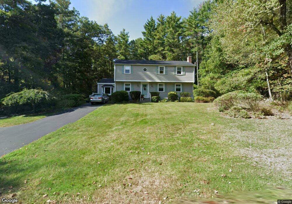
This home is located at 19 Eliot Dr, Stow, MA 01775 and is currently estimated at $815,499, approximately $342 per square foot. 19 Eliot Dr is a home located in Middlesex County with nearby schools including Center School, Hale Middle School, and Nashoba Regional High School.
Ownership History
Date
Name
Owned For
Owner Type
Purchase Details
Closed on
Jun 4, 2018
Sold by
Murphy James J and Murphy Nancy R
Bought by
Murphy Ft
Current Estimated Value
Purchase Details
Closed on
Jan 1, 1971
Bought by
Murphy James J and Murphy Nancy Ruth
Create a Home Valuation Report for This Property
The Home Valuation Report is an in-depth analysis detailing your home's value as well as a comparison with similar homes in the area
Home Values in the Area
Average Home Value in this Area
Purchase History
| Date | Buyer | Sale Price | Title Company |
|---|---|---|---|
| Murphy Ft | -- | -- | |
| Murphy James J | -- | -- |
Source: Public Records
Mortgage History
| Date | Status | Borrower | Loan Amount |
|---|---|---|---|
| Previous Owner | Murphy James J | $11,900 | |
| Previous Owner | Murphy James J | $16,000 | |
| Previous Owner | Murphy James J | $25,000 |
Source: Public Records
Tax History
| Year | Tax Paid | Tax Assessment Tax Assessment Total Assessment is a certain percentage of the fair market value that is determined by local assessors to be the total taxable value of land and additions on the property. | Land | Improvement |
|---|---|---|---|---|
| 2025 | $12,232 | $702,200 | $364,600 | $337,600 |
| 2024 | $12,536 | $738,700 | $400,800 | $337,900 |
| 2023 | $11,565 | $637,900 | $358,300 | $279,600 |
| 2022 | $10,052 | $513,900 | $276,100 | $237,800 |
| 2021 | $10,048 | $502,900 | $276,100 | $226,800 |
| 2020 | $9,746 | $472,900 | $254,700 | $218,200 |
| 2019 | $9,373 | $465,600 | $254,700 | $210,900 |
| 2018 | $8,732 | $416,200 | $254,700 | $161,500 |
| 2017 | $8,434 | $409,600 | $226,900 | $182,700 |
| 2016 | $8,242 | $412,500 | $226,900 | $185,600 |
| 2015 | $7,852 | $393,000 | $206,300 | $186,700 |
Source: Public Records
Map
Nearby Homes
- 53 Sylvan Dr
- 13 Pine Hill Way
- 14 Pine Hill Way
- 18 B Pine Hill Way Unit BB
- 77 Wheeler Dr Unit 77
- 20 Lyons Ln Unit 20
- 310 Codman Hill Rd Unit 35D
- 9 Cortland Dr Unit 9
- 30-6 Taylor Rd
- 54 Orchard Dr Unit 54
- 414 Great Rd
- 94 Hudson Rd
- 90 Corn Rd
- 15 Crescent St
- 247 W Acton Rd
- 53 Swanson Ct Unit 24C
- 143 Hudson Rd
- 19 Partridge Hill Rd
- 176 Swanson Rd Unit 304
- 220 Swanson Rd Unit 605
Your Personal Tour Guide
Ask me questions while you tour the home.