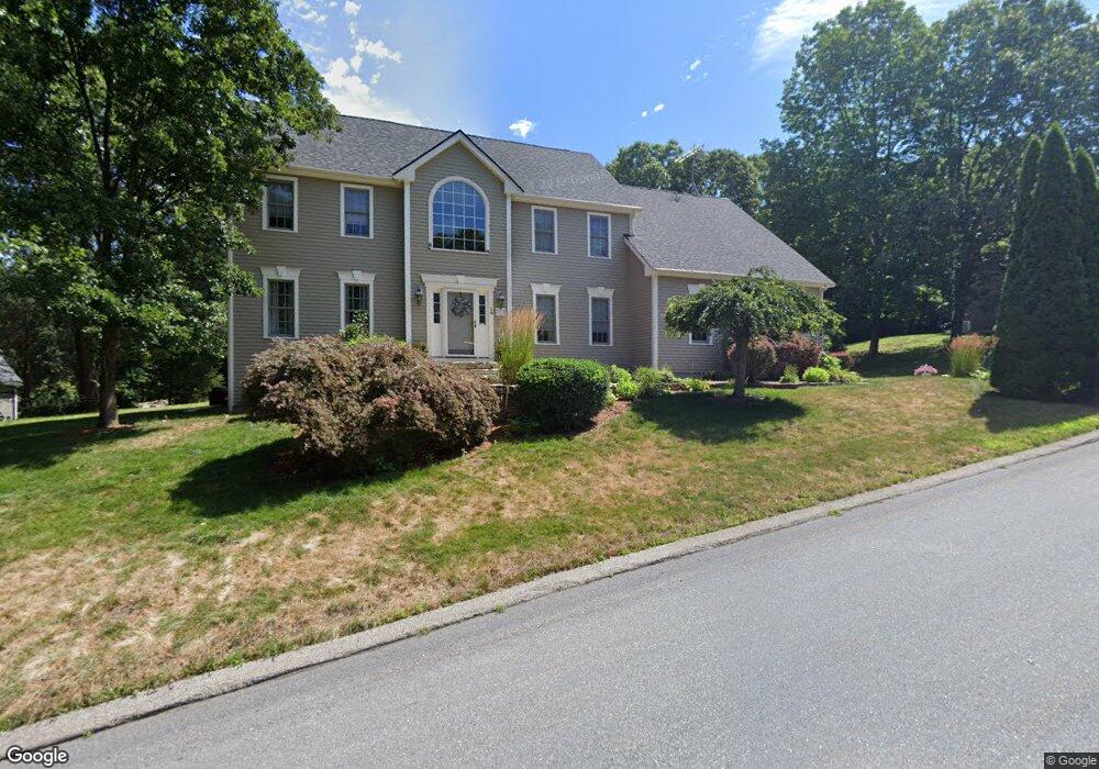
19 Elliot Trail Grafton, MA 01519
Estimated Value: $795,657 - $916,000
4
Beds
3
Baths
3,000
Sq Ft
$284/Sq Ft
Est. Value
About This Home
This home is located at 19 Elliot Trail, Grafton, MA 01519 and is currently estimated at $850,914, approximately $283 per square foot. 19 Elliot Trail is a home located in Worcester County with nearby schools including Grafton High School, Silver Spruce Montessori School, and Touchstone Community School.
Ownership History
Date
Name
Owned For
Owner Type
Purchase Details
Closed on
Nov 30, 2004
Sold by
Kaligian Penny K
Bought by
Stmartin Darcy K and Stmartin Ronald G
Current Estimated Value
Home Financials for this Owner
Home Financials are based on the most recent Mortgage that was taken out on this home.
Original Mortgage
$190,000
Outstanding Balance
$95,279
Interest Rate
5.75%
Mortgage Type
Purchase Money Mortgage
Estimated Equity
$755,635
Purchase Details
Closed on
Jun 2, 2000
Sold by
Rothkugel Michael J and Rothkugel Kelly D
Bought by
Kaligan Penny K
Purchase Details
Closed on
May 27, 1997
Sold by
Rt Simeone
Bought by
Rothkugel Michael L and Rothkugel Kelly D
Create a Home Valuation Report for This Property
The Home Valuation Report is an in-depth analysis detailing your home's value as well as a comparison with similar homes in the area
Home Values in the Area
Average Home Value in this Area
Purchase History
| Date | Buyer | Sale Price | Title Company |
|---|---|---|---|
| Stmartin Darcy K | $540,000 | -- | |
| Stmartin Darcy K | $540,000 | -- | |
| Stmartin Darcy K | $540,000 | -- | |
| Kaligan Penny K | $360,000 | -- | |
| Kaligan Penny K | $360,000 | -- | |
| Rothkugel Michael L | $260,659 | -- | |
| Rothkugel Michael L | $260,659 | -- |
Source: Public Records
Mortgage History
| Date | Status | Borrower | Loan Amount |
|---|---|---|---|
| Open | Stmartin Darcy K | $190,000 | |
| Closed | Stmartin Darcy K | $190,000 | |
| Previous Owner | Rothkugel Michael L | $240,600 |
Source: Public Records
Tax History Compared to Growth
Tax History
| Year | Tax Paid | Tax Assessment Tax Assessment Total Assessment is a certain percentage of the fair market value that is determined by local assessors to be the total taxable value of land and additions on the property. | Land | Improvement |
|---|---|---|---|---|
| 2025 | $9,513 | $682,400 | $173,900 | $508,500 |
| 2024 | $9,452 | $660,500 | $174,300 | $486,200 |
| 2023 | $8,672 | $552,000 | $174,300 | $377,700 |
| 2022 | $8,266 | $489,700 | $149,600 | $340,100 |
| 2021 | $8,030 | $467,400 | $136,000 | $331,400 |
| 2020 | $7,661 | $464,300 | $136,000 | $328,300 |
| 2019 | $7,344 | $440,800 | $132,000 | $308,800 |
| 2018 | $6,865 | $413,800 | $131,200 | $282,600 |
| 2017 | $6,627 | $404,100 | $121,500 | $282,600 |
| 2016 | $6,636 | $396,200 | $125,000 | $271,200 |
| 2015 | $6,579 | $398,700 | $125,000 | $273,700 |
| 2014 | $6,015 | $394,200 | $133,100 | $261,100 |
Source: Public Records
Map
Nearby Homes
- 54 Elliot Trail
- 151 Providence Rd Unit 15
- 151 Providence Rd Unit 24
- 13 Pullard Rd Unit 38
- 42 Gordon Cir Unit 42
- 30 Nottingham Rd
- 18 Pullard Rd
- 24 Coventry Rd
- 36 South St
- 49 South St
- 7 Pleasant St
- 3 Millbury St
- 63 Providence Rd Unit 2
- 78 Pleasant St
- 55 Upton St
- 81 Millbury St
- 8 Chestnut St
- 43 Barbara Jean St
- 18 Barbara Jean St
- 5 Merriam Rd