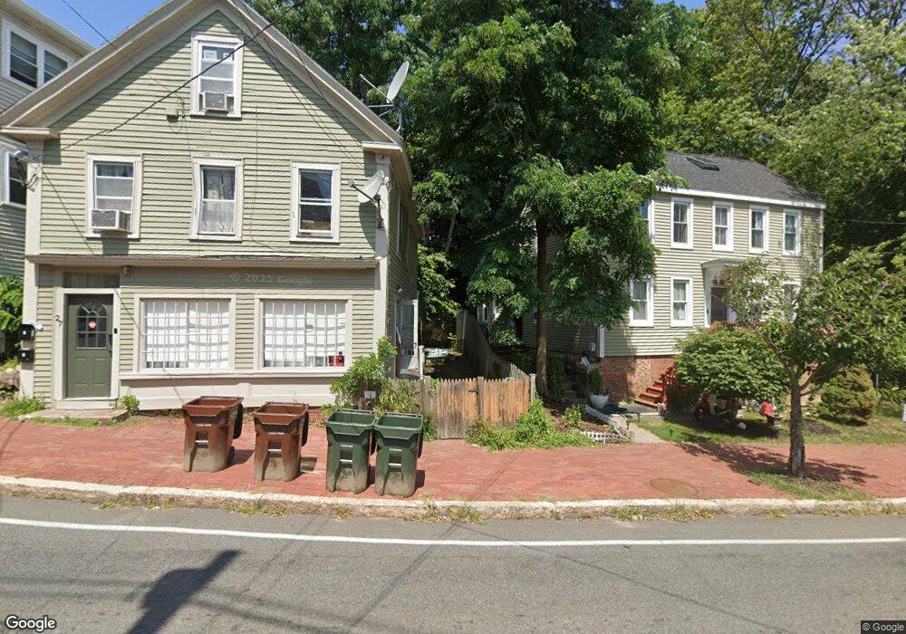
19 Elm St Unit F Amesbury, MA 01913
Estimated Value: $269,000 - $427,000
1
Bed
1
Bath
886
Sq Ft
$398/Sq Ft
Est. Value
About This Home
This home is located at 19 Elm St Unit F, Amesbury, MA 01913 and is currently estimated at $352,416, approximately $397 per square foot. 19 Elm St Unit F is a home located in Essex County with nearby schools including Amesbury High School and Amesbury Seventh-Day Adventist School.
Ownership History
Date
Name
Owned For
Owner Type
Purchase Details
Closed on
Jan 17, 2019
Sold by
Dumais Frank E Est
Bought by
Deorocki Ronald E and Deorocki Susan
Current Estimated Value
Home Financials for this Owner
Home Financials are based on the most recent Mortgage that was taken out on this home.
Original Mortgage
$164,350
Outstanding Balance
$144,789
Interest Rate
4.7%
Mortgage Type
New Conventional
Estimated Equity
$207,627
Purchase Details
Closed on
Jul 29, 2008
Sold by
Niven Andrew C and Niven Elizabeth F
Bought by
Niven Andrew C
Purchase Details
Closed on
Jun 2, 2004
Sold by
Healy Tracy K
Bought by
Niven Andrew C
Home Financials for this Owner
Home Financials are based on the most recent Mortgage that was taken out on this home.
Original Mortgage
$126,000
Interest Rate
5.94%
Mortgage Type
Purchase Money Mortgage
Create a Home Valuation Report for This Property
The Home Valuation Report is an in-depth analysis detailing your home's value as well as a comparison with similar homes in the area
Home Values in the Area
Average Home Value in this Area
Purchase History
| Date | Buyer | Sale Price | Title Company |
|---|---|---|---|
| Deorocki Ronald E | $173,000 | None Available | |
| Niven Andrew C | -- | -- | |
| Niven Andrew C | $157,500 | -- |
Source: Public Records
Mortgage History
| Date | Status | Borrower | Loan Amount |
|---|---|---|---|
| Open | Deorocki Ronald E | $164,350 | |
| Previous Owner | Niven Andrew C | $113,600 | |
| Previous Owner | Niven Andrew C | $153,000 | |
| Previous Owner | Niven Andrew C | $126,000 |
Source: Public Records
Tax History Compared to Growth
Tax History
| Year | Tax Paid | Tax Assessment Tax Assessment Total Assessment is a certain percentage of the fair market value that is determined by local assessors to be the total taxable value of land and additions on the property. | Land | Improvement |
|---|---|---|---|---|
| 2025 | $3,554 | $232,300 | $0 | $232,300 |
| 2024 | $3,460 | $221,200 | $0 | $221,200 |
| 2023 | $2,925 | $179,000 | $0 | $179,000 |
| 2022 | $3,128 | $176,800 | $0 | $176,800 |
| 2021 | $3,084 | $169,000 | $0 | $169,000 |
| 2020 | $2,915 | $169,700 | $0 | $169,700 |
| 2019 | $2,508 | $136,500 | $0 | $136,500 |
| 2018 | $2,364 | $124,500 | $0 | $124,500 |
| 2017 | $3,054 | $153,100 | $0 | $153,100 |
| 2016 | $3,010 | $148,400 | $0 | $148,400 |
| 2015 | $3,233 | $157,400 | $0 | $157,400 |
| 2014 | $3,301 | $157,400 | $0 | $157,400 |
Source: Public Records
Map
Nearby Homes
- 4 Clark St
- 13 High St Unit 2
- 5 Richs Ct Unit 3
- 37 Millyard Unit 204
- 97 Elm St
- 118 Elm St
- 43 Aubin St Unit 1
- 25 Cedar St Unit 4
- 25 Cedar St Unit 14
- 25 Cedar St Unit 7
- 25 Cedar St Unit 3
- 3 Arlington St
- 101 Market St Unit B
- 101 Market St Unit A
- 103 Market St Unit A
- 105 Market St Unit B
- 93 Friend St
- 161 Elm St Unit A
- 22 Huntington Ave
- 48 Orchard St