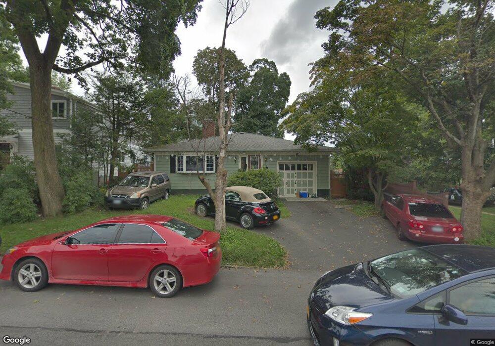
19 Elm St Dobbs Ferry, NY 10522
Estimated Value: $940,000 - $973,003
--
Bed
--
Bath
1,655
Sq Ft
$578/Sq Ft
Est. Value
About This Home
This home is located at 19 Elm St, Dobbs Ferry, NY 10522 and is currently estimated at $956,251, approximately $577 per square foot. 19 Elm St is a home located in Westchester County with nearby schools including Springhurst Elementary School, Dobbs Ferry High School, and The Masters School.
Ownership History
Date
Name
Owned For
Owner Type
Purchase Details
Closed on
Feb 12, 2018
Sold by
Martin Sandra M and Guerrero Ronald D
Bought by
Guerrero Ronald D and Martin Sandra
Current Estimated Value
Home Financials for this Owner
Home Financials are based on the most recent Mortgage that was taken out on this home.
Original Mortgage
$280,000
Interest Rate
3.99%
Mortgage Type
New Conventional
Create a Home Valuation Report for This Property
The Home Valuation Report is an in-depth analysis detailing your home's value as well as a comparison with similar homes in the area
Home Values in the Area
Average Home Value in this Area
Purchase History
| Date | Buyer | Sale Price | Title Company |
|---|---|---|---|
| Guerrero Ronald D | -- | Cross County Abstract Llc |
Source: Public Records
Mortgage History
| Date | Status | Borrower | Loan Amount |
|---|---|---|---|
| Closed | Guerrero Ronald D | $280,000 |
Source: Public Records
Tax History Compared to Growth
Tax History
| Year | Tax Paid | Tax Assessment Tax Assessment Total Assessment is a certain percentage of the fair market value that is determined by local assessors to be the total taxable value of land and additions on the property. | Land | Improvement |
|---|---|---|---|---|
| 2024 | $23,063 | $768,500 | $349,600 | $418,900 |
| 2023 | $22,995 | $772,700 | $329,800 | $442,900 |
| 2022 | $22,488 | $724,800 | $329,800 | $395,000 |
| 2021 | $21,435 | $683,800 | $329,800 | $354,000 |
| 2020 | $21,068 | $630,000 | $329,800 | $300,200 |
| 2019 | $20,319 | $630,000 | $329,800 | $300,200 |
| 2018 | $21,748 | $613,100 | $329,800 | $283,300 |
| 2017 | $2,130 | $585,000 | $329,800 | $255,200 |
| 2016 | $460,357 | $562,500 | $329,800 | $232,700 |
| 2015 | -- | $13,000 | $1,550 | $11,450 |
| 2014 | -- | $13,000 | $1,550 | $11,450 |
| 2013 | $9,231 | $13,750 | $1,550 | $12,200 |
Source: Public Records
Map
Nearby Homes
- 100 Cedar St Unit B33
- 18 Eldredge Place
- 33 Livingston Ave
- 31 Hudson Dr
- 66 Landing Dr
- 78 Oliphant Ave
- 10 Sherman Ave
- 36 Belden Ave
- 63 Grandview Ave
- 23 Seneca St
- 50 Belden Ave
- 177 Clinton Ave
- 13 English Ln Unit B
- 101 Beacon Hill Dr Unit 13
- 72 Magnolia Dr
- 0 Sherman Ave Unit KEY841006
- 70 Washington Ave
- 17 Manor House Dr Unit K13
- 14 Manor House Dr Unit G29
- 11 Fairlawn Ave
- 15 Elm St
- 11 Elm St
- 305 Broadway
- 100 Main St
- 100 Main St Unit A
- 100 Main St Unit B
- 92 Main St Unit 1
- 92 Main St Unit 5
- 92 Main St
- 92 Main St Unit 2
- 315 Broadway
- 12 Elm St
- 12 Elm St
- 12 Chestnut St Unit . West
- 12 Chestnut St
- 84 Main St
- 301 Broadway Unit 17C
- 301 Broadway Unit 10B
- 301 Broadway Unit 17B
- 301 Broadway Unit 16C