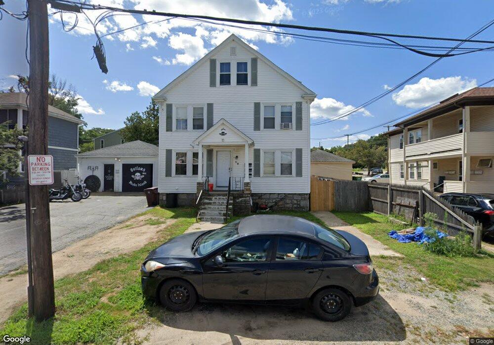
19 Fabien St Woonsocket, RI 02895
Globe District NeighborhoodEstimated Value: $477,000 - $524,000
5
Beds
3
Baths
2,475
Sq Ft
$202/Sq Ft
Est. Value
About This Home
This home is located at 19 Fabien St, Woonsocket, RI 02895 and is currently estimated at $501,006, approximately $202 per square foot. 19 Fabien St is a home located in Providence County with nearby schools including Woonsocket High School, Founders Academy, and Beacon Charter School.
Ownership History
Date
Name
Owned For
Owner Type
Purchase Details
Closed on
Oct 27, 2006
Sold by
Almeida Robert R and Almeida Rita M
Bought by
Petrarca John M and Petrarca Wendy
Current Estimated Value
Home Financials for this Owner
Home Financials are based on the most recent Mortgage that was taken out on this home.
Original Mortgage
$224,800
Outstanding Balance
$133,598
Interest Rate
6.48%
Mortgage Type
Purchase Money Mortgage
Estimated Equity
$367,408
Create a Home Valuation Report for This Property
The Home Valuation Report is an in-depth analysis detailing your home's value as well as a comparison with similar homes in the area
Home Values in the Area
Average Home Value in this Area
Purchase History
| Date | Buyer | Sale Price | Title Company |
|---|---|---|---|
| Petrarca John M | $281,000 | -- | |
| Petrarca John M | $281,000 | -- |
Source: Public Records
Mortgage History
| Date | Status | Borrower | Loan Amount |
|---|---|---|---|
| Open | Petrarca John M | $224,800 | |
| Closed | Petrarca John M | $28,100 | |
| Closed | Petrarca John M | $224,800 |
Source: Public Records
Tax History
| Year | Tax Paid | Tax Assessment Tax Assessment Total Assessment is a certain percentage of the fair market value that is determined by local assessors to be the total taxable value of land and additions on the property. | Land | Improvement |
|---|---|---|---|---|
| 2025 | $5,343 | $475,800 | $90,400 | $385,400 |
| 2024 | $4,688 | $322,400 | $92,000 | $230,400 |
| 2023 | $4,507 | $322,400 | $92,000 | $230,400 |
| 2022 | $4,507 | $322,400 | $92,000 | $230,400 |
| 2021 | $3,757 | $158,200 | $38,400 | $119,800 |
| 2020 | $3,797 | $158,200 | $38,400 | $119,800 |
| 2018 | $3,809 | $158,200 | $38,400 | $119,800 |
| 2017 | $4,398 | $146,100 | $41,100 | $105,000 |
| 2016 | $4,652 | $146,100 | $41,100 | $105,000 |
| 2015 | $5,344 | $146,100 | $41,100 | $105,000 |
| 2014 | $5,143 | $143,100 | $45,200 | $97,900 |
Source: Public Records
Map
Nearby Homes
- 1 Admiral St
- 0 Chester St
- 184 Avenue C Unit 2
- 184 Avenue C Unit 5
- 184 Avenue C Unit 6
- 184 Avenue C Unit 3
- 184 Avenue C Unit 4
- 184 Avenue C Unit 1
- 109 Hemond Ave
- 0 Laflamme Ave
- 147 Warwick St
- 43 Summit St
- 190 Coe St
- 34 Smithfield Rd
- 87 Kermit St
- 84 Bernice Ave
- 92 Rockland Ave
- 435 S Main St
- 163 Hanton Rd
- 36 Old Louisquisset Pike Unit 210
- 33 Fabien St
- 752 Providence St
- 730 Providence St
- 24 Fabien St
- 32 Fabien St
- 720 Providence St
- 800 Providence St
- 55 Fabien St
- 52 Fabien St
- 626 Smithfield Rd
- 708 Providence St
- 1 Endicott St
- 698 Providence St
- 0 Greenville Rd
- 652 Smithfield Rd
- 688 Providence St
- 0 Greenville Road Rd Unit 960916
- 0 Greenville Road Rd Unit 960915
- 0 Greenville Road Rd Unit 960917
- 0 Greenville Road Rd Unit 980211
Your Personal Tour Guide
Ask me questions while you tour the home.