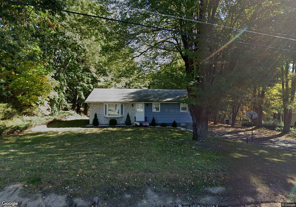
19 Falvey St West Springfield, MA 01089
Estimated Value: $277,000 - $329,996
3
Beds
2
Baths
1,008
Sq Ft
$304/Sq Ft
Est. Value
About This Home
This home is located at 19 Falvey St, West Springfield, MA 01089 and is currently estimated at $305,999, approximately $303 per square foot. 19 Falvey St is a home located in Hampden County with nearby schools including West Springfield High School, St Thomas The Apostle School, and Pope Francis High School.
Ownership History
Date
Name
Owned For
Owner Type
Purchase Details
Closed on
May 4, 2010
Sold by
Fnma
Bought by
Huremovic Sabahudin and Huremovic Elvisa
Current Estimated Value
Home Financials for this Owner
Home Financials are based on the most recent Mortgage that was taken out on this home.
Original Mortgage
$122,325
Outstanding Balance
$81,748
Interest Rate
4.99%
Mortgage Type
Purchase Money Mortgage
Estimated Equity
$224,251
Purchase Details
Closed on
Jan 22, 2010
Sold by
Berg Carol C
Bought by
Federal National Mortgage Association
Purchase Details
Closed on
Aug 31, 2007
Sold by
Gonyea Marie A
Bought by
Berg Carol C and Calvanese Joseph
Home Financials for this Owner
Home Financials are based on the most recent Mortgage that was taken out on this home.
Original Mortgage
$180,500
Interest Rate
6.71%
Mortgage Type
Purchase Money Mortgage
Create a Home Valuation Report for This Property
The Home Valuation Report is an in-depth analysis detailing your home's value as well as a comparison with similar homes in the area
Home Values in the Area
Average Home Value in this Area
Purchase History
| Date | Buyer | Sale Price | Title Company |
|---|---|---|---|
| Huremovic Sabahudin | $159,900 | -- | |
| Federal National Mortgage Association | $172,248 | -- | |
| Berg Carol C | $190,000 | -- |
Source: Public Records
Mortgage History
| Date | Status | Borrower | Loan Amount |
|---|---|---|---|
| Open | Huremovic Sabahudin | $122,325 | |
| Previous Owner | Berg Carol C | $180,500 |
Source: Public Records
Tax History Compared to Growth
Tax History
| Year | Tax Paid | Tax Assessment Tax Assessment Total Assessment is a certain percentage of the fair market value that is determined by local assessors to be the total taxable value of land and additions on the property. | Land | Improvement |
|---|---|---|---|---|
| 2025 | $3,673 | $247,000 | $109,000 | $138,000 |
| 2024 | $3,655 | $246,800 | $109,000 | $137,800 |
| 2023 | $3,441 | $221,400 | $106,700 | $114,700 |
| 2022 | $3,120 | $198,000 | $96,900 | $101,100 |
| 2021 | $3,128 | $185,100 | $92,400 | $92,700 |
| 2020 | $3,068 | $180,600 | $92,400 | $88,200 |
| 2019 | $3,063 | $180,600 | $92,400 | $88,200 |
| 2018 | $3,079 | $180,600 | $92,400 | $88,200 |
| 2017 | $3,079 | $180,600 | $92,400 | $88,200 |
| 2016 | $2,995 | $176,300 | $86,900 | $89,400 |
| 2015 | $2,939 | $173,000 | $85,300 | $87,700 |
| 2014 | $711 | $173,000 | $85,300 | $87,700 |
Source: Public Records
Map
Nearby Homes
- Lot 3 Hyde Rd
- 26 Clayton Dr
- 80 Brush Hill Ave Unit 35
- 80 Brush Hill Ave Unit 28
- 9 Annie's Way
- 12 Victorian Dr
- 11 Annie's Way
- 59 Clayton Dr
- 40 Wilfred St
- 86 Birnie Ave
- 75 Birnie Ave
- 780 Birnie Ave
- 39 Bonnie Brae Dr
- 36 Shady Brook
- 89 Vincent Dr
- 32 Windpath E
- 87 Blanchwood Ave
- 636 Amostown Rd
- 95 Mount Pleasant Ave
- 89-111 Whitney Ave
- 389 Brush Hill Ave
- 381 Brush Hill Ave
- 33 Falvey St
- 20 Falvey St
- 399 Brush Hill Ave
- 373 Brush Hill Ave
- 36 Falvey St
- 409 Brush Hill Ave
- 390 Brush Hill Ave
- 419 Brush Hill Ave
- 404 Brush Hill Ave
- 378 Brush Hill Ave
- 46 Falvey St
- 416 Brush Hill Ave
- 433 Brush Hill Ave
- 428 Brush Hill Ave
- 445 Brush Hill Ave
- 436 Brush Hill Ave
- 446 Brush Hill Ave
- 459 Brush Hill Ave