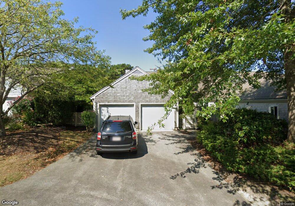
19 Forest Gate Yarmouth Port, MA 02675
Yarmouth Port NeighborhoodEstimated Value: $762,000 - $805,000
2
Beds
4
Baths
1,829
Sq Ft
$428/Sq Ft
Est. Value
About This Home
This home is located at 19 Forest Gate, Yarmouth Port, MA 02675 and is currently estimated at $782,305, approximately $427 per square foot. 19 Forest Gate is a home located in Barnstable County with nearby schools including Dennis-Yarmouth Regional High School.
Ownership History
Date
Name
Owned For
Owner Type
Purchase Details
Closed on
Jan 30, 2025
Sold by
Hill Joan W
Bought by
Joan W Hill 2025 T W and Joan Hill
Current Estimated Value
Purchase Details
Closed on
Feb 22, 2024
Sold by
Joann S Curley Ret and Lake
Bought by
Hill Joan W
Purchase Details
Closed on
Mar 7, 2022
Sold by
Curley Joann S
Bought by
Joann S Curlwey Ret and Lake
Purchase Details
Closed on
Jun 30, 1995
Sold by
Kings Way Prop Rt and Kurson
Bought by
Curley Joann S and Curley John F
Home Financials for this Owner
Home Financials are based on the most recent Mortgage that was taken out on this home.
Original Mortgage
$60,000
Interest Rate
7.8%
Mortgage Type
Purchase Money Mortgage
Create a Home Valuation Report for This Property
The Home Valuation Report is an in-depth analysis detailing your home's value as well as a comparison with similar homes in the area
Home Values in the Area
Average Home Value in this Area
Purchase History
| Date | Buyer | Sale Price | Title Company |
|---|---|---|---|
| Joan W Hill 2025 T W | -- | None Available | |
| Hill Joan W | $789,000 | None Available | |
| Joann S Curlwey Ret | -- | None Available | |
| Curley Joann S | $234,000 | -- | |
| Curley Joann S | $234,000 | -- |
Source: Public Records
Mortgage History
| Date | Status | Borrower | Loan Amount |
|---|---|---|---|
| Previous Owner | Curley Joann S | $60,000 |
Source: Public Records
Tax History Compared to Growth
Tax History
| Year | Tax Paid | Tax Assessment Tax Assessment Total Assessment is a certain percentage of the fair market value that is determined by local assessors to be the total taxable value of land and additions on the property. | Land | Improvement |
|---|---|---|---|---|
| 2025 | $5,294 | $747,700 | $0 | $747,700 |
| 2024 | $5,134 | $695,600 | $0 | $695,600 |
| 2023 | $5,100 | $628,900 | $0 | $628,900 |
| 2022 | $5,178 | $564,100 | $0 | $564,100 |
| 2021 | $4,808 | $502,900 | $0 | $502,900 |
| 2020 | $4,853 | $485,300 | $0 | $485,300 |
| 2019 | $4,552 | $450,700 | $0 | $450,700 |
| 2018 | $4,638 | $450,700 | $0 | $450,700 |
| 2017 | $4,169 | $416,100 | $0 | $416,100 |
| 2016 | $3,980 | $398,800 | $0 | $398,800 |
| 2015 | $3,978 | $396,200 | $0 | $396,200 |
Source: Public Records
Map
Nearby Homes
- 7 Forest Gate Unit 7
- 30 W Woods Cir Unit 30
- 30 W Woods
- 2 Pine Grove
- 25 Oak Glen Village Unit 25
- 25 Oak Glen
- 17 Kates Path Unit A
- 228 Kates Path
- 34 Kates Path
- 34 Kates Path Unit 34
- 50 John Hall Cartway
- 50 John Hall Cartway Unit 50
- 64 Kates Path
- 42 John Hall Cartway Unit 42
- 43 Canterbury Rd
- 44 Stratford Ln
- 86 Pompano Rd
- 1 Barnacle Rd
- 51 Bray Farm Rd N
- 23 Dauphine Dr
- 23 Forest Gate
- 21 Forest Gate
- 21 Forest Gate Unit 21
- 21 Forest Gate Unit G
- 19 Forest Gate Unit H
- 23 Forest Gate Unit I
- 17 Forest Gate
- 15 Forest Gate
- 13 Forest Gate
- 17 Forest Gate Unit H
- 27 Forest Gate
- 25 Forest Gate
- 33 Forest Gate
- 31 Forest Gate
- 29 Forest Gate
- 31 Forest Gate Unit G
- 11 Forest Gate
- 7 Forest Gate
- 9 Forest Gate Unit G
- 11 Forest Gate Unit H