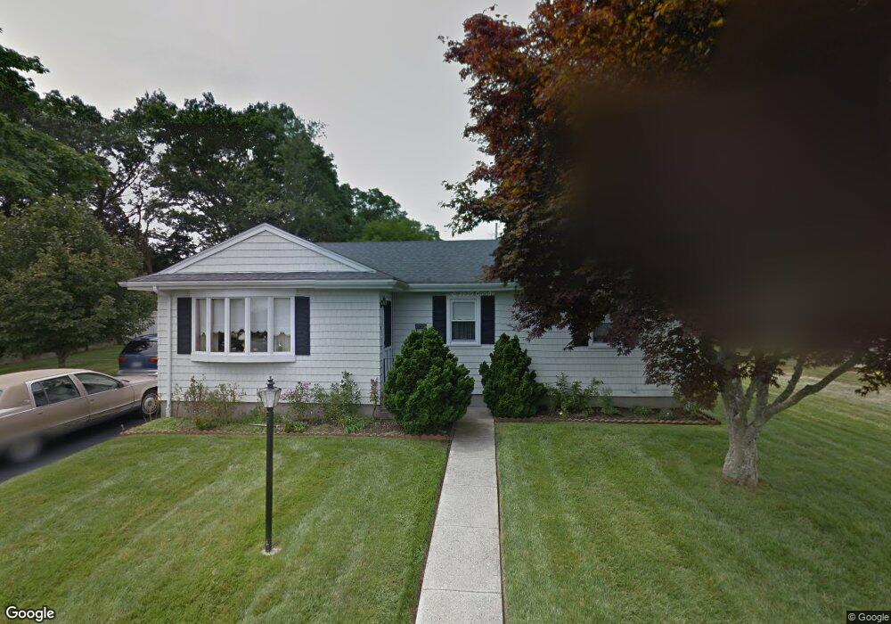
19 Frank St Acushnet, MA 02743
Upper Acushnet NeighborhoodEstimated Value: $472,000 - $613,000
3
Beds
1
Bath
2,160
Sq Ft
$243/Sq Ft
Est. Value
About This Home
This home is located at 19 Frank St, Acushnet, MA 02743 and is currently estimated at $525,262, approximately $243 per square foot. 19 Frank St is a home located in Bristol County with nearby schools including Acushnet Elementary School, Albert F Ford Middle School, and Alma Del Mar Charter School.
Ownership History
Date
Name
Owned For
Owner Type
Purchase Details
Closed on
Jan 7, 2021
Sold by
Nogueira Americo
Bought by
Nogueira Americo and Nogueira Robert
Current Estimated Value
Purchase Details
Closed on
May 11, 2004
Sold by
Nogueira Diogenes T and Nogueira Diogenes
Bought by
Nogueira Americo F
Home Financials for this Owner
Home Financials are based on the most recent Mortgage that was taken out on this home.
Original Mortgage
$75,000
Interest Rate
5.99%
Purchase Details
Closed on
Jun 17, 1971
Bought by
Nogueira Americo F
Create a Home Valuation Report for This Property
The Home Valuation Report is an in-depth analysis detailing your home's value as well as a comparison with similar homes in the area
Home Values in the Area
Average Home Value in this Area
Purchase History
| Date | Buyer | Sale Price | Title Company |
|---|---|---|---|
| Nogueira Americo | -- | None Available | |
| Nogueira Americo F | -- | -- | |
| Nogueira Americo F | -- | -- |
Source: Public Records
Mortgage History
| Date | Status | Borrower | Loan Amount |
|---|---|---|---|
| Previous Owner | Nogueira Americo F | $75,000 | |
| Previous Owner | Nogueira Americo F | $5,000 |
Source: Public Records
Tax History
| Year | Tax Paid | Tax Assessment Tax Assessment Total Assessment is a certain percentage of the fair market value that is determined by local assessors to be the total taxable value of land and additions on the property. | Land | Improvement |
|---|---|---|---|---|
| 2025 | $39 | $357,700 | $121,800 | $235,900 |
| 2024 | $3,754 | $329,000 | $115,400 | $213,600 |
| 2023 | $3,631 | $302,600 | $104,700 | $197,900 |
| 2022 | $3,591 | $270,600 | $98,300 | $172,300 |
| 2021 | $3,731 | $247,800 | $98,300 | $149,500 |
| 2020 | $4,332 | $241,400 | $91,900 | $149,500 |
| 2019 | $3,213 | $226,600 | $87,600 | $139,000 |
| 2018 | $3,425 | $214,500 | $87,600 | $126,900 |
| 2017 | $2,992 | $207,200 | $87,600 | $119,600 |
| 2016 | $2,902 | $199,700 | $87,600 | $112,100 |
| 2015 | $2,745 | $192,200 | $87,600 | $104,600 |
Source: Public Records
Map
Nearby Homes
Your Personal Tour Guide
Ask me questions while you tour the home.