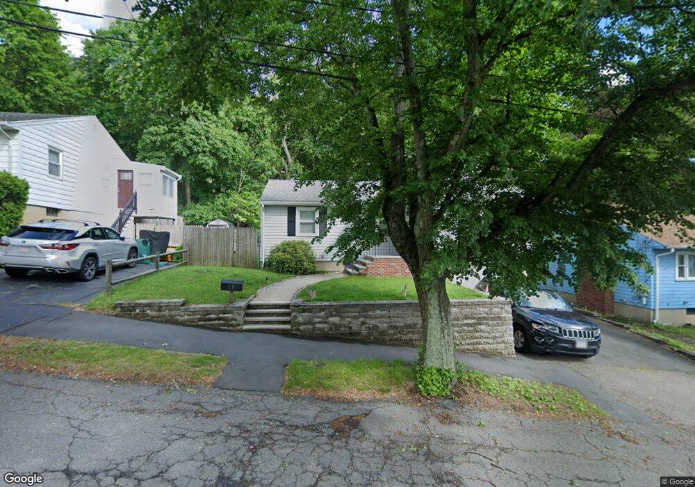
19 Gateway Ln Lynn, MA 01905
Upper Walnut Street NeighborhoodEstimated Value: $560,201 - $580,000
3
Beds
1
Bath
1,031
Sq Ft
$554/Sq Ft
Est. Value
About This Home
This home is located at 19 Gateway Ln, Lynn, MA 01905 and is currently estimated at $570,800, approximately $553 per square foot. 19 Gateway Ln is a home located in Essex County with nearby schools including Julia F. Callahan Elementary School, William R. Fallon School, and Breed Middle School.
Ownership History
Date
Name
Owned For
Owner Type
Purchase Details
Closed on
May 31, 2001
Sold by
Nestor Hugh F and Nestor Hugh G
Bought by
Greeley Philip M
Current Estimated Value
Home Financials for this Owner
Home Financials are based on the most recent Mortgage that was taken out on this home.
Original Mortgage
$164,000
Outstanding Balance
$60,772
Interest Rate
7.09%
Mortgage Type
Purchase Money Mortgage
Estimated Equity
$510,028
Create a Home Valuation Report for This Property
The Home Valuation Report is an in-depth analysis detailing your home's value as well as a comparison with similar homes in the area
Home Values in the Area
Average Home Value in this Area
Purchase History
| Date | Buyer | Sale Price | Title Company |
|---|---|---|---|
| Greeley Philip M | $205,000 | -- | |
| Greeley Philip M | $205,000 | -- |
Source: Public Records
Mortgage History
| Date | Status | Borrower | Loan Amount |
|---|---|---|---|
| Open | Greeley Philip M | $164,000 | |
| Closed | Greeley Philip M | $164,000 | |
| Previous Owner | Greeley Philip M | $40,000 |
Source: Public Records
Tax History
| Year | Tax Paid | Tax Assessment Tax Assessment Total Assessment is a certain percentage of the fair market value that is determined by local assessors to be the total taxable value of land and additions on the property. | Land | Improvement |
|---|---|---|---|---|
| 2025 | $5,436 | $524,700 | $206,200 | $318,500 |
| 2024 | $5,194 | $493,300 | $204,800 | $288,500 |
| 2023 | $4,957 | $444,600 | $189,000 | $255,600 |
| 2022 | $4,799 | $386,100 | $170,100 | $216,000 |
| 2021 | $4,630 | $355,300 | $158,400 | $196,900 |
| 2020 | $4,442 | $331,500 | $140,900 | $190,600 |
| 2019 | $4,579 | $320,200 | $144,900 | $175,300 |
| 2018 | $4,362 | $287,900 | $135,500 | $152,400 |
| 2017 | $4,075 | $261,200 | $117,500 | $143,700 |
| 2016 | $3,911 | $241,700 | $111,200 | $130,500 |
| 2015 | $3,762 | $224,600 | $109,800 | $114,800 |
Source: Public Records
Map
Nearby Homes
- 32 Birch Brook Rd Unit 13
- 32 Birch Brook Rd Unit 27
- 32 Birch Brook Rd Unit 16
- 32 Birch Brook Rd Unit 1
- 32 Birch Brook Rd Unit 14
- 32 Birch Brook Rd Unit 28
- 8 Menlo Terrace Unit A
- 32 Birch Brook Landing Unit 23
- 32 Birch Brook Landing Unit 25
- 32 Birch Brook Landing Unit 22
- 268 Walnut St
- 43 W Sigourney St
- 27 Garfield Ave
- 76 Myrtle St
- 74 Myrtle St
- 189 Holyoke St
- 90 Newton Ave
- 70 Wyman St
- 46 Wilfred St
- 4 Oneil Way
- 23 Gateway Ln
- 15 Gateway Ln
- 16 Belmont Ave
- 18 Belmont Ave
- 20 Gateway Ln
- 29 Gateway Ln
- 7 Meadow Brook Rd
- 10 Belmont Ave Unit 2
- 10 Belmont Ave Unit 1
- 10 Belmont Ave Unit 1-10
- 26 Gateway Ln
- 3 Gateway Ln
- 33 Gateway Ln
- 6 Belmont Ave
- 39 Revere Ave
- 41 Revere Ave
- 4 Meadow Brook Rd
- 4 Belmont Ave
- 439 Walnut St
- 439 Walnut St Unit single fam
Your Personal Tour Guide
Ask me questions while you tour the home.