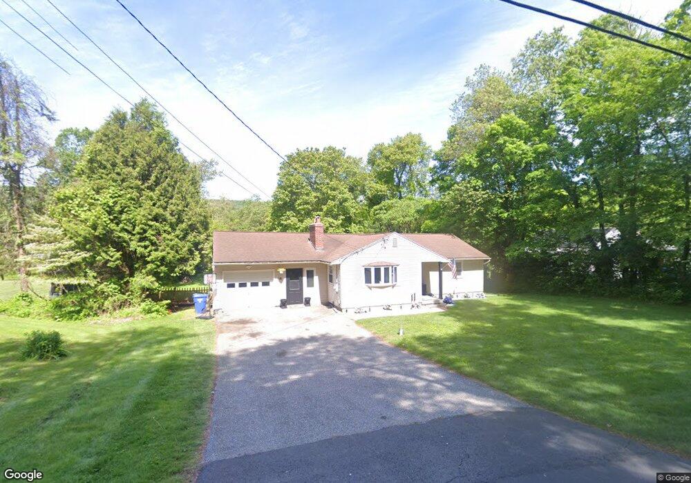
19 George Loomis Rd Southwick, MA 01077
Estimated Value: $249,000 - $324,000
3
Beds
2
Baths
1,136
Sq Ft
$264/Sq Ft
Est. Value
About This Home
This home is located at 19 George Loomis Rd, Southwick, MA 01077 and is currently estimated at $299,568, approximately $263 per square foot. 19 George Loomis Rd is a home located in Hampden County with nearby schools including Woodland School, Powder Mill Middle School, and Southwick Regional School.
Ownership History
Date
Name
Owned For
Owner Type
Purchase Details
Closed on
Sep 28, 2023
Sold by
Henderson John W and Winch Christine J
Bought by
Winch Madison and Malloy Christopher
Current Estimated Value
Home Financials for this Owner
Home Financials are based on the most recent Mortgage that was taken out on this home.
Original Mortgage
$217,083
Outstanding Balance
$212,790
Interest Rate
7.09%
Mortgage Type
FHA
Estimated Equity
$86,778
Create a Home Valuation Report for This Property
The Home Valuation Report is an in-depth analysis detailing your home's value as well as a comparison with similar homes in the area
Home Values in the Area
Average Home Value in this Area
Purchase History
| Date | Buyer | Sale Price | Title Company |
|---|---|---|---|
| Winch Madison | $251,000 | None Available |
Source: Public Records
Mortgage History
| Date | Status | Borrower | Loan Amount |
|---|---|---|---|
| Open | Winch Madison | $217,083 |
Source: Public Records
Tax History Compared to Growth
Tax History
| Year | Tax Paid | Tax Assessment Tax Assessment Total Assessment is a certain percentage of the fair market value that is determined by local assessors to be the total taxable value of land and additions on the property. | Land | Improvement |
|---|---|---|---|---|
| 2025 | $4,058 | $260,600 | $72,900 | $187,700 |
| 2024 | $3,841 | $248,300 | $68,500 | $179,800 |
| 2023 | $3,625 | $225,000 | $68,500 | $156,500 |
| 2022 | $3,474 | $204,600 | $62,300 | $142,300 |
| 2021 | $3,307 | $188,000 | $62,300 | $125,700 |
| 2020 | $3,269 | $186,900 | $62,300 | $124,600 |
| 2019 | $3,162 | $181,000 | $61,000 | $120,000 |
| 2018 | $3,053 | $163,500 | $61,000 | $102,500 |
| 2017 | $2,759 | $155,600 | $58,100 | $97,500 |
| 2016 | $2,661 | $155,600 | $58,100 | $97,500 |
| 2015 | $2,622 | $154,800 | $57,200 | $97,600 |
Source: Public Records
Map
Nearby Homes
- 444 Loomis St
- 162 Honey Pot Rd
- 156 Honey Pot Rd
- 240 Hillside Rd
- 197 Loomis Rg
- 2 Gableview
- 82 Hillside Rd
- 386 Hillside Rd
- 112 Sunnyside Rd
- 53 Yankee Cir
- 0 Fox Hill Dr
- 57 Jessie Ln
- 76 Rosewood Ln
- 508 Granville Rd
- 42 Rosewood Ln
- 150 Hillside Rd Unit 11
- 69 Beveridge Blvd
- 44 Governor Dr
- 7 Sawgrass Ln
- 2 Hummell Ln
- 17 George Loomis Rd
- 25 George Loomis Rd
- 15 George Loomis Rd
- 18 George Loomis Rd
- 13 George Loomis Rd
- 16 George Loomis Rd
- 11 Fenton Dr
- 28 George Loomis Rd
- 9 Fenton Dr
- 9 George Loomis Rd
- 7 Fenton Dr
- 27 George Loomis Rd
- 26 George Loomis Rd
- 14 George Loomis Rd
- 5 Fenton Dr
- 7 George Loomis Rd
- 12 George Loomis Rd
- 20 Ham Hill Rd
- 3 George Loomis Rd
- 12 Fenton Dr