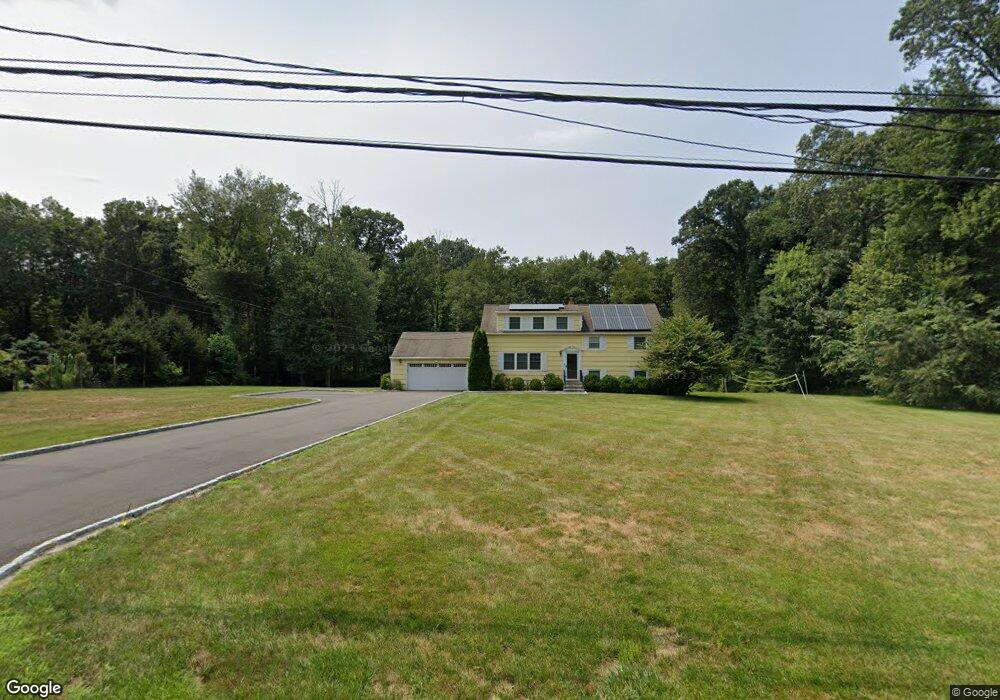
19 Ground Pine Rd Wilton, CT 06897
Estimated Value: $938,000 - $1,221,000
4
Beds
3
Baths
2,117
Sq Ft
$491/Sq Ft
Est. Value
About This Home
This home is located at 19 Ground Pine Rd, Wilton, CT 06897 and is currently estimated at $1,039,432, approximately $490 per square foot. 19 Ground Pine Rd is a home located in Fairfield County with nearby schools including Miller-Driscoll School, Cider Mill School, and Middlebrook School.
Ownership History
Date
Name
Owned For
Owner Type
Purchase Details
Closed on
Sep 1, 2009
Sold by
Brooks-Brody Susan
Bought by
Garritano Anthony and Garritano Otuyelu-Garritano K
Current Estimated Value
Home Financials for this Owner
Home Financials are based on the most recent Mortgage that was taken out on this home.
Original Mortgage
$638,226
Interest Rate
5.17%
Purchase Details
Closed on
Jun 26, 1987
Sold by
Cioffi Joseph
Bought by
Hunters Susan
Create a Home Valuation Report for This Property
The Home Valuation Report is an in-depth analysis detailing your home's value as well as a comparison with similar homes in the area
Home Values in the Area
Average Home Value in this Area
Purchase History
| Date | Buyer | Sale Price | Title Company |
|---|---|---|---|
| Garritano Anthony | $650,000 | -- | |
| Hunters Susan | $388,000 | -- |
Source: Public Records
Mortgage History
| Date | Status | Borrower | Loan Amount |
|---|---|---|---|
| Open | Hunters Susan | $634,372 | |
| Closed | Hunters Susan | $632,260 | |
| Closed | Hunters Susan | $638,226 |
Source: Public Records
Tax History
| Year | Tax Paid | Tax Assessment Tax Assessment Total Assessment is a certain percentage of the fair market value that is determined by local assessors to be the total taxable value of land and additions on the property. | Land | Improvement |
|---|---|---|---|---|
| 2025 | $11,676 | $478,310 | $308,490 | $169,820 |
| 2024 | $11,451 | $478,310 | $308,490 | $169,820 |
| 2023 | $13,750 | $379,820 | $294,980 | $84,840 |
| 2022 | $10,722 | $379,820 | $294,980 | $84,840 |
| 2021 | $9,872 | $379,820 | $294,980 | $84,840 |
| 2020 | $10,430 | $379,820 | $294,980 | $84,840 |
| 2019 | $10,840 | $379,820 | $294,980 | $84,840 |
| 2018 | $10,012 | $380,660 | $310,240 | $70,420 |
| 2017 | $10,159 | $380,660 | $310,240 | $70,420 |
| 2016 | $10,407 | $380,660 | $310,240 | $70,420 |
| 2015 | $10,213 | $380,660 | $310,240 | $70,420 |
| 2014 | $10,091 | $380,660 | $310,240 | $70,420 |
Source: Public Records
Map
Nearby Homes
- 178 Linden Tree Rd
- 109 Signal Hill Rd
- 792 N Wilton Rd
- 1 Canaan Cir
- 26 Ledgewood Dr
- 45 Ledgewood Dr
- 20 Pheasant Run Rd
- 330 Ridgefield Rd
- 44 Benedict Hill Rd
- 360 Thayer Pond Rd
- 533L N Wilton Rd
- 531L N Wilton Rd
- 55 Tanners Dr
- 33 Middlebrook Farm Rd
- 469L N Wilton Rd
- 88 Drum Hill Rd
- 469, 531,533 N Wilton Rd
- 14 Tanners Dr
- 30 Wild Duck Rd
- 1343 Smith Ridge Rd
- 7 Ground Pine Rd
- 20 Ground Pine Rd
- 8 Ground Pine Rd
- 0 Deforest Rd
- 82 Deforest Rd
- 105 Deforest Rd
- 122 Deforest Rd
- 93 Deforest Rd
- 121 Deforest Rd
- 72 Deforest Rd
- 76 Deforest Rd
- 70 Deforest Rd
- 128 Deforest Rd
- 35 Ground Pine Rd
- 34 Ground Pine Rd
- 129 Deforest Rd
- 75 Deforest Rd
- 11 Crofoot Rd
- 134 Deforest Rd
- 20 Abbott Ln
Your Personal Tour Guide
Ask me questions while you tour the home.