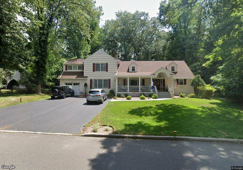
19 Haring Dr Old Tappan, NJ 07675
Estimated Value: $1,217,516 - $1,539,000
--
Bed
--
Bath
3,878
Sq Ft
$352/Sq Ft
Est. Value
About This Home
This home is located at 19 Haring Dr, Old Tappan, NJ 07675 and is currently estimated at $1,364,129, approximately $351 per square foot. 19 Haring Dr is a home located in Bergen County with nearby schools including T. Baldwin Demarest Elementary School, Charles DeWolf Middle School, and Northern Valley Regional High School at Old Tappan.
Ownership History
Date
Name
Owned For
Owner Type
Purchase Details
Closed on
Aug 1, 2018
Sold by
Massaro Kathleen and Massaro John
Bought by
Massaro Kathleen
Current Estimated Value
Purchase Details
Closed on
Jul 8, 1999
Sold by
Massaro Raymond M and Massaro Kathleen
Bought by
Massaro Kathleen
Create a Home Valuation Report for This Property
The Home Valuation Report is an in-depth analysis detailing your home's value as well as a comparison with similar homes in the area
Home Values in the Area
Average Home Value in this Area
Purchase History
| Date | Buyer | Sale Price | Title Company |
|---|---|---|---|
| Massaro Kathleen | -- | -- | |
| Massaro Kathleen | -- | -- |
Source: Public Records
Tax History Compared to Growth
Tax History
| Year | Tax Paid | Tax Assessment Tax Assessment Total Assessment is a certain percentage of the fair market value that is determined by local assessors to be the total taxable value of land and additions on the property. | Land | Improvement |
|---|---|---|---|---|
| 2025 | $16,828 | $764,200 | $411,500 | $352,700 |
| 2024 | $16,461 | $764,200 | $411,500 | $352,700 |
| 2023 | $16,262 | $764,200 | $411,500 | $352,700 |
| 2022 | $16,262 | $764,200 | $411,500 | $352,700 |
| 2021 | $16,224 | $764,200 | $411,500 | $352,700 |
| 2020 | $15,987 | $764,200 | $411,500 | $352,700 |
| 2019 | $15,765 | $764,200 | $411,500 | $352,700 |
| 2018 | $15,444 | $764,200 | $411,500 | $352,700 |
| 2017 | $15,322 | $764,200 | $411,500 | $352,700 |
| 2016 | $14,925 | $764,200 | $411,500 | $352,700 |
| 2015 | $14,688 | $764,200 | $411,500 | $352,700 |
| 2014 | $14,298 | $764,200 | $411,500 | $352,700 |
Source: Public Records
Map
Nearby Homes
- 192 White Ave
- 121 Winding Creek
- 32 Moeser Place
- 4 Lenape Ln Unit 805
- 1 Woods Edge Rd
- 11 Oconnors Ln
- 11 Oconners Ln
- 28 Woods Edge Rd
- 43 Old Tappan Rd
- 959 Broadway
- 407 Overbrook Rd
- 401 Dercole Ct Unit 332
- 401 Dercole Ct Unit 127
- 401 Dercole Ct Unit 319
- 401 Dercole Ct Unit CT114
- 407 Semino Rd
- 7 Orchard Ln
- 48 Flint Terrace
- 26 Garnett Place
- 40 Virgil Rd