T
Seller's Agent in 2025
The Riel Estate Team
Keller Williams Pinnacle Central
(508) 213-1285
9 in this area
521 Total Sales
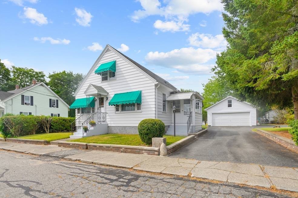
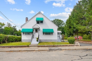
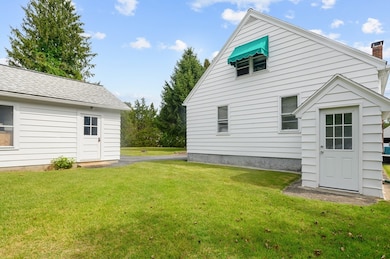
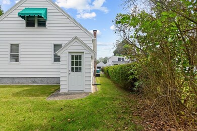
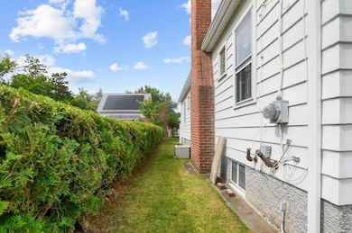
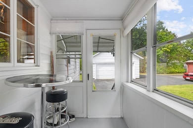
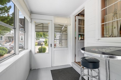
Lovingly cared for 4 bedroom 1 full bath home for sale in Uxbridge! Located on a dead end street in a quiet neighborhood on a level quarter acre lot! Enter in and find gorgeous hardwood flooring throughout the main level! The sunny kitchen offers wall oven, tile flooring and access to the enclosed porch. The dining space adjacent to the kitchen divided by built in shelving flows into the living room. The living room boasts a cozy pellet stove with brick fireplace & mantle, stunning wood paneling walls & moldings, and front door access. Primary bedroom & full bath located on the main level as well as an additional bedroom. Upstairs you will find a cedar closet that divides 2 additional spacious bedrooms. Lower finished level offers spacious carpeted bonus room as well as a laundry sink & the laundry. Storage galore w/ attic eave storage & hall closets on each level. Outside offers a private yard enclosed with bushes, a detached 2 car garage, a shed. Offer deadline 9/9/25 12 noon.
Last Agent to Sell the Property
Keller Williams Pinnacle Central Listed on: 09/02/2025

Co-Listed By
Danielle Stolle
Keller Williams Pinnacle Central
| Date | Type | Sale Price | Title Company |
|---|---|---|---|
| Deed | $425,000 | -- | |
| Quit Claim Deed | -- | -- | |
| Quit Claim Deed | -- | None Available |
| Date | Status | Loan Amount | Loan Type |
|---|---|---|---|
| Open | $210,000 | Purchase Money Mortgage |
| Date | Event | Price | List to Sale | Price per Sq Ft |
|---|---|---|---|---|
| 10/21/2025 10/21/25 | Sold | $425,000 | +6.3% | $259 / Sq Ft |
| 09/10/2025 09/10/25 | Pending | -- | -- | -- |
| 09/02/2025 09/02/25 | For Sale | $399,900 | -- | $244 / Sq Ft |
| Year | Tax Paid | Tax Assessment Tax Assessment Total Assessment is a certain percentage of the fair market value that is determined by local assessors to be the total taxable value of land and additions on the property. | Land | Improvement |
|---|---|---|---|---|
| 2025 | $49 | $372,500 | $140,100 | $232,400 |
| 2024 | $4,572 | $353,900 | $132,900 | $221,000 |
| 2023 | $4,334 | $310,700 | $115,000 | $195,700 |
| 2022 | $4,160 | $274,400 | $100,600 | $173,800 |
| 2021 | $4,195 | $265,200 | $98,400 | $166,800 |
| 2020 | $4,165 | $248,800 | $97,000 | $151,800 |
| 2019 | $4,171 | $240,400 | $97,000 | $143,400 |
| 2018 | $3,862 | $224,900 | $97,000 | $127,900 |
| 2017 | $3,721 | $219,400 | $89,100 | $130,300 |
| 2016 | $3,396 | $193,300 | $73,000 | $120,300 |
| 2015 | $3,323 | $191,000 | $73,000 | $118,000 |
T
Seller's Agent in 2025
The Riel Estate Team
Keller Williams Pinnacle Central
(508) 213-1285
9 in this area
521 Total Sales
D
Seller Co-Listing Agent in 2025
Danielle Stolle
Keller Williams Pinnacle Central
G
Buyer's Agent in 2025
Giuliana Kinney
Westcott Properties
(401) 275-3136
1 in this area
34 Total Sales
Source: MLS Property Information Network (MLS PIN)
MLS Number: 73424494
APN: UXBR-000012C-002856
Disclaimer: Certain information contained herein is derived from information provided by parties other than Homes.com. All information provided is deemed reliable, but is not guaranteed to be accurate and should be independently verified.
![]() The property listing data and information, or the Images, set forth herein were provided to MLS Property Information Network, Inc. from third party sources, including sellers, lessors and public records, and were compiled by MLS Property Information Network, Inc. The property listing data and information, and the Images, are for the personal, non-commercial use of consumers having a good faith interest in purchasing or leasing listed properties of the type displayed to them and may not be used for any purpose other than to identify prospective properties which such consumers may have a good faith interest in purchasing or leasing. MLS Property Information Network, Inc. and its subscribers disclaim any and all representations and warranties as to the accuracy of the property listing data and information, or as to the accuracy of any of the Images, set forth herein.
The property listing data and information, or the Images, set forth herein were provided to MLS Property Information Network, Inc. from third party sources, including sellers, lessors and public records, and were compiled by MLS Property Information Network, Inc. The property listing data and information, and the Images, are for the personal, non-commercial use of consumers having a good faith interest in purchasing or leasing listed properties of the type displayed to them and may not be used for any purpose other than to identify prospective properties which such consumers may have a good faith interest in purchasing or leasing. MLS Property Information Network, Inc. and its subscribers disclaim any and all representations and warranties as to the accuracy of the property listing data and information, or as to the accuracy of any of the Images, set forth herein.