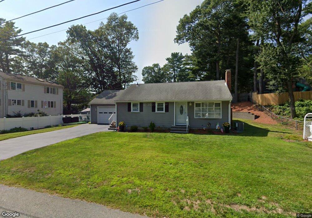
19 Hawthorne Rd Holbrook, MA 02343
Estimated Value: $505,545 - $578,000
4
Beds
2
Baths
1,878
Sq Ft
$287/Sq Ft
Est. Value
About This Home
This home is located at 19 Hawthorne Rd, Holbrook, MA 02343 and is currently estimated at $539,636, approximately $287 per square foot. 19 Hawthorne Rd is a home located in Norfolk County with nearby schools including John F. Kennedy Elementary School, Holbrook Middle High School, and Boston Higashi School.
Create a Home Valuation Report for This Property
The Home Valuation Report is an in-depth analysis detailing your home's value as well as a comparison with similar homes in the area
Home Values in the Area
Average Home Value in this Area
Tax History Compared to Growth
Tax History
| Year | Tax Paid | Tax Assessment Tax Assessment Total Assessment is a certain percentage of the fair market value that is determined by local assessors to be the total taxable value of land and additions on the property. | Land | Improvement |
|---|---|---|---|---|
| 2025 | $47 | $354,700 | $103,300 | $251,400 |
| 2024 | $4,717 | $351,000 | $103,200 | $247,800 |
| 2023 | $5,037 | $327,500 | $93,800 | $233,700 |
| 2022 | $4,606 | $279,300 | $85,300 | $194,000 |
| 2021 | $4,551 | $264,300 | $77,400 | $186,900 |
| 2020 | $4,734 | $257,700 | $75,000 | $182,700 |
| 2019 | $4,655 | $239,200 | $70,200 | $169,000 |
| 2018 | $4,721 | $228,400 | $65,000 | $163,400 |
| 2017 | $4,529 | $216,700 | $59,000 | $157,700 |
| 2016 | $4,036 | $205,500 | $57,500 | $148,000 |
| 2015 | $3,795 | $198,900 | $55,000 | $143,900 |
| 2014 | $3,656 | $194,800 | $55,000 | $139,800 |
Source: Public Records
Map
Nearby Homes
- 28 Border Rd
- 55 Border Rd
- 13 Mayflower Rd
- 25 Valley Rd
- 27 Ell Rd
- 17 W Shore Rd
- 68 Spring St
- 14 Fern Rd
- 40 Overlook Rd
- 719 S Franklin St Unit L Block 1
- 719 S Franklin St Unit D Block 1
- 719 S Franklin St Unit C Block 1
- 45 King Rd
- 375 S Franklin St Unit 1
- 12 Hamilton Way
- 58 Woodlawn Rd
- 35 Marion St
- 0 Payson Ave
- 15 Payson Ave
- 68 Robbins St