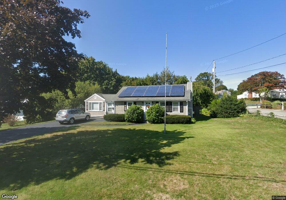
19 Hazel Ave Scituate, MA 02066
Estimated Value: $639,877 - $778,000
2
Beds
1
Bath
1,100
Sq Ft
$668/Sq Ft
Est. Value
About This Home
This home is located at 19 Hazel Ave, Scituate, MA 02066 and is currently estimated at $734,469, approximately $667 per square foot. 19 Hazel Ave is a home located in Plymouth County with nearby schools including Jenkins Elementary School, Lester J. Gates Middle School, and Scituate High School.
Ownership History
Date
Name
Owned For
Owner Type
Purchase Details
Closed on
May 29, 2008
Sold by
Curran Charles W and Curran Nancy A
Bought by
Ross Linda E
Current Estimated Value
Create a Home Valuation Report for This Property
The Home Valuation Report is an in-depth analysis detailing your home's value as well as a comparison with similar homes in the area
Home Values in the Area
Average Home Value in this Area
Purchase History
| Date | Buyer | Sale Price | Title Company |
|---|---|---|---|
| Ross Linda E | $330,000 | -- |
Source: Public Records
Mortgage History
| Date | Status | Borrower | Loan Amount |
|---|---|---|---|
| Open | Ross Linda E | $226,500 | |
| Closed | Ross Linda E | $15,000 | |
| Closed | Ross Linda E | $240,000 | |
| Closed | Ross Linda E | $250,000 |
Source: Public Records
Tax History
| Year | Tax Paid | Tax Assessment Tax Assessment Total Assessment is a certain percentage of the fair market value that is determined by local assessors to be the total taxable value of land and additions on the property. | Land | Improvement |
|---|---|---|---|---|
| 2025 | $5,461 | $546,600 | $455,400 | $91,200 |
| 2024 | $5,260 | $507,700 | $414,000 | $93,700 |
| 2023 | $5,037 | $463,600 | $376,400 | $87,200 |
| 2022 | $5,037 | $399,100 | $314,700 | $84,400 |
| 2021 | $4,973 | $373,100 | $299,700 | $73,400 |
| 2020 | $4,825 | $357,400 | $288,100 | $69,300 |
| 2019 | $4,645 | $338,100 | $270,200 | $67,900 |
| 2018 | $4,721 | $338,400 | $280,300 | $58,100 |
| 2017 | $4,475 | $317,600 | $259,500 | $58,100 |
| 2016 | $4,051 | $286,500 | $228,400 | $58,100 |
| 2015 | $3,617 | $276,100 | $218,000 | $58,100 |
Source: Public Records
Map
Nearby Homes
- 50 First Parish Rd
- 33 Beaver Dam Rd
- 46 Tilden Rd
- 25 Morton Place
- 91 Front St Unit 106
- 20 Meeting House Ln
- 38 Lauren Ln
- 11 Brookline Rd
- 24 Ridge Hill Rd
- 32 Barker Rd Unit 3
- 23 Sunset Rd
- 86 Hatherly Rd
- 59 Greenfield Ln
- 55 Crescent Ave
- 15 Bearce Ln
- 1 Washington Ln
- 21 Circuit Ave
- 20 Lee Ave
- 49 Jackson Rd
- 23 Oceanside Dr
- 7 Stenbeck Place
- 17 Hazel Ave
- 6 Stenbeck Place
- 6 Stenbeck Place Unit 1
- 24 Hazel Ave
- 27 Hazel Ave
- 18 Hazel Ave
- 15 Hazel Ave
- 15 Hazel Ave
- 28 Hazel Ave
- 10 Stenbeck Place
- 11 Stenbeck Place
- 11 Stenbeck Place Unit 1
- 11 Stenbeck Place Unit b
- 32 Hazel Ave
- 55 Otis Place
- 54 Otis Place
- 33 Hazel Ave
- 12 Hazel Ave
- 15 Stenbeck Place
Your Personal Tour Guide
Ask me questions while you tour the home.