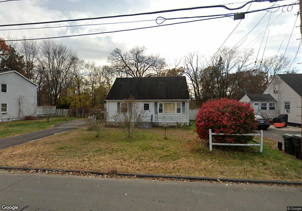
19 Helm Rd East Hartford, CT 06108
Estimated Value: $275,000 - $319,000
3
Beds
1
Bath
1,152
Sq Ft
$260/Sq Ft
Est. Value
About This Home
This home is located at 19 Helm Rd, East Hartford, CT 06108 and is currently estimated at $299,626, approximately $260 per square foot. 19 Helm Rd is a home located in Hartford County with nearby schools including Robert J. O'Brien School, East Hartford Middle School, and East Hartford High School.
Ownership History
Date
Name
Owned For
Owner Type
Purchase Details
Closed on
Jun 30, 1999
Sold by
Peterson Ralph F
Bought by
Hall Christopher A and Beliveau Laureete A
Current Estimated Value
Home Financials for this Owner
Home Financials are based on the most recent Mortgage that was taken out on this home.
Original Mortgage
$100,150
Outstanding Balance
$27,234
Interest Rate
7.19%
Estimated Equity
$272,392
Create a Home Valuation Report for This Property
The Home Valuation Report is an in-depth analysis detailing your home's value as well as a comparison with similar homes in the area
Home Values in the Area
Average Home Value in this Area
Purchase History
| Date | Buyer | Sale Price | Title Company |
|---|---|---|---|
| Hall Christopher A | $101,000 | -- |
Source: Public Records
Mortgage History
| Date | Status | Borrower | Loan Amount |
|---|---|---|---|
| Open | Hall Christopher A | $100,150 |
Source: Public Records
Tax History Compared to Growth
Tax History
| Year | Tax Paid | Tax Assessment Tax Assessment Total Assessment is a certain percentage of the fair market value that is determined by local assessors to be the total taxable value of land and additions on the property. | Land | Improvement |
|---|---|---|---|---|
| 2025 | $5,477 | $119,330 | $40,120 | $79,210 |
| 2024 | $5,251 | $119,330 | $40,120 | $79,210 |
| 2023 | $5,076 | $119,330 | $40,120 | $79,210 |
| 2022 | $4,893 | $119,330 | $40,120 | $79,210 |
| 2021 | $4,384 | $88,830 | $33,770 | $55,060 |
| 2020 | $4,434 | $88,830 | $33,770 | $55,060 |
| 2019 | $4,362 | $88,830 | $33,770 | $55,060 |
| 2018 | $4,234 | $88,830 | $33,770 | $55,060 |
| 2017 | $4,179 | $88,830 | $33,770 | $55,060 |
| 2016 | $4,179 | $91,120 | $33,770 | $57,350 |
| 2015 | $4,179 | $91,120 | $33,770 | $57,350 |
| 2014 | $4,137 | $91,120 | $33,770 | $57,350 |
Source: Public Records
Map
Nearby Homes
- 50 Northbrook Ct
- 69 Pheasant Ln
- 110 Goodwin St
- 9 Main St Unit TRLR 22
- 39 Tiffany Rd
- 29 Joanne Dr Unit 29
- 51 Wood Dr
- 345 Goodwin St
- 577 Goodwin St
- 22 Matthew Rd
- 67 Laurel St
- 89 Henderson Dr
- 15 Michael Ave
- 12 Depauw Cir
- 51 Daniel St
- 1589 Main St
- 421 Tolland St
- 421 Tolland St Unit 209
- 453 Burnside Ave
- 506 Burnside Ave