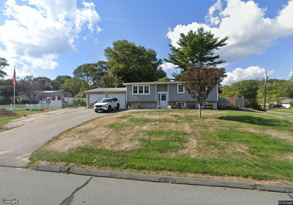
19 Highland Dr Ledyard, CT 06339
Estimated Value: $326,000 - $376,648
3
Beds
2
Baths
1,100
Sq Ft
$321/Sq Ft
Est. Value
About This Home
This home is located at 19 Highland Dr, Ledyard, CT 06339 and is currently estimated at $352,662, approximately $320 per square foot. 19 Highland Dr is a home located in New London County with nearby schools including Ledyard Middle School and Ledyard High School.
Ownership History
Date
Name
Owned For
Owner Type
Purchase Details
Closed on
Dec 26, 2013
Sold by
Shea 3Rd Edward J
Bought by
Shea 3Rd Edward J and Shea Lori A
Current Estimated Value
Home Financials for this Owner
Home Financials are based on the most recent Mortgage that was taken out on this home.
Original Mortgage
$15,000
Interest Rate
4.35%
Mortgage Type
New Conventional
Purchase Details
Closed on
Feb 1, 2001
Sold by
Sharps Priscilla T
Bought by
Shea Edward J
Home Financials for this Owner
Home Financials are based on the most recent Mortgage that was taken out on this home.
Original Mortgage
$123,000
Interest Rate
7.14%
Purchase Details
Closed on
Mar 14, 1994
Sold by
Killam Harold D and Killam Phillis
Bought by
Sharps Albert L and Sharps Priscilla
Create a Home Valuation Report for This Property
The Home Valuation Report is an in-depth analysis detailing your home's value as well as a comparison with similar homes in the area
Home Values in the Area
Average Home Value in this Area
Purchase History
| Date | Buyer | Sale Price | Title Company |
|---|---|---|---|
| Shea Edward J | $124,000 | -- | |
| Sharps Albert L | $107,000 | -- | |
| Shea 3Rd Edward J | -- | -- |
Source: Public Records
Mortgage History
| Date | Status | Borrower | Loan Amount |
|---|---|---|---|
| Closed | Sharps Albert L | $15,000 | |
| Previous Owner | Sharps Albert L | $148,000 | |
| Previous Owner | Sharps Albert L | $123,000 | |
| Previous Owner | Sharps Albert L | $5,000 |
Source: Public Records
Tax History
| Year | Tax Paid | Tax Assessment Tax Assessment Total Assessment is a certain percentage of the fair market value that is determined by local assessors to be the total taxable value of land and additions on the property. | Land | Improvement |
|---|---|---|---|---|
| 2025 | $5,553 | $149,520 | $42,700 | $106,820 |
| 2024 | $5,230 | $148,540 | $42,700 | $105,840 |
| 2023 | $5,134 | $148,540 | $42,700 | $105,840 |
| 2022 | $5,024 | $148,540 | $42,700 | $105,840 |
| 2021 | $4,991 | $148,540 | $42,700 | $105,840 |
| 2020 | $4,524 | $129,360 | $34,160 | $95,200 |
| 2019 | $4,535 | $129,360 | $34,160 | $95,200 |
| 2018 | $4,436 | $129,360 | $34,160 | $95,200 |
| 2017 | $4,209 | $129,360 | $34,160 | $95,200 |
| 2016 | $4,127 | $129,360 | $34,160 | $95,200 |
| 2015 | $3,933 | $129,360 | $34,160 | $95,200 |
| 2014 | $3,943 | $131,880 | $34,160 | $97,720 |
Source: Public Records
Map
Nearby Homes
- 22 Boulder Way
- 14 Pennywise Ln
- 115 Meeting House Ln
- 20 Lakeside Dr Unit K
- 575 Shewville Rd
- 497 Colonel Ledyard Hwy
- 459 Colonel Ledyard Hwy
- 449 Lantern Hill Rd
- 332 Lantern Hill Rd
- 39 Long Pond Rd S
- 669 Colonel Ledyard Hwy
- Lot 5 Lantern Hill Rd
- 419 Colonel Ledyard Hwy
- 188 Wolf Neck Rd
- 24 Fairway Dr Unit 9
- 28 Golden Spur
- 22 Golden Spur
- 3 Hilltop Dr
- 106 Stephen Dr
- 130 Stephen Dr
- 11 Blacksmith Dr
- 17 Highland Dr
- 4 Powder Horn Ln
- 20 Highland Dr
- 10 Blacksmith Dr
- 13 Blacksmith Dr
- 53 R Route 2
- 18 Highland Dr
- 12 Blacksmith Dr
- 6 Powder Horn Ln
- 6 Blacksmith Dr
- 16 Highland Dr
- 14 Blacksmith Dr
- 4 Blacksmith Dr
- 15 Blacksmith Dr
- 13 Highland Dr
- 25 Highland Dr
- 17 Town Farm Rd
- 5 Powder Horn Ln
- 17 Blacksmith Dr
Your Personal Tour Guide
Ask me questions while you tour the home.