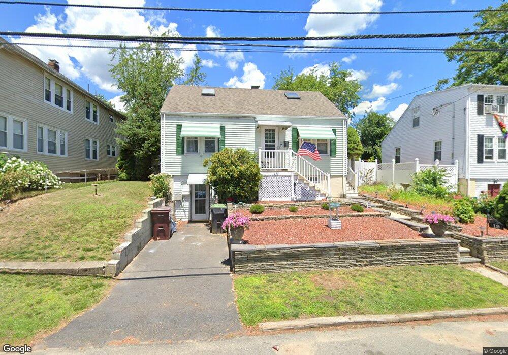
19 Hillcrest Ave Dedham, MA 02026
Riverdale NeighborhoodEstimated Value: $652,000 - $814,000
3
Beds
3
Baths
1,513
Sq Ft
$483/Sq Ft
Est. Value
About This Home
This home is located at 19 Hillcrest Ave, Dedham, MA 02026 and is currently estimated at $730,186, approximately $482 per square foot. 19 Hillcrest Ave is a home located in Norfolk County with nearby schools including Riverdale Elementary School, Dedham Middle School, and Dedham High School.
Ownership History
Date
Name
Owned For
Owner Type
Purchase Details
Closed on
Jul 3, 2015
Sold by
Lloyd Walter G and Lloyd Donna M
Bought by
Lloyd Walter G and Lloyd Donna M
Current Estimated Value
Purchase Details
Closed on
Oct 29, 1992
Sold by
Wood Shane M and Wood Isabelle G
Bought by
Curtis Henry A
Home Financials for this Owner
Home Financials are based on the most recent Mortgage that was taken out on this home.
Original Mortgage
$70,000
Interest Rate
7.85%
Mortgage Type
Purchase Money Mortgage
Create a Home Valuation Report for This Property
The Home Valuation Report is an in-depth analysis detailing your home's value as well as a comparison with similar homes in the area
Home Values in the Area
Average Home Value in this Area
Purchase History
| Date | Buyer | Sale Price | Title Company |
|---|---|---|---|
| Lloyd Walter G | -- | -- | |
| Curtis Henry A | $143,000 | -- |
Source: Public Records
Mortgage History
| Date | Status | Borrower | Loan Amount |
|---|---|---|---|
| Previous Owner | Curtis Henry A | $97,000 | |
| Previous Owner | Curtis Henry A | $70,000 |
Source: Public Records
Tax History
| Year | Tax Paid | Tax Assessment Tax Assessment Total Assessment is a certain percentage of the fair market value that is determined by local assessors to be the total taxable value of land and additions on the property. | Land | Improvement |
|---|---|---|---|---|
| 2025 | $7,737 | $613,100 | $318,100 | $295,000 |
| 2024 | $7,600 | $608,000 | $288,600 | $319,400 |
| 2023 | $7,161 | $557,700 | $261,300 | $296,400 |
| 2022 | $6,720 | $503,400 | $245,400 | $258,000 |
| 2021 | $6,117 | $447,500 | $227,200 | $220,300 |
| 2020 | $6,138 | $447,400 | $227,200 | $220,200 |
| 2019 | $5,695 | $402,500 | $197,600 | $204,900 |
| 2018 | $5,443 | $374,100 | $175,100 | $199,000 |
| 2017 | $5,361 | $363,200 | $164,200 | $199,000 |
| 2016 | $5,178 | $334,300 | $152,000 | $182,300 |
| 2015 | $5,036 | $317,300 | $144,800 | $172,500 |
| 2014 | -- | $302,800 | $142,100 | $160,700 |
Source: Public Records
Map
Nearby Homes
- 147 Pine St
- 14 Arbor Ln
- 63 Marlboro St
- 27 Pine St
- 1515 Vfw Pkwy Unit M19
- 75 Bingham Ave
- 55 Maynard Rd
- 342 Needham St
- 41 Vogel St
- 15 Vogel St
- 191 Glenellen Rd
- 2505 Centre St
- 69 Keystone St Unit 1
- 71 Joyce Kilmer Rd
- 235 Curve St
- 115 Grove St Unit 1
- 115 Grove St Unit 11
- 92 Old River Place
- 111 Schiller Rd
- 25R Rockland St Unit 6
- 15 Hillcrest Ave
- 25 Hillcrest Ave
- 18 Kiely Rd
- 22 Kiely Rd
- LOT 62 Deerpath
- 14 Kiely Rd
- 31 Hillcrest Ave
- 20 Hillcrest Ave
- 28 Kiely Rd
- 16 Hillcrest Ave
- 28 Hillcrest Ave
- 35 Hillcrest Ave
- 36 Kiely Rd Unit 1
- 36 Kiely Rd
- 229 Bridge St
- 32 Hillcrest Ave
- 23 Zoar Ave
- 243 Bridge St Unit 243
- 249 Bridge St
- 247 Bridge St Unit 247
Your Personal Tour Guide
Ask me questions while you tour the home.