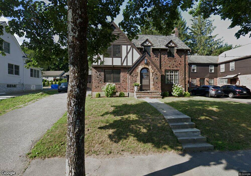
19 Howe Rd Newton Center, MA 02459
Oak Hill NeighborhoodEstimated Value: $1,862,000 - $1,952,000
5
Beds
3
Baths
2,908
Sq Ft
$658/Sq Ft
Est. Value
About This Home
This home is located at 19 Howe Rd, Newton Center, MA 02459 and is currently estimated at $1,913,229, approximately $657 per square foot. 19 Howe Rd is a home located in Middlesex County with nearby schools including Countryside Elementary School, Charles E Brown Middle School, and Newton South High School.
Create a Home Valuation Report for This Property
The Home Valuation Report is an in-depth analysis detailing your home's value as well as a comparison with similar homes in the area
Home Values in the Area
Average Home Value in this Area
Tax History Compared to Growth
Tax History
| Year | Tax Paid | Tax Assessment Tax Assessment Total Assessment is a certain percentage of the fair market value that is determined by local assessors to be the total taxable value of land and additions on the property. | Land | Improvement |
|---|---|---|---|---|
| 2025 | $15,816 | $1,613,900 | $1,160,300 | $453,600 |
| 2024 | $15,293 | $1,566,900 | $1,126,500 | $440,400 |
| 2023 | $14,648 | $1,438,900 | $883,000 | $555,900 |
| 2022 | $14,016 | $1,332,300 | $817,600 | $514,700 |
| 2021 | $13,524 | $1,256,900 | $771,300 | $485,600 |
| 2020 | $13,122 | $1,256,900 | $771,300 | $485,600 |
| 2019 | $12,752 | $1,220,300 | $748,800 | $471,500 |
| 2018 | $12,387 | $1,144,800 | $681,100 | $463,700 |
| 2017 | $12,010 | $1,080,000 | $642,500 | $437,500 |
| 2016 | $11,486 | $1,009,300 | $600,500 | $408,800 |
| 2015 | $10,952 | $943,300 | $561,200 | $382,100 |
Source: Public Records
Map
Nearby Homes
- 415 Dedham St Unit D
- 15 Buff Cir
- 58 Country Club Rd
- 36 Cannon St
- 45 Brandeis Rd
- 250 Woodcliff Rd
- 65 Levbert Rd
- 19 Selwyn Rd
- 35 Haynes Rd
- 41 Juniper Ln
- 135 Hartman Rd
- 59 Deborah Rd
- 207 Nahanton St Unit 207
- 51 Carl St
- 21 Philbrick Rd
- 628 Boylston St
- 56 Cynthia Rd
- 1308 Walnut St
- 125 Oakdale Rd
- 116 Upland Ave