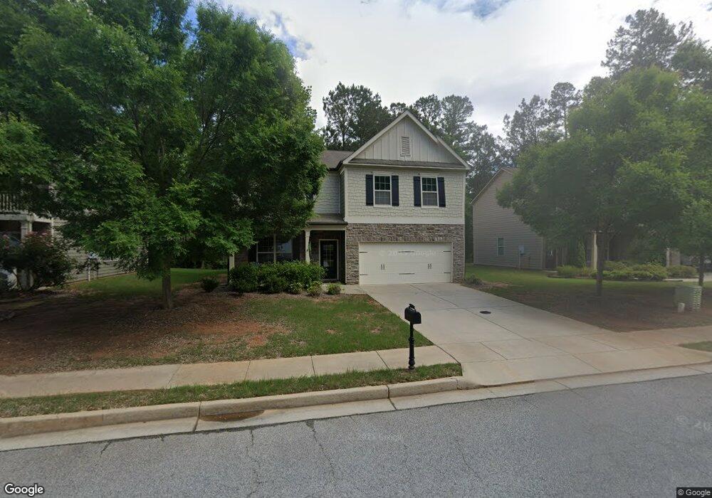
19 Inverness Ave Unit 233 Newnan, GA 30263
Estimated Value: $400,187 - $425,000
5
Beds
3
Baths
3,040
Sq Ft
$136/Sq Ft
Est. Value
About This Home
This home is located at 19 Inverness Ave Unit 233, Newnan, GA 30263 and is currently estimated at $414,047, approximately $136 per square foot. 19 Inverness Ave Unit 233 is a home located in Coweta County with nearby schools including Newnan Crossing Elementary School, Welch Elementary School, and Lee Middle School.
Ownership History
Date
Name
Owned For
Owner Type
Purchase Details
Closed on
Apr 24, 2014
Sold by
Dr Horton Inc
Bought by
Youst Paul
Current Estimated Value
Home Financials for this Owner
Home Financials are based on the most recent Mortgage that was taken out on this home.
Original Mortgage
$212,472
Outstanding Balance
$161,595
Interest Rate
4.43%
Mortgage Type
New Conventional
Estimated Equity
$252,452
Purchase Details
Closed on
Jun 27, 2013
Sold by
Lakeshore Newnan Llc
Bought by
D R Horton Inc
Purchase Details
Closed on
Nov 17, 2005
Sold by
Scarbrough Brent
Bought by
Lakeshore-Newnan Llc
Purchase Details
Closed on
Jul 7, 2004
Sold by
Brown E W
Bought by
Scarbrough Brent
Purchase Details
Closed on
Dec 31, 1975
Bought by
Brown E W
Create a Home Valuation Report for This Property
The Home Valuation Report is an in-depth analysis detailing your home's value as well as a comparison with similar homes in the area
Home Values in the Area
Average Home Value in this Area
Purchase History
| Date | Buyer | Sale Price | Title Company |
|---|---|---|---|
| Youst Paul | $223,655 | -- | |
| D R Horton Inc | $256,000 | -- | |
| Lakeshore-Newnan Llc | -- | -- | |
| Scarbrough Brent | -- | -- | |
| Brown E W | -- | -- |
Source: Public Records
Mortgage History
| Date | Status | Borrower | Loan Amount |
|---|---|---|---|
| Open | Youst Paul | $212,472 |
Source: Public Records
Tax History Compared to Growth
Tax History
| Year | Tax Paid | Tax Assessment Tax Assessment Total Assessment is a certain percentage of the fair market value that is determined by local assessors to be the total taxable value of land and additions on the property. | Land | Improvement |
|---|---|---|---|---|
| 2025 | $4,059 | $175,964 | $30,000 | $145,964 |
| 2024 | $3,745 | $167,307 | $22,000 | $145,307 |
| 2023 | $3,745 | $148,406 | $22,000 | $126,406 |
| 2022 | $3,126 | $131,964 | $22,000 | $109,964 |
| 2021 | $3,151 | $117,260 | $10,000 | $107,260 |
| 2020 | $3,223 | $117,260 | $10,000 | $107,260 |
| 2019 | $2,863 | $95,322 | $14,000 | $81,322 |
| 2018 | $2,881 | $95,322 | $14,000 | $81,322 |
| 2017 | $2,617 | $86,981 | $14,000 | $72,981 |
| 2016 | $2,619 | $86,981 | $14,000 | $72,981 |
| 2015 | $2,414 | $80,030 | $14,000 | $66,030 |
| 2014 | $300 | $12,000 | $12,000 | $0 |
Source: Public Records
Map
Nearby Homes
- 35 Hidden Lakes Dr
- 84 Hidden Lakes Ct
- 44 Hidden Lakes Ct
- 10 Lakeshore Pkwy
- 49 Preserve Dr
- 27 Tahoe Dr
- 0 Poplar Rd Unit 10623910
- 233 Merritt Cir
- 15 Chestnut Dr
- 131 Greison Trail
- 139 Greison Trail
- 145 Greison Trail
- 65 Tahoe Dr
- 118 Newnan Lakes Blvd
- 26 Remington Way
- 267 E Broad St
- 38 Remington Way
- 21 Thomaston St Unit 5
- 39 Covington Terrace
- 75 Camellia Dr
- 19 Inverness Ave
- 23 Inverness Ave Unit 232
- 23 Inverness Ave
- 15 Inverness Ave Unit 234
- 15 Inverness Ave
- 27 Inverness Ave Unit 231
- 27 Inverness Ave
- 22 Inverness Ave Unit 145
- 22 Inverness Ave
- 18 Inverness Ave
- 26 Inverness Ave
- 31 Inverness Ave Unit 230
- 31 Inverness Ave
- 14 Inverness Ave
- 14 Inverness Ave Unit 143
- 30 Inverness Ave
- 10 Inverness Ave
- 37 Inverness Ave Unit 229
- 37 Inverness Ave
- 34 Inverness Ave Unit 148