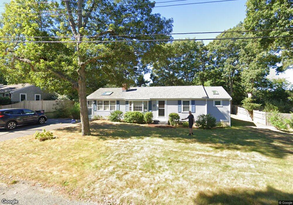
19 Jacqueline Cir West Yarmouth, MA 02673
West Yarmouth NeighborhoodEstimated Value: $537,910 - $632,000
2
Beds
2
Baths
1,152
Sq Ft
$506/Sq Ft
Est. Value
About This Home
This home is located at 19 Jacqueline Cir, West Yarmouth, MA 02673 and is currently estimated at $583,478, approximately $506 per square foot. 19 Jacqueline Cir is a home located in Barnstable County with nearby schools including Dennis-Yarmouth Regional High School, Barnstable Community Horace Mann Charter Public School, and Sturgis Charter Public School.
Ownership History
Date
Name
Owned For
Owner Type
Purchase Details
Closed on
Aug 16, 2010
Sold by
Wolf Katherine M
Bought by
Kimball Mark W and Kimball Timothea K
Current Estimated Value
Home Financials for this Owner
Home Financials are based on the most recent Mortgage that was taken out on this home.
Original Mortgage
$203,200
Outstanding Balance
$134,945
Interest Rate
4.63%
Mortgage Type
Purchase Money Mortgage
Estimated Equity
$448,533
Purchase Details
Closed on
Apr 29, 1996
Sold by
Woznik Theodore J and Woznik Marie A
Bought by
Wolf Paul D and Wolf Katherine M
Home Financials for this Owner
Home Financials are based on the most recent Mortgage that was taken out on this home.
Original Mortgage
$74,400
Interest Rate
7.81%
Mortgage Type
Purchase Money Mortgage
Create a Home Valuation Report for This Property
The Home Valuation Report is an in-depth analysis detailing your home's value as well as a comparison with similar homes in the area
Home Values in the Area
Average Home Value in this Area
Purchase History
| Date | Buyer | Sale Price | Title Company |
|---|---|---|---|
| Kimball Mark W | $254,000 | -- | |
| Wolf Paul D | $93,000 | -- |
Source: Public Records
Mortgage History
| Date | Status | Borrower | Loan Amount |
|---|---|---|---|
| Open | Kimball Mark W | $203,200 | |
| Previous Owner | Wolf Paul D | $75,000 | |
| Previous Owner | Wolf Paul D | $74,400 |
Source: Public Records
Tax History Compared to Growth
Tax History
| Year | Tax Paid | Tax Assessment Tax Assessment Total Assessment is a certain percentage of the fair market value that is determined by local assessors to be the total taxable value of land and additions on the property. | Land | Improvement |
|---|---|---|---|---|
| 2025 | $3,127 | $441,600 | $161,800 | $279,800 |
| 2024 | $2,934 | $397,500 | $140,700 | $256,800 |
| 2023 | $2,881 | $355,200 | $127,900 | $227,300 |
| 2022 | $2,576 | $280,600 | $122,100 | $158,500 |
| 2021 | $2,448 | $256,100 | $122,100 | $134,000 |
| 2020 | $0 | $251,500 | $129,200 | $122,300 |
| 2019 | $5,646 | $233,400 | $129,200 | $104,200 |
| 2018 | $2,180 | $211,900 | $107,700 | $104,200 |
| 2017 | $2,126 | $212,200 | $107,700 | $104,500 |
| 2016 | $2,032 | $203,600 | $99,100 | $104,500 |
| 2015 | $1,892 | $188,400 | $94,800 | $93,600 |
Source: Public Records
Map
Nearby Homes
- 23 Baxter Ave
- 0 Ken's Way
- 14 Brewster Rd
- 13 Webster Rd
- 18 Rachel Rd
- 21 & 23 Glenwood St
- 16 Iyannough Rd
- 83 Main St
- 481 Buck Island Rd Unit 9AA
- 481 Buck Island Rd Unit 17FA
- 110 School St Unit E113
- 115 School St Unit W206
- 24 Valley Rd
- 22 Terry Ct
- 107 Wimbledon Dr
- 107 Channel Point Rd
- 130 Wimbledon Dr
- 85 Baker Rd
- 121 Camp St Unit 128
- 38 Traders Ln
- 15 Jacqueline Cir
- 120 Wendward Way
- 25 Jacqueline Cir
- 20 Jacqueline Cir
- 112 Wendward Way
- 16 Jacqueline Cir
- 11 Jacqueline Cir
- 128 Wendward Way
- 99 Baxter Ave
- 12 Jacqueline Cir
- 32 Jacqueline Cir
- 107 Baxter Ave
- 119 Wendward Way
- 5 Jacqueline Cir
- 95 Baxter Ave
- 33 Jacqueline Cir
- 106 Wendward Way
- 127 Wendward Way
- 111 Wendward Way
- 113 Baxter Ave