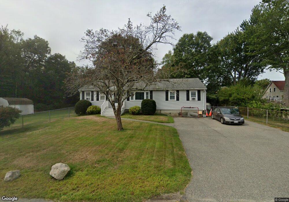
19 John St Abington, MA 02351
Estimated Value: $511,000 - $567,000
3
Beds
1
Bath
1,248
Sq Ft
$426/Sq Ft
Est. Value
About This Home
This home is located at 19 John St, Abington, MA 02351 and is currently estimated at $531,235, approximately $425 per square foot. 19 John St is a home located in Plymouth County with nearby schools including Beaver Brook Elementary School, Abington Middle School, and Woodsdale School.
Ownership History
Date
Name
Owned For
Owner Type
Purchase Details
Closed on
Mar 3, 2017
Sold by
Spellane Jane V
Bought by
Lebel Enterprises Inc
Current Estimated Value
Purchase Details
Closed on
Jul 27, 2007
Sold by
Nigrelli Richard J and Scurti Laurie
Bought by
Spellane Michael J and Spellane Jane V
Home Financials for this Owner
Home Financials are based on the most recent Mortgage that was taken out on this home.
Original Mortgage
$236,800
Interest Rate
6.78%
Mortgage Type
Purchase Money Mortgage
Purchase Details
Closed on
Apr 29, 1992
Sold by
Benn Lauris A
Bought by
Nigrelli Richard J and Scurti Laurie
Create a Home Valuation Report for This Property
The Home Valuation Report is an in-depth analysis detailing your home's value as well as a comparison with similar homes in the area
Home Values in the Area
Average Home Value in this Area
Purchase History
| Date | Buyer | Sale Price | Title Company |
|---|---|---|---|
| Lebel Enterprises Inc | $229,000 | -- | |
| Spellane Michael J | $296,000 | -- | |
| Nigrelli Richard J | $95,000 | -- |
Source: Public Records
Mortgage History
| Date | Status | Borrower | Loan Amount |
|---|---|---|---|
| Previous Owner | Nigrelli Richard J | $236,800 | |
| Previous Owner | Nigrelli Richard J | $59,200 |
Source: Public Records
Tax History Compared to Growth
Tax History
| Year | Tax Paid | Tax Assessment Tax Assessment Total Assessment is a certain percentage of the fair market value that is determined by local assessors to be the total taxable value of land and additions on the property. | Land | Improvement |
|---|---|---|---|---|
| 2025 | $5,584 | $427,600 | $244,700 | $182,900 |
| 2024 | $5,260 | $393,100 | $223,000 | $170,100 |
| 2023 | $5,303 | $373,200 | $194,600 | $178,600 |
| 2022 | $5,158 | $338,900 | $171,000 | $167,900 |
| 2021 | $4,840 | $293,700 | $155,600 | $138,100 |
| 2020 | $4,837 | $284,500 | $151,000 | $133,500 |
| 2019 | $4,546 | $261,400 | $144,100 | $117,300 |
| 2018 | $4,601 | $258,200 | $144,100 | $114,100 |
| 2017 | $4,360 | $237,600 | $144,100 | $93,500 |
| 2016 | $4,009 | $223,600 | $137,500 | $86,100 |
| 2015 | $3,487 | $205,100 | $137,500 | $67,600 |
Source: Public Records
Map
Nearby Homes
- 96 Plymouth St
- 5 Florence St
- 57 Battery St
- 38 Lantern Ln
- 33 Birch St Unit 126
- 20 Birch St
- 5 Forsythia Ln
- 40 Wales St
- 40 Fir Rd Unit 386
- 5 Clark Rd
- 27 Fir Rd
- 1353 Washington St
- 3 Dogwood Cir Unit 95
- 119 Grove St Unit 238
- 119 Grove St Unit 231
- 0 Bedford St
- 6 Chestnut Cir
- 103 Grove St Unit 337
- 225 W Water St
- 676 Bedford St
- 243 Birch St
- 239 Birch St
- 233 Birch St
- 18 Charles St
- 227 Birch St Unit 227
- 225 Birch St Unit 225
- 225 Birch St
- 223 Birch St
- 223 Birch St Unit 2
- 221 Birch St Unit 1,2,3 & 4
- 221 Birch St
- 227 Birch St Unit D
- 221 Birch St Unit C
- 221 Birch St Unit B
- 221 Birch St Unit 1-4
- 384 North Ave
- 392 North Ave
- 215 Birch St
- 28 Charles St
- 36 Charles St