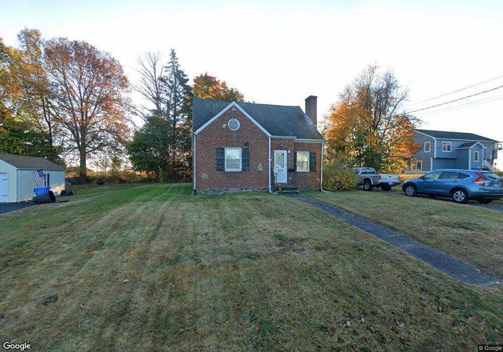
19 Jordan St New Britain, CT 06053
Estimated Value: $287,417 - $317,000
3
Beds
12
Baths
1,241
Sq Ft
$239/Sq Ft
Est. Value
About This Home
This home is located at 19 Jordan St, New Britain, CT 06053 and is currently estimated at $296,604, approximately $239 per square foot. 19 Jordan St is a home located in Hartford County with nearby schools including Jefferson School, Pulaski Middle School, and Mountain Laurel Sudbury School.
Ownership History
Date
Name
Owned For
Owner Type
Purchase Details
Closed on
May 29, 2020
Sold by
Vocke Jason
Bought by
Marie Warren Llc
Current Estimated Value
Purchase Details
Closed on
Oct 26, 2009
Sold by
Rivers Marie
Bought by
Vocke Jason
Purchase Details
Closed on
Aug 5, 2004
Sold by
Rivers Marie E
Bought by
Vocke Jason
Home Financials for this Owner
Home Financials are based on the most recent Mortgage that was taken out on this home.
Original Mortgage
$84,870
Interest Rate
6.5%
Create a Home Valuation Report for This Property
The Home Valuation Report is an in-depth analysis detailing your home's value as well as a comparison with similar homes in the area
Home Values in the Area
Average Home Value in this Area
Purchase History
| Date | Buyer | Sale Price | Title Company |
|---|---|---|---|
| Marie Warren Llc | -- | None Available | |
| Vocke Jason | -- | -- | |
| Vocke Jason | $82,400 | -- |
Source: Public Records
Mortgage History
| Date | Status | Borrower | Loan Amount |
|---|---|---|---|
| Previous Owner | Vocke Jason | $84,870 | |
| Previous Owner | Vocke Jason | $10,000 |
Source: Public Records
Tax History
| Year | Tax Paid | Tax Assessment Tax Assessment Total Assessment is a certain percentage of the fair market value that is determined by local assessors to be the total taxable value of land and additions on the property. | Land | Improvement |
|---|---|---|---|---|
| 2025 | $6,305 | $160,930 | $66,780 | $94,150 |
| 2024 | $6,371 | $160,930 | $66,780 | $94,150 |
| 2023 | $6,160 | $160,930 | $66,780 | $94,150 |
| 2022 | $5,111 | $103,250 | $28,070 | $75,180 |
| 2021 | $5,111 | $103,250 | $28,070 | $75,180 |
| 2020 | $5,214 | $103,250 | $28,070 | $75,180 |
| 2019 | $5,214 | $103,250 | $28,070 | $75,180 |
| 2018 | $5,214 | $103,250 | $28,070 | $75,180 |
| 2017 | $4,878 | $96,600 | $28,070 | $68,530 |
| 2016 | $4,878 | $96,600 | $28,070 | $68,530 |
| 2015 | $4,733 | $96,600 | $28,070 | $68,530 |
| 2014 | $4,733 | $96,600 | $28,070 | $68,530 |
Source: Public Records
Map
Nearby Homes
- 234 Pierremount Ave
- 527 Burritt St
- 822 Slater Rd
- 24 Pentlow Ave
- 2453 Corbin Ave
- 51 Kenyon Cir
- 55 Allen St
- 432 Mcclintock St
- 230 Hillhurst Ave
- 25 Clinton St
- 153 Horseplain Rd
- 50 Curtin Ave
- 240 Hillhurst Ave
- 678 Farmington Ave
- 154 Allen St
- 376 Broad St
- 45 Atlantic St Unit C
- 80 Gold St
- 77 Booth St
- 235 High St Unit C
Your Personal Tour Guide
Ask me questions while you tour the home.