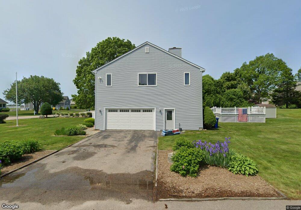
19 Juniper Ave Westerly, RI 02891
Estimated Value: $901,000 - $1,382,000
3
Beds
3
Baths
1,926
Sq Ft
$606/Sq Ft
Est. Value
About This Home
This home is located at 19 Juniper Ave, Westerly, RI 02891 and is currently estimated at $1,166,562, approximately $605 per square foot. 19 Juniper Ave is a home located in Washington County with nearby schools including Westerly High School.
Ownership History
Date
Name
Owned For
Owner Type
Purchase Details
Closed on
Aug 27, 1999
Sold by
Floyd Thomas R and Sheedy Gail
Bought by
Brennan Todd M and Brennan Jennifer A
Current Estimated Value
Purchase Details
Closed on
Dec 5, 1997
Sold by
Hellwig Edgar O
Bought by
Floyd Thomas R and Floyd Gail
Purchase Details
Closed on
Nov 27, 1996
Sold by
Zanfini Joseph C
Bought by
Hellwig Edgar O
Purchase Details
Closed on
Nov 22, 1993
Sold by
Sorensen Kenneth J and Mccuin Brian H
Bought by
Zanfini Joseph C and Zanfini Martina
Create a Home Valuation Report for This Property
The Home Valuation Report is an in-depth analysis detailing your home's value as well as a comparison with similar homes in the area
Home Values in the Area
Average Home Value in this Area
Purchase History
| Date | Buyer | Sale Price | Title Company |
|---|---|---|---|
| Brennan Todd M | $207,000 | -- | |
| Floyd Thomas R | $188,000 | -- | |
| Hellwig Edgar O | $166,000 | -- | |
| Zanfini Joseph C | $181,500 | -- |
Source: Public Records
Mortgage History
| Date | Status | Borrower | Loan Amount |
|---|---|---|---|
| Open | Zanfini Joseph C | $378,500 | |
| Closed | Zanfini Joseph C | $370,000 |
Source: Public Records
Tax History
| Year | Tax Paid | Tax Assessment Tax Assessment Total Assessment is a certain percentage of the fair market value that is determined by local assessors to be the total taxable value of land and additions on the property. | Land | Improvement |
|---|---|---|---|---|
| 2025 | $6,773 | $952,600 | $421,800 | $530,800 |
| 2024 | $6,591 | $671,900 | $301,300 | $370,600 |
| 2023 | $6,464 | $671,900 | $301,300 | $370,600 |
| 2022 | $6,423 | $671,900 | $301,300 | $370,600 |
| 2021 | $5,925 | $514,300 | $222,600 | $291,700 |
| 2020 | $5,817 | $514,300 | $222,600 | $291,700 |
| 2019 | $5,760 | $514,300 | $222,600 | $291,700 |
| 2018 | $5,824 | $490,200 | $222,600 | $267,600 |
| 2017 | $5,681 | $490,200 | $222,600 | $267,600 |
| 2016 | $5,726 | $490,200 | $222,600 | $267,600 |
| 2015 | $5,396 | $498,700 | $227,300 | $271,400 |
| 2014 | $5,306 | $498,700 | $227,300 | $271,400 |
Source: Public Records
Map
Nearby Homes
- 19 Wicklow Rd
- 432 Atlantic Ave
- 446 Atlantic Ave
- 470 Atlantic Ave
- 9 Compass Way Unit 201
- 9 Compass Way Unit 202
- 9 Compass Way Unit 101
- 9 Compass Way Unit 102
- 9 Compass Way Unit 103
- 9 Compass Way Unit 203
- 54 Sherwood Dr
- 26 Charlene Ave
- 20 Snowberry Ln
- 13 Plateau Rd
- 30 Clifford Dr
- 22 Breach Dr
- 15 Breach Dr
- 27 Benson Ave
- 10 Tristam St
- 43 Noyes Neck Rd
- 22 Pondview Ave
- 26 S Fairway Ave
- 15 Juniper Ave
- 20 Juniper Ave
- 7 S Fairway Ave
- 9 S Fairway Ave
- 22 Juniper Ave
- 18 Juniper Ave
- 13 Juniper Ave
- 11 S Fairway Ave
- 18 Pondview Ave
- 18 Pond View Ave
- 21 Pondview Ave
- 5 S Fairway Ave
- 16 Juniper Ave
- 19 Pondview Ave
- 23 E Fairway Ave
- 11 Juniper Ave
- 17 Pondview Ave
- 17 E Fairway Ave
Your Personal Tour Guide
Ask me questions while you tour the home.