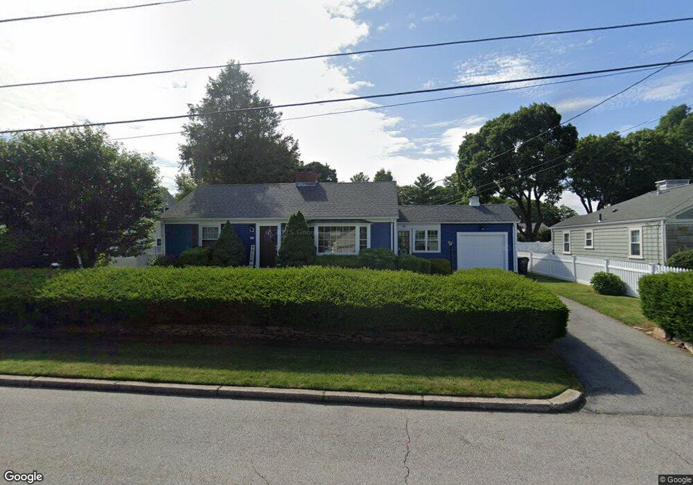
19 King Philip Rd Pawtucket, RI 02861
Darlington NeighborhoodEstimated Value: $412,000 - $497,000
2
Beds
1
Bath
1,208
Sq Ft
$378/Sq Ft
Est. Value
About This Home
This home is located at 19 King Philip Rd, Pawtucket, RI 02861 and is currently estimated at $457,125, approximately $378 per square foot. 19 King Philip Rd is a home located in Providence County with nearby schools including St Cecilia School and Saint Teresa Catholic Elementary School.
Ownership History
Date
Name
Owned For
Owner Type
Purchase Details
Closed on
Oct 14, 2021
Sold by
Costigan Cathleen M
Bought by
Duffy Cathleen
Current Estimated Value
Purchase Details
Closed on
Aug 16, 2013
Sold by
Eileen S Barker Lt
Bought by
Costigan Cathlenn M
Home Financials for this Owner
Home Financials are based on the most recent Mortgage that was taken out on this home.
Original Mortgage
$152,000
Interest Rate
4.31%
Mortgage Type
New Conventional
Purchase Details
Closed on
Nov 23, 2011
Sold by
Eileen S Barker Lt
Bought by
Brown Elizabeth S and Barker Eileen S
Create a Home Valuation Report for This Property
The Home Valuation Report is an in-depth analysis detailing your home's value as well as a comparison with similar homes in the area
Home Values in the Area
Average Home Value in this Area
Purchase History
| Date | Buyer | Sale Price | Title Company |
|---|---|---|---|
| Duffy Cathleen | -- | None Available | |
| Costigan Cathlenn M | $160,000 | -- | |
| Brown Elizabeth S | -- | -- |
Source: Public Records
Mortgage History
| Date | Status | Borrower | Loan Amount |
|---|---|---|---|
| Previous Owner | Brown Elizabeth S | $21,000 | |
| Previous Owner | Brown Elizabeth S | $152,000 |
Source: Public Records
Tax History Compared to Growth
Tax History
| Year | Tax Paid | Tax Assessment Tax Assessment Total Assessment is a certain percentage of the fair market value that is determined by local assessors to be the total taxable value of land and additions on the property. | Land | Improvement |
|---|---|---|---|---|
| 2024 | $3,872 | $313,800 | $151,500 | $162,300 |
| 2023 | $4,179 | $246,700 | $115,800 | $130,900 |
| 2022 | $4,090 | $246,700 | $115,800 | $130,900 |
| 2021 | $4,017 | $242,300 | $115,800 | $126,500 |
| 2020 | $4,023 | $192,600 | $108,500 | $84,100 |
| 2019 | $4,023 | $192,600 | $108,500 | $84,100 |
| 2018 | $3,877 | $192,600 | $108,500 | $84,100 |
| 2017 | $4,255 | $187,300 | $102,400 | $84,900 |
| 2016 | $4,100 | $187,300 | $102,400 | $84,900 |
| 2015 | $4,100 | $187,300 | $102,400 | $84,900 |
| 2014 | $4,100 | $177,800 | $89,600 | $88,200 |
Source: Public Records
Map
Nearby Homes
- 1150 Newman Ave
- 87 Baker St
- 245 Manton St
- 245 Manton St Unit 83
- 242 St
- 242 Manton #41 St
- 618 Armistice Blvd
- 91 Seabiscuit Place
- 104 Crescent Rd
- 329 Pullen Ave
- 95 Federal St
- 63 Whirlaway Place
- 66 1st St
- 3 Lindesta Rd
- 400 Newport Ave
- 57 Grand Ave
- 246 Vine St
- 127 Ricard St
- 24 State St
- 728 Beverage Hill Ave Unit 24
- 11 King Philip Rd
- 28 Alexander Mcgregor Rd
- 925 Armistice Blvd
- 20 King Philip Rd
- 12 Alexander Mcgregor Rd
- 33 King Philip Rd
- 12 King Philip Rd
- 915 Armistice Blvd
- 929 Armistice Blvd
- 30 King Philip Rd
- 30 Alexander Mcgregor Rd
- 901 Armistice Blvd
- 42 Alexander Mcgregor Rd
- 21 Anawan Rd
- 11 Anawan Rd
- 35 King Philip Rd
- 36 King Philip Rd
- 27 Anawan Rd
- 5 Anawan Rd
- 35 Anawan Rd