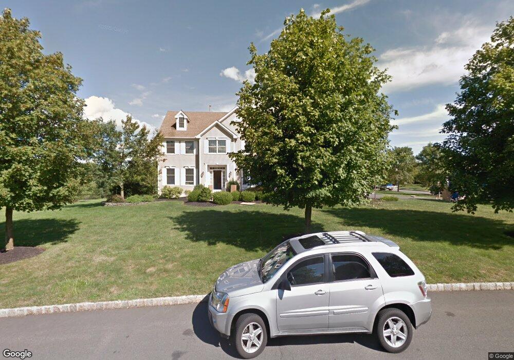
19 Labaw Way Belle Mead, NJ 08502
Estimated Value: $1,130,000 - $1,207,000
4
Beds
3
Baths
2,986
Sq Ft
$394/Sq Ft
Est. Value
About This Home
This home is located at 19 Labaw Way, Belle Mead, NJ 08502 and is currently estimated at $1,175,270, approximately $393 per square foot. 19 Labaw Way is a home located in Somerset County with nearby schools including Orchard Hill Elementary School, Montgomery Lower Mid School, and Village Elementary School.
Ownership History
Date
Name
Owned For
Owner Type
Purchase Details
Closed on
Aug 18, 2011
Sold by
Giordano Deborah Ann
Bought by
Huff Dale A and Huff Lori J
Current Estimated Value
Home Financials for this Owner
Home Financials are based on the most recent Mortgage that was taken out on this home.
Original Mortgage
$520,000
Outstanding Balance
$360,879
Interest Rate
4.62%
Mortgage Type
New Conventional
Estimated Equity
$814,391
Purchase Details
Closed on
Oct 7, 1998
Sold by
Kings Crossing
Bought by
Giordano Deborel
Home Financials for this Owner
Home Financials are based on the most recent Mortgage that was taken out on this home.
Original Mortgage
$140,000
Interest Rate
6.68%
Create a Home Valuation Report for This Property
The Home Valuation Report is an in-depth analysis detailing your home's value as well as a comparison with similar homes in the area
Home Values in the Area
Average Home Value in this Area
Purchase History
| Date | Buyer | Sale Price | Title Company |
|---|---|---|---|
| Huff Dale A | $650,000 | Old Republic National Title | |
| Giordano Deborel | $355,057 | -- |
Source: Public Records
Mortgage History
| Date | Status | Borrower | Loan Amount |
|---|---|---|---|
| Open | Huff Dale A | $520,000 | |
| Previous Owner | Giordano Deborel | $140,000 |
Source: Public Records
Tax History Compared to Growth
Tax History
| Year | Tax Paid | Tax Assessment Tax Assessment Total Assessment is a certain percentage of the fair market value that is determined by local assessors to be the total taxable value of land and additions on the property. | Land | Improvement |
|---|---|---|---|---|
| 2025 | $19,282 | $562,800 | $281,900 | $280,900 |
| 2024 | $19,282 | $562,800 | $281,900 | $280,900 |
| 2023 | $19,265 | $562,800 | $281,900 | $280,900 |
| 2022 | $18,133 | $562,800 | $281,900 | $280,900 |
| 2021 | $17,981 | $562,800 | $281,900 | $280,900 |
| 2020 | $17,835 | $562,800 | $281,900 | $280,900 |
| 2019 | $17,717 | $562,800 | $281,900 | $280,900 |
| 2018 | $17,306 | $562,800 | $281,900 | $280,900 |
| 2017 | $17,008 | $562,800 | $281,900 | $280,900 |
| 2016 | $16,710 | $562,800 | $281,900 | $280,900 |
| 2015 | $16,327 | $562,800 | $281,900 | $280,900 |
| 2014 | $16,130 | $562,800 | $281,900 | $280,900 |
Source: Public Records
Map
Nearby Homes
- 74 Harlingen Rd
- 21 Harlingen Rd
- 43 Dead Tree Run Rd
- 44 Bridle Path
- 40 Johnson Dr
- 68 Johnson Dr
- 00 W Dutchtown Harlingen Rd
- 167 Dead Tree Run Rd
- 1723 Us Highway 206
- 74 Dublin Rd
- 11 Briar Hill Ct
- 52 Ketcham Rd
- 16 Dorland Farm Ct
- 161 Grayson Dr
- 100 Knickerbocker Dr
- 87 Meadow Lark Ln
- 38 Van Doren Way
- 125 Tomahawk Ct
- 1105 Rhoads Dr Unit 1105
- 59 Montgomery Rd