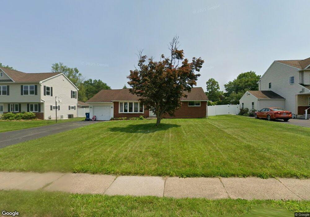
19 Maple Ave Hatboro, PA 19040
Estimated Value: $398,416 - $443,000
3
Beds
1
Bath
1,204
Sq Ft
$350/Sq Ft
Est. Value
About This Home
This home is located at 19 Maple Ave, Hatboro, PA 19040 and is currently estimated at $421,604, approximately $350 per square foot. 19 Maple Ave is a home located in Montgomery County with nearby schools including Hallowell Elementary School, Keith Valley Middle School, and Hatboro-Horsham Senior High School.
Ownership History
Date
Name
Owned For
Owner Type
Purchase Details
Closed on
Dec 19, 2003
Sold by
Fricker Alice J
Bought by
Brinsfield Jeffrey T
Current Estimated Value
Home Financials for this Owner
Home Financials are based on the most recent Mortgage that was taken out on this home.
Original Mortgage
$198,000
Outstanding Balance
$91,621
Interest Rate
5.86%
Estimated Equity
$329,983
Purchase Details
Closed on
Jul 17, 2003
Sold by
Fricker John V and Fricker William V
Bought by
Fricker Alice J
Purchase Details
Closed on
Sep 6, 2002
Sold by
Fricker Alice Jean
Bought by
Halbe Patricia and Fricker John
Create a Home Valuation Report for This Property
The Home Valuation Report is an in-depth analysis detailing your home's value as well as a comparison with similar homes in the area
Home Values in the Area
Average Home Value in this Area
Purchase History
| Date | Buyer | Sale Price | Title Company |
|---|---|---|---|
| Brinsfield Jeffrey T | $220,000 | -- | |
| Fricker Alice J | -- | -- | |
| Halbe Patricia | -- | -- |
Source: Public Records
Mortgage History
| Date | Status | Borrower | Loan Amount |
|---|---|---|---|
| Open | Brinsfield Jeffrey T | $198,000 |
Source: Public Records
Tax History
| Year | Tax Paid | Tax Assessment Tax Assessment Total Assessment is a certain percentage of the fair market value that is determined by local assessors to be the total taxable value of land and additions on the property. | Land | Improvement |
|---|---|---|---|---|
| 2025 | $4,919 | $125,140 | $48,640 | $76,500 |
| 2024 | $4,919 | $125,140 | $48,640 | $76,500 |
| 2023 | $4,683 | $125,140 | $48,640 | $76,500 |
| 2022 | $4,531 | $125,140 | $48,640 | $76,500 |
| 2021 | $4,423 | $125,140 | $48,640 | $76,500 |
| 2020 | $4,319 | $125,140 | $48,640 | $76,500 |
| 2019 | $4,236 | $125,140 | $48,640 | $76,500 |
Source: Public Records
Map
Nearby Homes
- 1171 W County Line Rd
- 532 Sherwood Ln
- 60 Caledonia Dr
- 537 Sherwood Ln
- 25 Patriot Ln
- 18 Patriot Ln
- 604 Liberty Ridge Rd
- 602 America Dr Unit FARADAY MODEL HOME
- 604 America #Northbrook Model Dr
- 1246 Victoria Rd
- 36 Patriot Ln
- 407 W Moreland Ave
- 616 Liberty Ridge Rd
- 607 America Dr
- 204 Wilson Ave
- 619 Liberty Ridge Rd
- 623 Liberty Ridge Rd
- 158 Wiltshire Ln
- 194 Gibson Ave
- 1454 Kingsley Dr
Your Personal Tour Guide
Ask me questions while you tour the home.