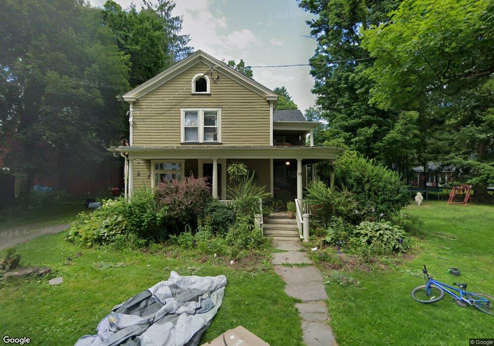
19 Maple St Gilbertsville, NY 13776
Estimated Value: $167,680 - $205,000
5
Beds
2
Baths
2,732
Sq Ft
$69/Sq Ft
Est. Value
About This Home
This home is located at 19 Maple St, Gilbertsville, NY 13776 and is currently estimated at $188,170, approximately $68 per square foot. 19 Maple St is a home with nearby schools including Gilbertsville-Mount Upton Elementary School and Gilbertsville-Mount Upton Junior/Senior High School.
Ownership History
Date
Name
Owned For
Owner Type
Purchase Details
Closed on
Aug 30, 2018
Sold by
Finger Jason
Bought by
Reff Thomas and Parslow Tara
Current Estimated Value
Purchase Details
Closed on
Jan 6, 2011
Sold by
Birdsall John G
Bought by
Covington Heather
Home Financials for this Owner
Home Financials are based on the most recent Mortgage that was taken out on this home.
Original Mortgage
$140,000
Interest Rate
4.46%
Mortgage Type
Purchase Money Mortgage
Purchase Details
Closed on
Aug 13, 1998
Sold by
Mediatore Charmaine
Bought by
Jensen Lance and Jensen Carol A
Purchase Details
Closed on
Jun 21, 1996
Purchase Details
Closed on
Sep 16, 1994
Sold by
Mediatore Charmaine
Bought by
Paglia Joseph and Field Cynthia
Create a Home Valuation Report for This Property
The Home Valuation Report is an in-depth analysis detailing your home's value as well as a comparison with similar homes in the area
Home Values in the Area
Average Home Value in this Area
Purchase History
| Date | Buyer | Sale Price | Title Company |
|---|---|---|---|
| Reff Thomas | -- | -- | |
| Covington Heather | -- | Scott Clippinger | |
| Jensen Lance | $63,000 | -- | |
| -- | $81,196 | -- | |
| Paglia Joseph | $93,000 | -- |
Source: Public Records
Mortgage History
| Date | Status | Borrower | Loan Amount |
|---|---|---|---|
| Previous Owner | Covington Heather | $140,000 |
Source: Public Records
Tax History Compared to Growth
Tax History
| Year | Tax Paid | Tax Assessment Tax Assessment Total Assessment is a certain percentage of the fair market value that is determined by local assessors to be the total taxable value of land and additions on the property. | Land | Improvement |
|---|---|---|---|---|
| 2024 | $3,399 | $118,200 | $5,600 | $112,600 |
| 2023 | $2,988 | $118,200 | $5,600 | $112,600 |
| 2022 | $3,171 | $118,200 | $5,600 | $112,600 |
| 2021 | $2,505 | $118,200 | $5,600 | $112,600 |
| 2020 | $2,724 | $118,200 | $5,600 | $112,600 |
| 2019 | $2,622 | $118,200 | $5,600 | $112,600 |
| 2018 | $2,622 | $118,200 | $5,600 | $112,600 |
| 2017 | $2,582 | $118,200 | $5,600 | $112,600 |
| 2016 | $2,508 | $118,200 | $5,600 | $112,600 |
| 2015 | -- | $118,200 | $5,600 | $112,600 |
| 2014 | -- | $118,200 | $5,600 | $112,600 |
Source: Public Records
Map
Nearby Homes
- 1 Green St
- 1657 County Highway 4 Rd
- 137 Lovers Ln
- 779 Copes Corners Rd
- 513 Halbert Hill Rd
- 0 Musson Erwin Rd Unit LotWP001 22177085
- 0WP Musson Erwin Rd
- 216 Opperman Rd
- 00 Oregon Rd
- 143 Cross Rd
- 1050 Copes Corners Rd
- 512 County Highway 18
- 1657 County Road 4
- 0 Lulu Coon Rd
- 1457 Butternut Rd
- 949 County Highway 18
- 0 Town Line Rd
- 2614 State Highway 8
- 115 State Highway 51
- 113 State Highway 51