Estimated Value: $365,000 - $378,000
2
Beds
1
Bath
840
Sq Ft
$441/Sq Ft
Est. Value
About This Home
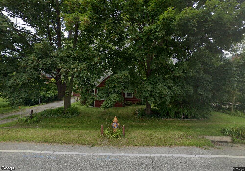
This home is located at 19 Maple St, Kent, CT 06757 and is currently estimated at $370,333, approximately $440 per square foot. 19 Maple St is a home located in Litchfield County with nearby schools including Kent Center School, Housatonic Valley Regional High School, and Kent School.
Ownership History
Date
Name
Owned For
Owner Type
Purchase Details
Closed on
Mar 26, 2015
Sold by
Bank New York Mellon T
Bought by
Kent Affordable Hsng I
Current Estimated Value
Purchase Details
Closed on
Jan 12, 2007
Sold by
Barton-Thompson Thelma
Bought by
Barton John F
Purchase Details
Closed on
Feb 23, 2005
Sold by
Alderman Gwendolyn R
Bought by
Alderman John D
Create a Home Valuation Report for This Property
The Home Valuation Report is an in-depth analysis detailing your home's value as well as a comparison with similar homes in the area
Home Values in the Area
Average Home Value in this Area
Purchase History
| Date | Buyer | Sale Price | Title Company |
|---|---|---|---|
| Kent Affordable Hsng I | $59,900 | -- | |
| Barton John F | -- | -- | |
| Alderman John D | $80,000 | -- |
Source: Public Records
Mortgage History
| Date | Status | Borrower | Loan Amount |
|---|---|---|---|
| Previous Owner | Alderman John D | $127,000 | |
| Previous Owner | Alderman John D | $28,500 |
Source: Public Records
Tax History
| Year | Tax Paid | Tax Assessment Tax Assessment Total Assessment is a certain percentage of the fair market value that is determined by local assessors to be the total taxable value of land and additions on the property. | Land | Improvement |
|---|---|---|---|---|
| 2025 | $3,387 | $200,800 | $53,600 | $147,200 |
| 2024 | $3,130 | $200,800 | $53,600 | $147,200 |
| 2023 | $2,454 | $130,800 | $53,600 | $77,200 |
| 2022 | $2,429 | $130,800 | $53,600 | $77,200 |
| 2021 | $2,429 | $130,800 | $53,600 | $77,200 |
| 2020 | $2,434 | $130,800 | $53,600 | $77,200 |
| 2019 | $2,434 | $130,800 | $53,600 | $77,200 |
| 2018 | $1,677 | $90,100 | $39,800 | $50,300 |
| 2017 | $1,677 | $90,100 | $39,800 | $50,300 |
| 2016 | $1,659 | $90,500 | $39,800 | $50,700 |
| 2015 | $1,616 | $90,500 | $39,800 | $50,700 |
| 2014 | $1,541 | $90,500 | $39,800 | $50,700 |
Source: Public Records
Map
Nearby Homes
- 80 N Main St Unit 2A1
- 132 S Kent Rd
- 0 Spooner Hill Rd Unit 24077524
- 46 Spooner Hill Rd
- 0 Richards Rd Unit 24140078
- 103 Geer Mountain Rd
- 23 Mauwee Brook Rd
- 308 Skiff Mountain Rd
- 591 Bog Hollow Rd
- 0 Gorham Rd Unit 24138133
- 00 Camps Flat Rd
- 0 Mount Mauwee Rd
- 221 Fuller Mountain Rd
- 00 Upper Kent Hollow Rd
- 11 Old Paddock Ln
- 0 Stonewall Unit 39
- 14 Straight Rd
- 1 W Woods Rd
- 105 Sand Hill Rd
- 0 W Woods Rd Unit 2
- 23 Maple St
- 25 Maple St
- 25 Maple St Unit A
- 25 Maple St Unit A
- 25 Maple St Unit B
- 25 A&B Maple St
- 27 Maple St
- 29 Maple St
- 31 Maple St
- 3 Maple St
- 3 Maple St Unit 8
- 3 Maple St Unit 7
- 0 N Main St Unit 99155083
- 00 N Main St
- 15 S Main St
- 12 N Main St
- 14 N Main St
- 1 Bridge St
- 1 Bridge St Unit 1
- 1 Bridge St Unit 2
Your Personal Tour Guide
Ask me questions while you tour the home.