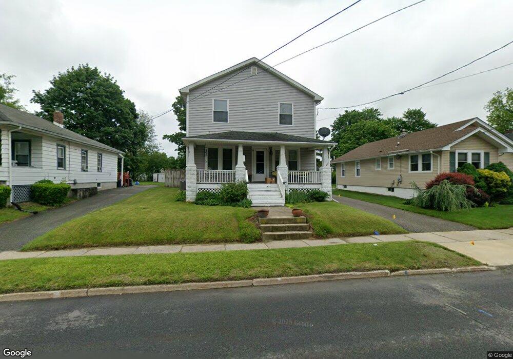
19 Mason Ave Newton, NJ 07860
Estimated Value: $392,000 - $444,000
--
Bed
--
Bath
1,840
Sq Ft
$227/Sq Ft
Est. Value
About This Home
This home is located at 19 Mason Ave, Newton, NJ 07860 and is currently estimated at $417,704, approximately $227 per square foot. 19 Mason Ave is a home located in Sussex County with nearby schools including Merriam Avenue School, Halsted Street Middle School, and Newton High School.
Ownership History
Date
Name
Owned For
Owner Type
Purchase Details
Closed on
Jul 12, 1996
Sold by
Rios Ruben and Rios Mary Anne T
Bought by
Nisler Jason C and Taliercio Jennifer A
Current Estimated Value
Home Financials for this Owner
Home Financials are based on the most recent Mortgage that was taken out on this home.
Original Mortgage
$121,600
Outstanding Balance
$8,588
Interest Rate
7.98%
Estimated Equity
$409,116
Purchase Details
Closed on
May 16, 1994
Sold by
Holenstein Michael E and Holenstein Penny L
Bought by
Rios Ruben and Rios Mary Anne T
Create a Home Valuation Report for This Property
The Home Valuation Report is an in-depth analysis detailing your home's value as well as a comparison with similar homes in the area
Home Values in the Area
Average Home Value in this Area
Purchase History
| Date | Buyer | Sale Price | Title Company |
|---|---|---|---|
| Nisler Jason C | $128,000 | -- | |
| Rios Ruben | $128,900 | -- |
Source: Public Records
Mortgage History
| Date | Status | Borrower | Loan Amount |
|---|---|---|---|
| Open | Nisler Jason C | $121,600 |
Source: Public Records
Tax History Compared to Growth
Tax History
| Year | Tax Paid | Tax Assessment Tax Assessment Total Assessment is a certain percentage of the fair market value that is determined by local assessors to be the total taxable value of land and additions on the property. | Land | Improvement |
|---|---|---|---|---|
| 2025 | $9,975 | $389,400 | $95,300 | $294,100 |
| 2024 | $9,496 | $365,800 | $78,600 | $287,200 |
| 2023 | $9,496 | $211,300 | $63,600 | $147,700 |
| 2022 | $9,534 | $211,300 | $63,600 | $147,700 |
| 2021 | $9,492 | $211,300 | $63,600 | $147,700 |
| 2020 | $9,346 | $211,300 | $63,600 | $147,700 |
| 2019 | $9,056 | $211,300 | $63,600 | $147,700 |
| 2018 | $9,008 | $211,300 | $63,600 | $147,700 |
| 2017 | $8,955 | $211,300 | $63,600 | $147,700 |
| 2016 | $8,811 | $211,300 | $63,600 | $147,700 |
| 2015 | $8,579 | $211,300 | $63,600 | $147,700 |
| 2014 | $8,401 | $211,300 | $63,600 | $147,700 |
Source: Public Records
Map
Nearby Homes
- 63 Merriam Ave
- 46 Pine St
- 22 Woodside Ave
- 46 Orchard St Unit 2
- 8 Orchard St
- 14 Trenton Place
- 18 Joseph Dr
- 9 Lawnwood Ave
- 21 Gregg Ct
- 0 W Nelson St
- 19 Gregg Ct
- 103 Woodside Ave
- 36 Paterson Ave
- 30 Linmor Ave
- 41 Plainfield Ave
- 76 Carriage Ln Unit 76
- 5 Clarkson St
- 67 Ryerson Ave
- 18 Lincoln Place
- 252 Spring St